What should a combined survey brief achieve?
A combined brief should connect the building information with the site information needed by the designer. It should also make clear who is responsible for each part of the work and for coordinating the issued drawings.
The starting point is the project, rather than a fixed bundle of drawings. Describe the intended alteration and ask the architect or designer what information is needed to develop it.
For example, a rear alteration could involve the existing internal layout, the rear elevation and the garden outside the proposed work. The brief needs to identify the relevant views and external extent, rather than assume “full survey” means the same thing to everyone.
If you are still deciding whether both surveys are needed, read the measured building survey versus topographical survey guide. The following steps are for defining the work once the project team has identified the need for both.
How do you define the building survey scope?
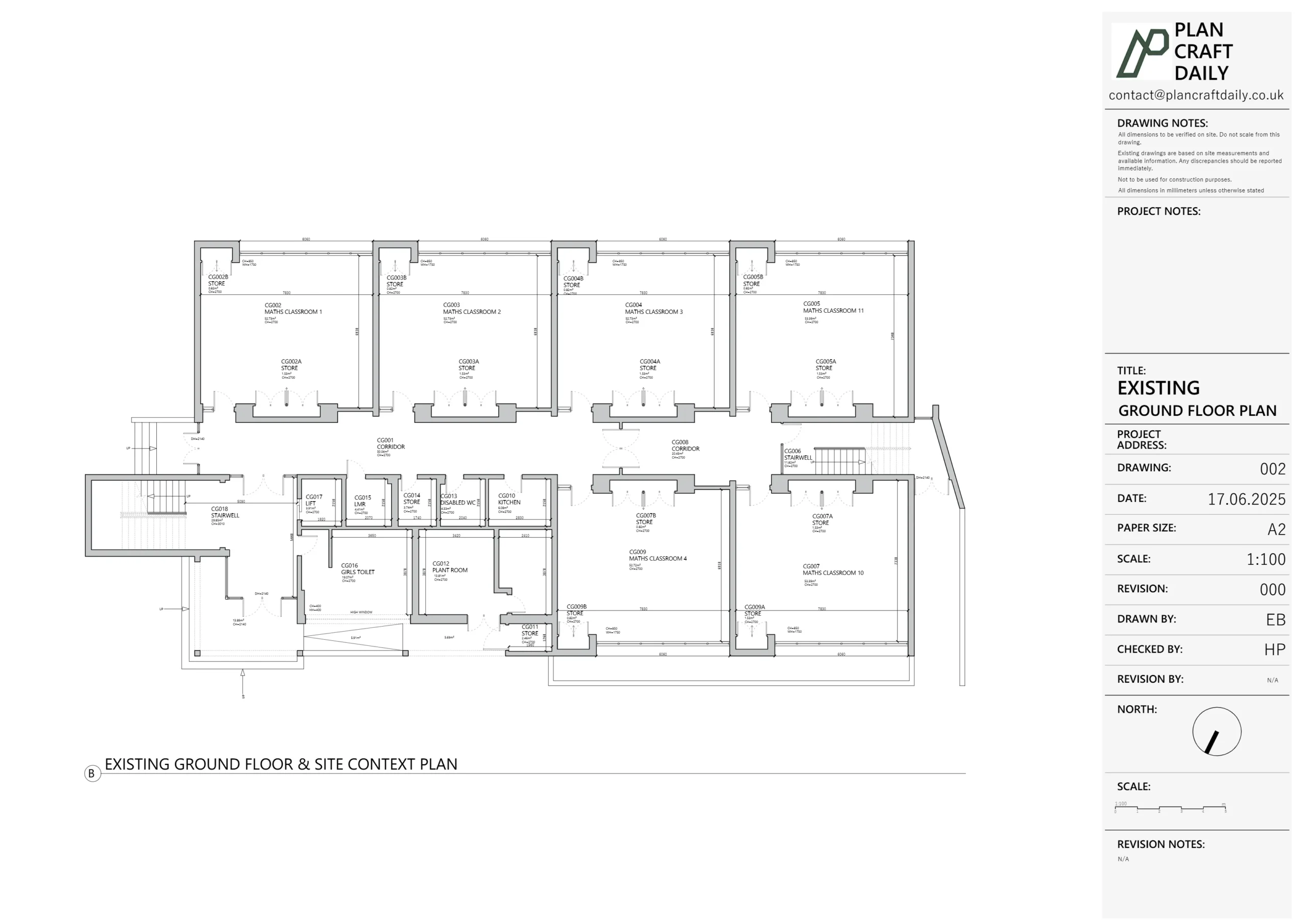
List the floors, drawing views and features needed for the design. A house address does not specify whether the survey should cover one floor, all floors, the garage, the roof or selected internal details.
Ask the designer to confirm:
- Which floors and attached spaces need recording
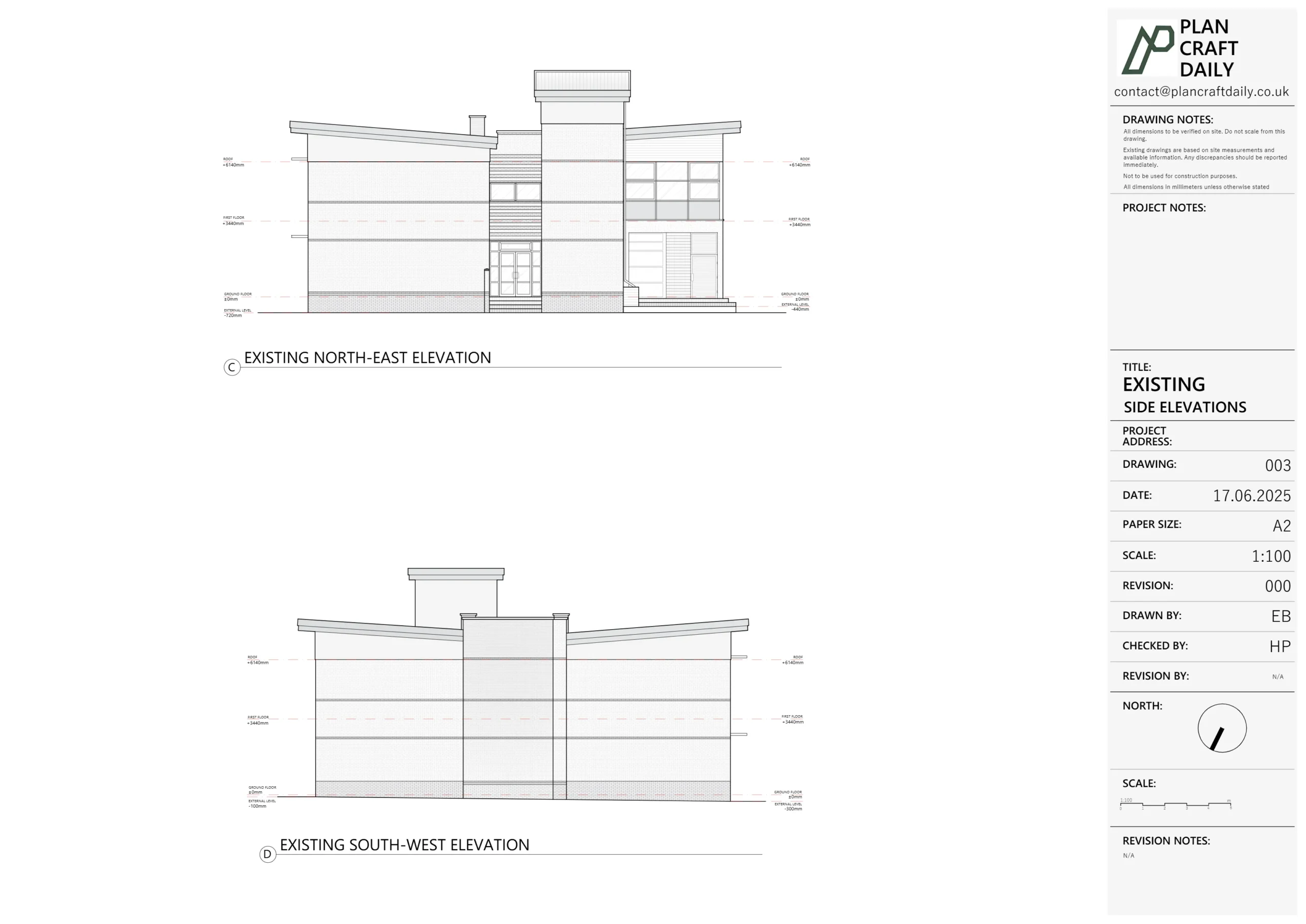
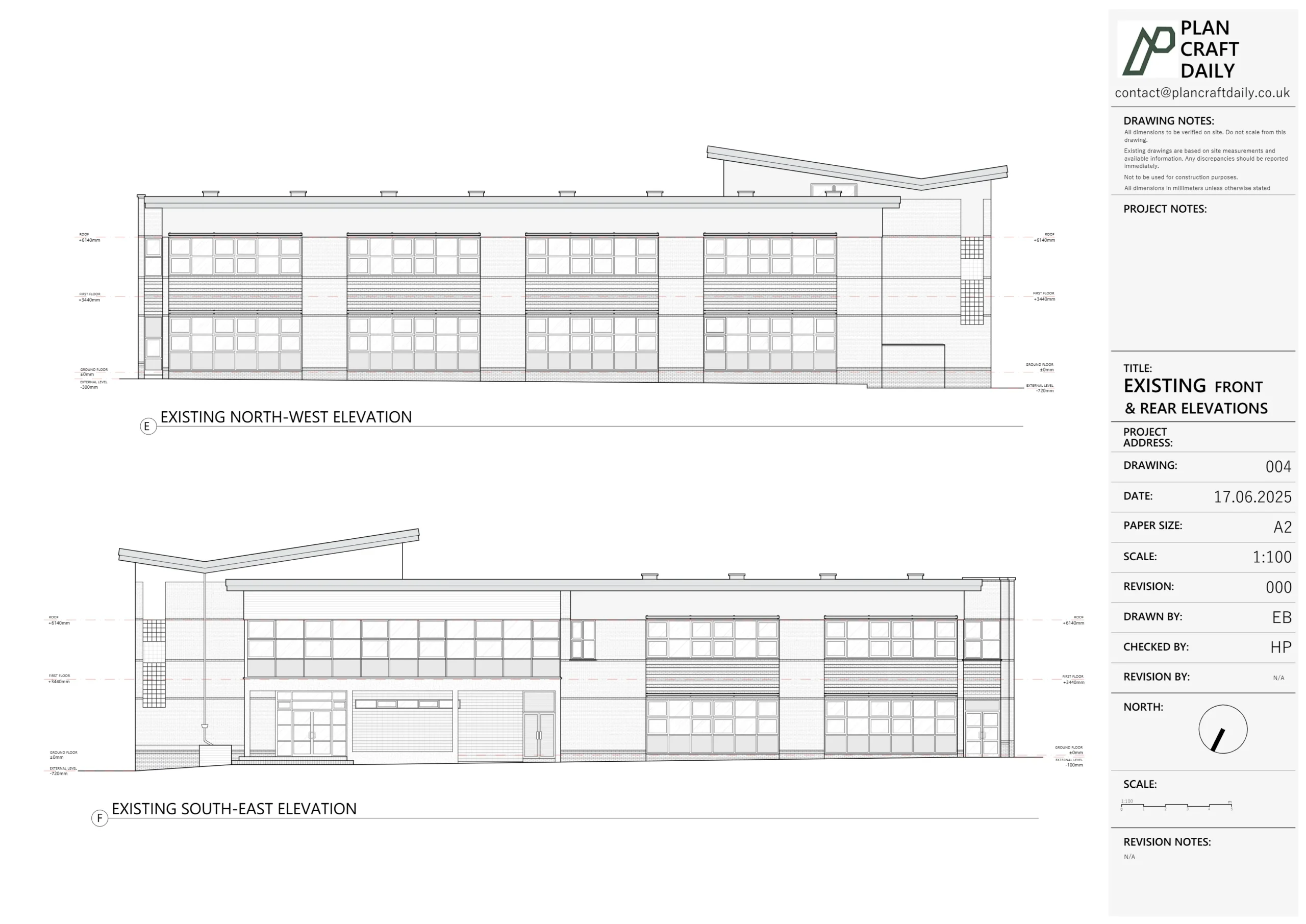
- Which external elevations are required
- Whether a roof plan is needed
- Where any sections should pass through the building
- Which heights, openings or other details need particular attention
- Which areas might be inaccessible at the visit
Use a sketch to identify section positions or less obvious spaces. “Section A through the stair and rear of the house” is easier to review than “one section included.”
The guide to what a measured building survey includes explains the general drawing options. Your quotation should state the selected scope for this project.
How do you define the external survey area?
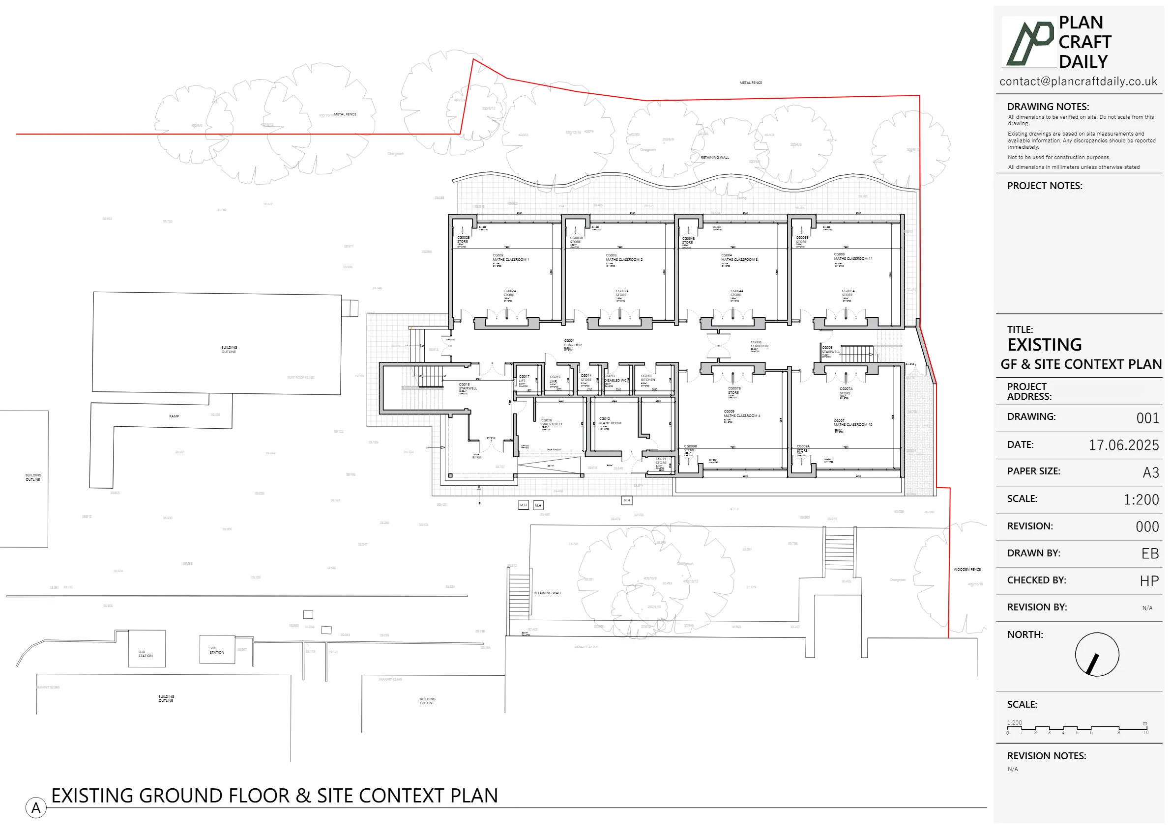
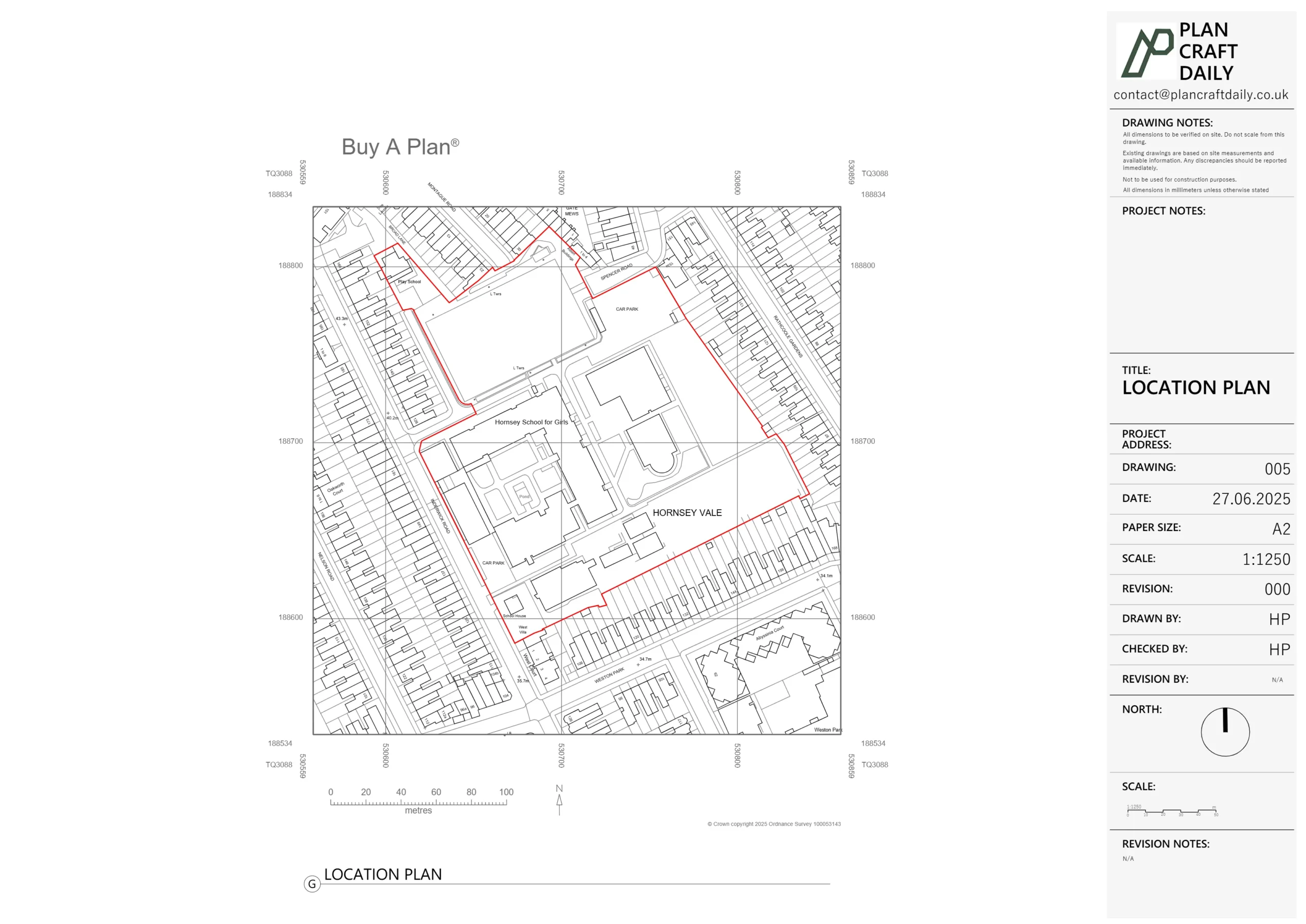
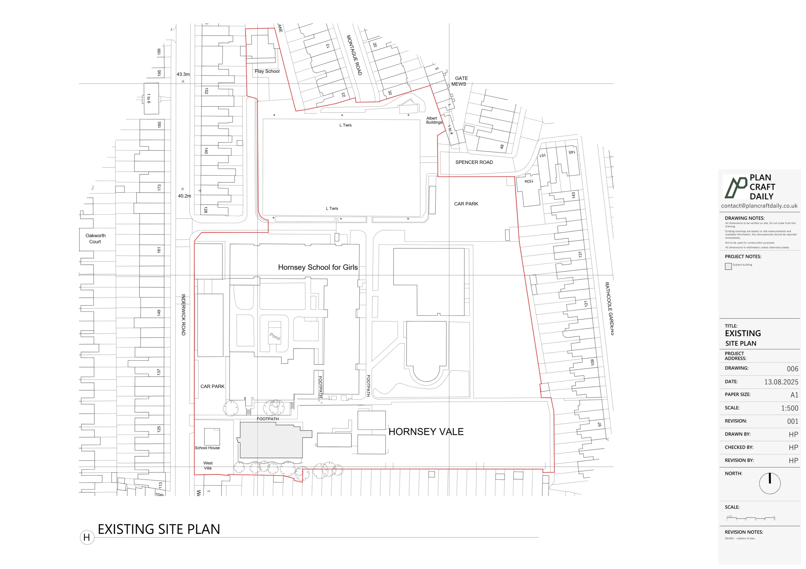
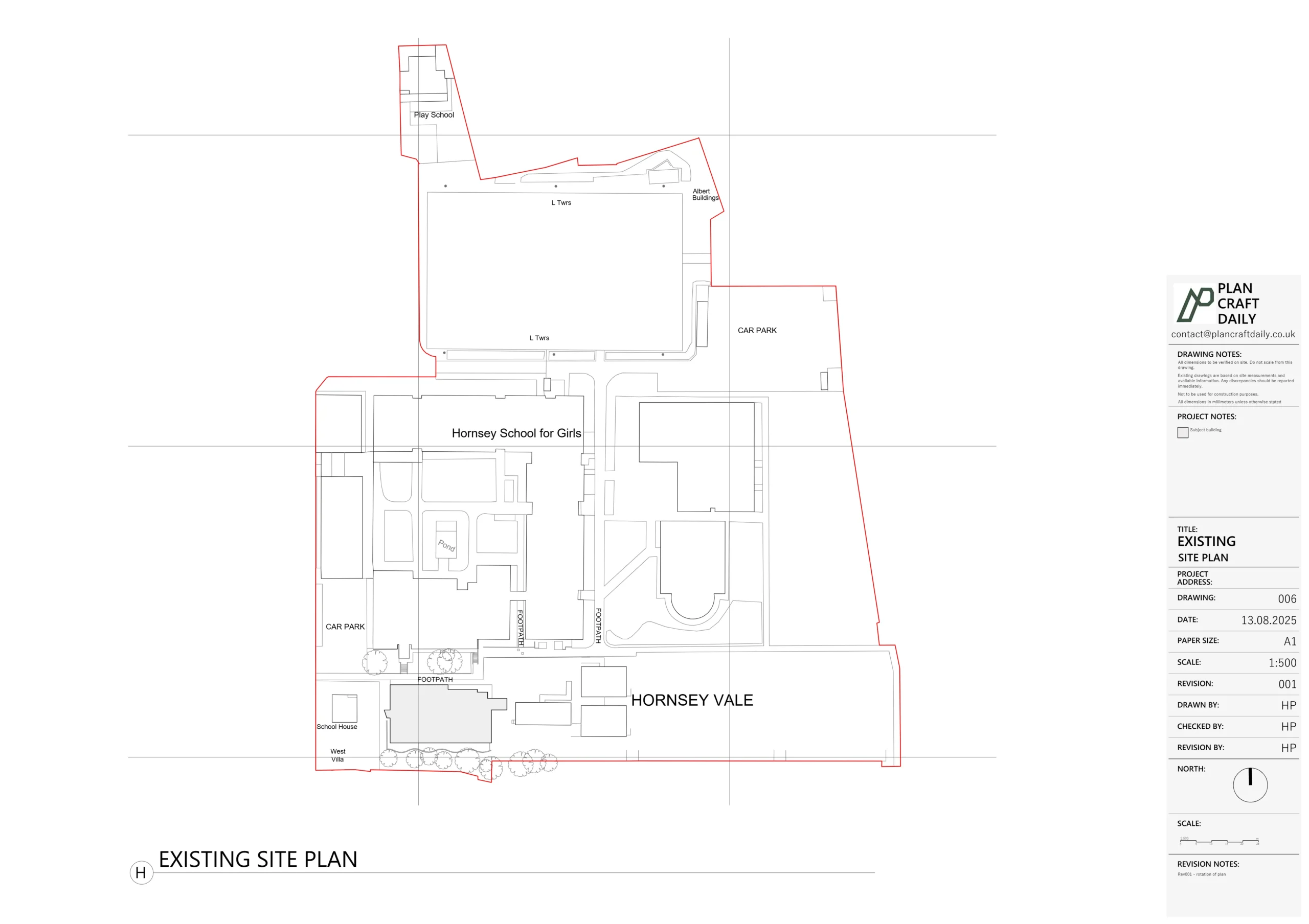
Mark the required survey extent on a plan and identify the outside features the designer needs. Avoid relying on “the garden” or “around the house” where the extent could be interpreted in different ways.
Use separate markings for the proposed work area and the area requested for surveying. The designer may need information beyond the immediate construction footprint, but that should be specified rather than assumed.
Discuss the relevant paths, steps, walls, trees, visible drainage features and ground levels. Note any separate access arrangements for a side passage, rear entrance or other part of the site.
If the requested information extends onto neighbouring land, identify that in the enquiry. Confirm permissions, access and what can actually be recorded before including it in the agreed scope.
For the wider feature checklist, see what a topographical survey includes.
Which connections between the house and site need attention?
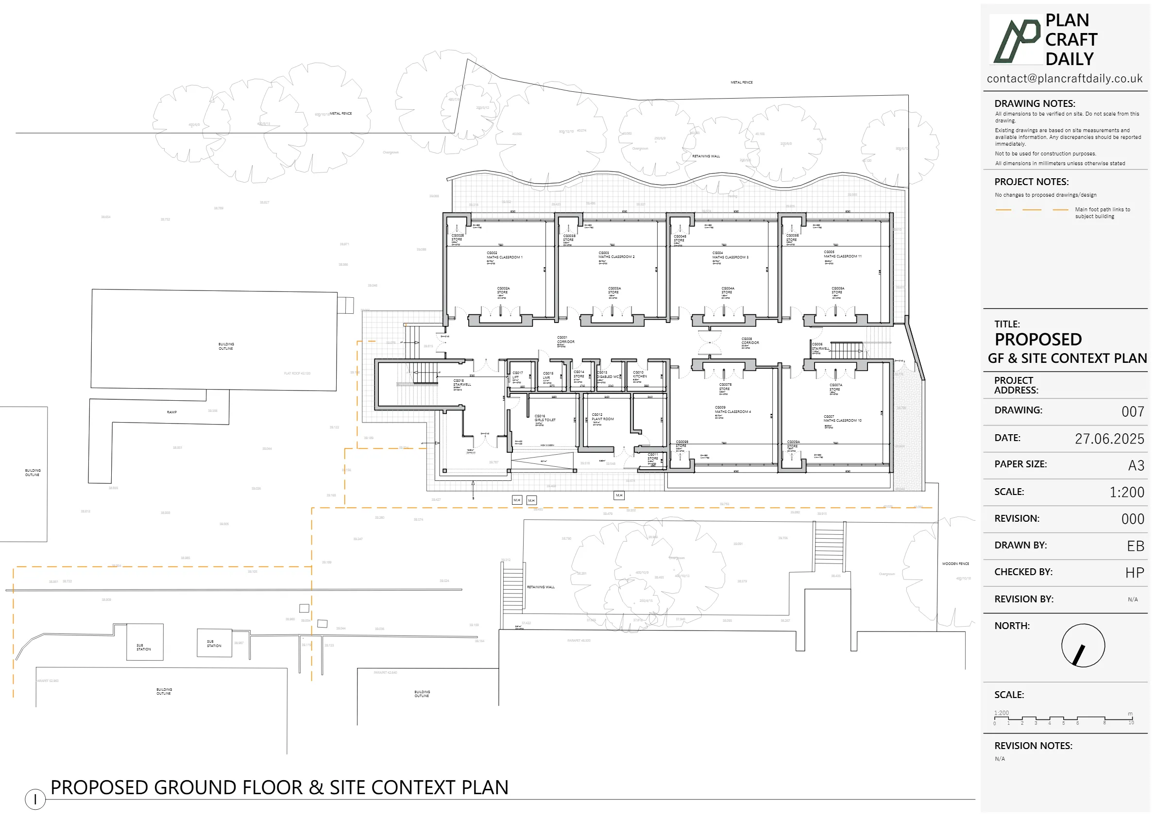
Identify where the designer needs to compare the building with the surrounding ground. These points are easy to leave between two separate briefs, so name them explicitly.
| Project question to discuss | Information request to confirm |
|---|---|
| How does the existing rear doorway meet the patio? | Relevant threshold, floor and adjacent external level information |
| How does a side passage relate to the house? | The requested building face, path and visible enclosing features |
| Where should a section explain the site relationship? | A marked section position and its required building and external extent |
| Which parts of the garden affect the design? | The agreed survey boundary, level detail and relevant site features |
| Are two providers supplying information? | Responsibility for connecting and coordinating their drawings |
These are prompts for the design team. They do not prescribe a standard package or tell the designer what levels the finished project should have.
Why do the drawings need compatible level and coordinate references?
The recipient needs to know how positions and heights in one survey relate to those in the other. A coordinate reference locates points; a level datum is the reference used for height values. Agree the required references and any necessary connection between datasets before the work begins.
A value on its own is not enough to make that connection. In a simple illustration, one drawing could assign a floor a level of 0.000 while another assigns the same point 100.000. The numbers use different starting references; they do not mean the floor has moved.
The RICS measured-survey specification addresses coordinate systems, height datums and connections to existing survey information. Ask the survey team and designer to agree what the project requires. The client does not need to choose a technical system without their advice.
Does booking both surveys mean one visit?
Not necessarily. Combined commissioning and a single site visit are different things. Confirm who will attend, which areas they need and whether separate appointments are planned.
The building survey may require access to rooms and other agreed internal spaces. The external work needs access to its own defined area. The same person may not hold the keys or permissions for both.
When arranging attendance, provide:
- A named contact and telephone number for each access arrangement
- Any limits on occupied rooms or working hours
- Information about locked gates, detached spaces and separate entrances
- Known obstructions or ongoing building work
- The process for reporting areas that cannot be accessed
Agree how incomplete access will affect the drawing notes and whether further attendance would need arranging. Our survey-visit preparation guide covers the practical arrangements in more detail.
What did a combined Plan Craft Daily project include?
The Beckenham project brought building and external-site information into one agreed drawing package. It provides an example of a defined brief rather than a standard bundle for every property.
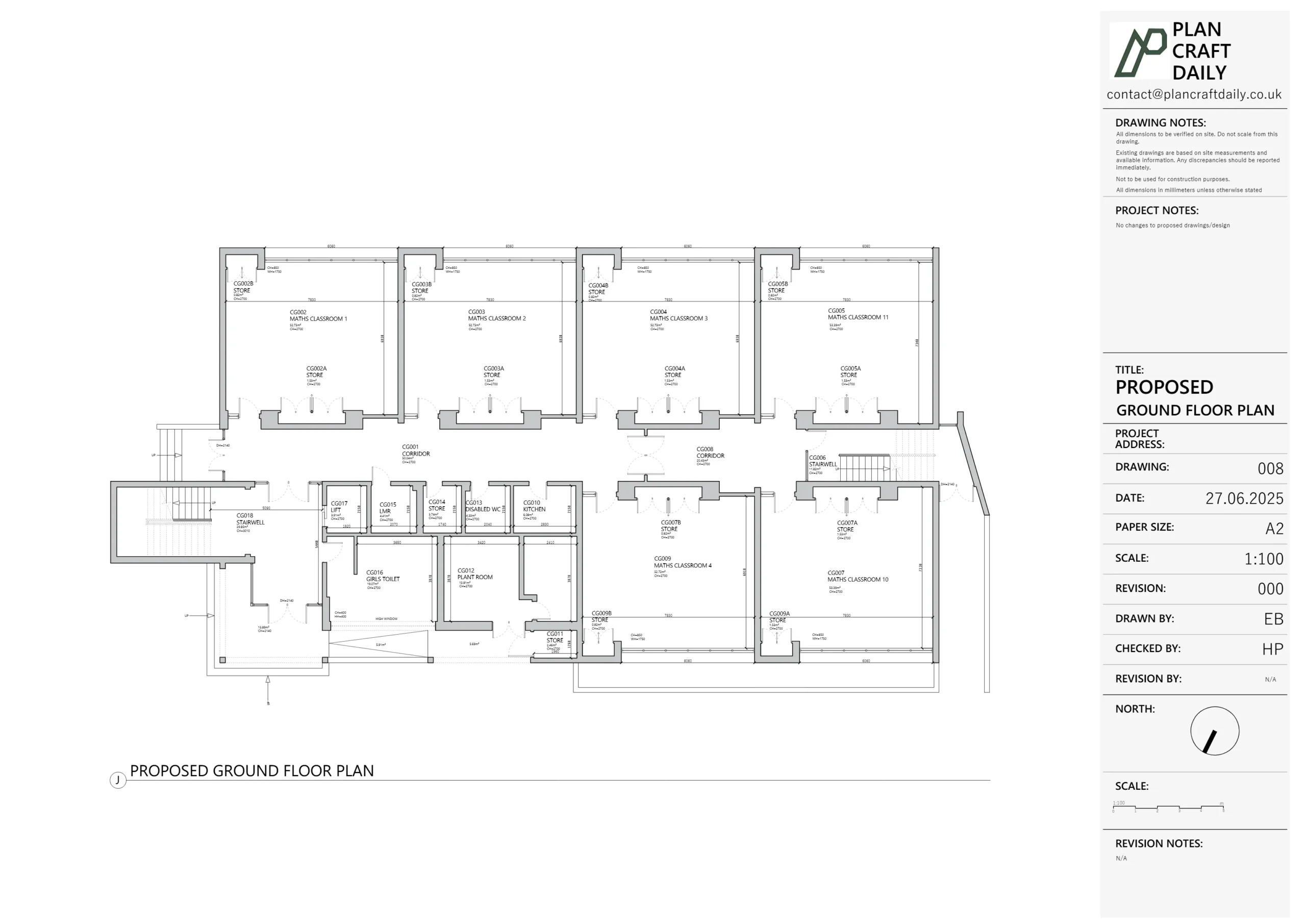
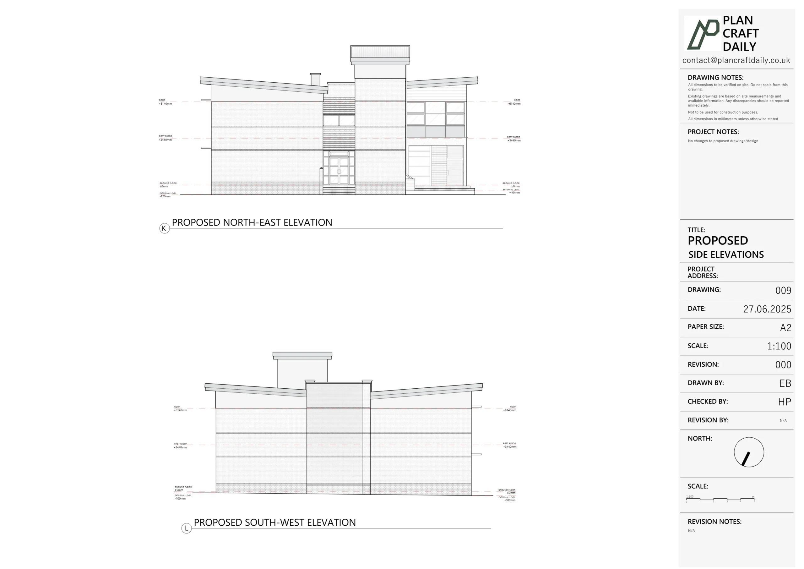
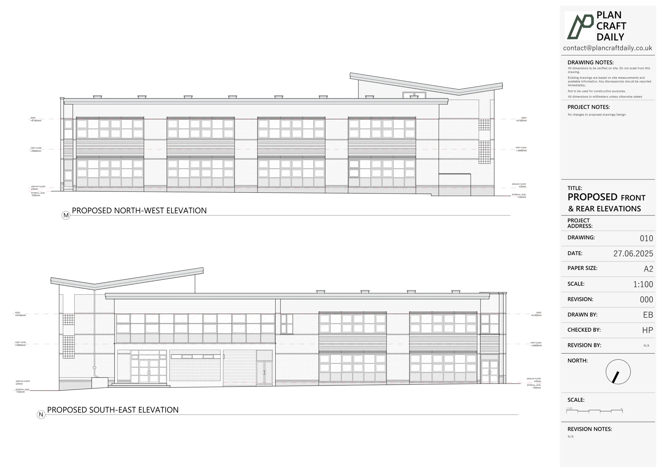
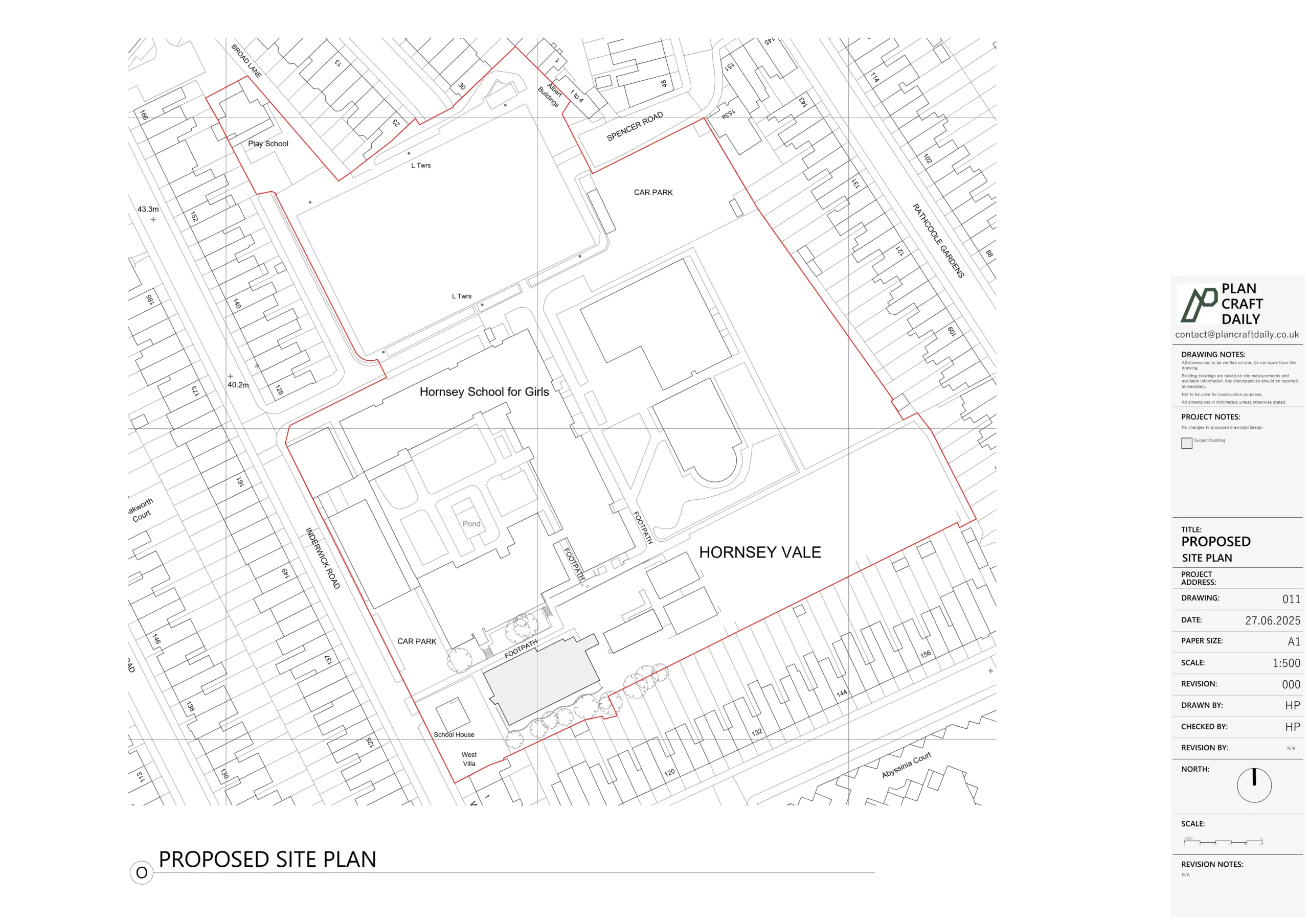
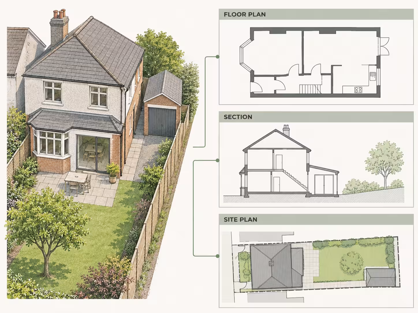
The client requested floor plans across three levels, including the side garage, all elevations, a front-to-back section and a survey-based site plan. External information included site levels and plotted trees.
Separate visits were arranged for the measured building and topographical work. The team then prepared draft drawings for review before issuing the final DWG and PDF files with site photographs.
Read the Beckenham combined-survey case study for the published project details. A different property or design task may need a smaller package or a different selection of views.
Can you reuse an existing survey for part of the work?
Yes, if the project team confirms that the existing information is suitable for the intended use. Send the original files and accompanying notes for review before assuming that one part must be surveyed again.
Explain what has changed since the information was collected and identify any missing areas. Ask the team to confirm what can be retained, what needs checking and what additional work is required.
The Survey Association's client guide explains why information prepared for one purpose may not meet another purpose's detail or accuracy needs. The decision should consider the proposed use, not just the existence of a drawing file.
Our guide to old floor plans and new measured surveys provides a fuller checklist for reviewing earlier building information.
What should the final drawing package contain?
The final package should contain the agreed views and files, with clear titles, revisions and any relevant survey limitations. Confirm how the building and site information will be presented and who will coordinate it for the recipient.
Ask the designer about the preferred CAD version and file arrangement before drawing production. For example, they may have requirements for receiving the site and building information that should be considered when the work is quoted.
Check that the issue list matches the agreed brief. If a section, floor or external area could not be completed, that should be apparent from the delivered information rather than discovered during design.
The DWG and PDF deliverables guide explains the formats. Requesting editable files does not by itself define the drawing contents or guarantee that independently prepared files will align.
What is a useful combined-survey enquiry template?
Use a short brief that the designer can complete and the survey team can confirm. Attach marked-up drawings where a list alone would be unclear.
Property address:
Purpose of the work: Describe the intended alteration and who will use the drawings.
Building areas: List the floors, rooms and attached spaces required.
Drawing views: List the plans and elevations; mark any section positions.
External survey extent: Attach a plan outlining the area requested.
Important site features: Identify the levels, features and building-to-ground relationships the designer needs.
Existing information: Attach available drawings and explain known changes or gaps.
Coordination: Ask who will confirm the survey references and bring the information together.
Access: Name the contacts, restrictions and any separate permissions needed.
Deliverables: State the required file formats and any drawing-organisation requirements.
Programme: Give the required issue date for the team to review and confirm.
If a requirement is undecided, mark it for discussion. That is more useful than selecting a technical option without knowing whether the project needs it.
How can Plan Craft Daily help with a combined survey brief?
Plan Craft Daily can review the building and site information your project needs and quote for the agreed survey and drawing scope. Send the designer's requirements, marked survey extent and available files before arranging attendance.