Noel, Finance Director for a local property owner in High Wycombe town centre, was referred to us by his solicitors at Blandy & Blandy. His company owned two adjoining commercial properties sharing a rear car park. One of the properties was being sold to a related company.
The problem:
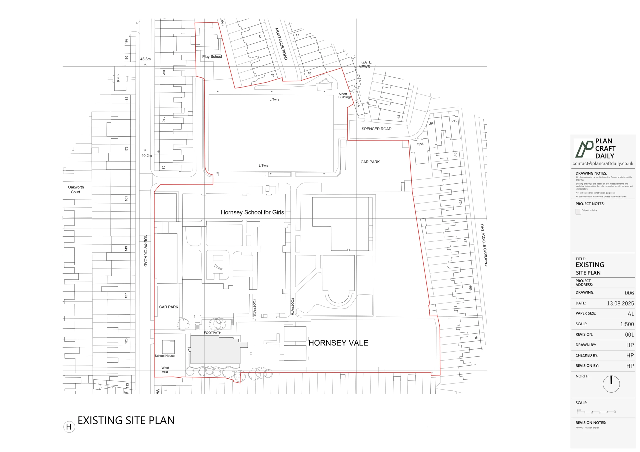
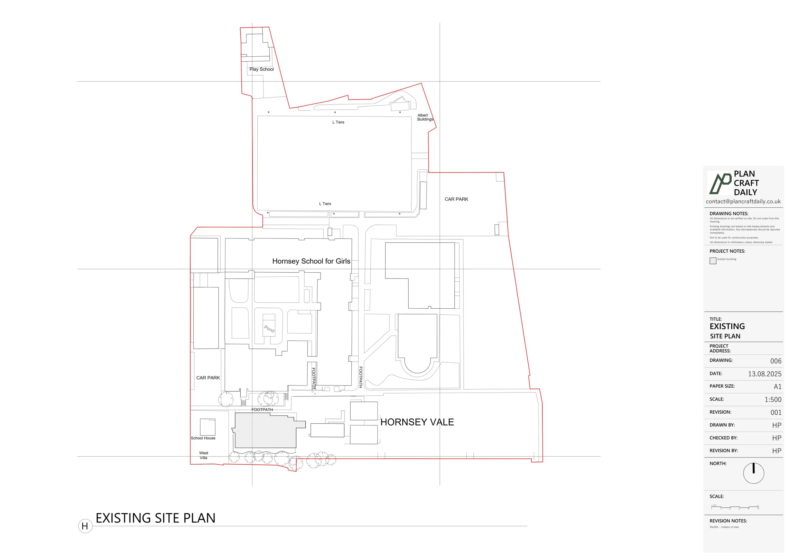
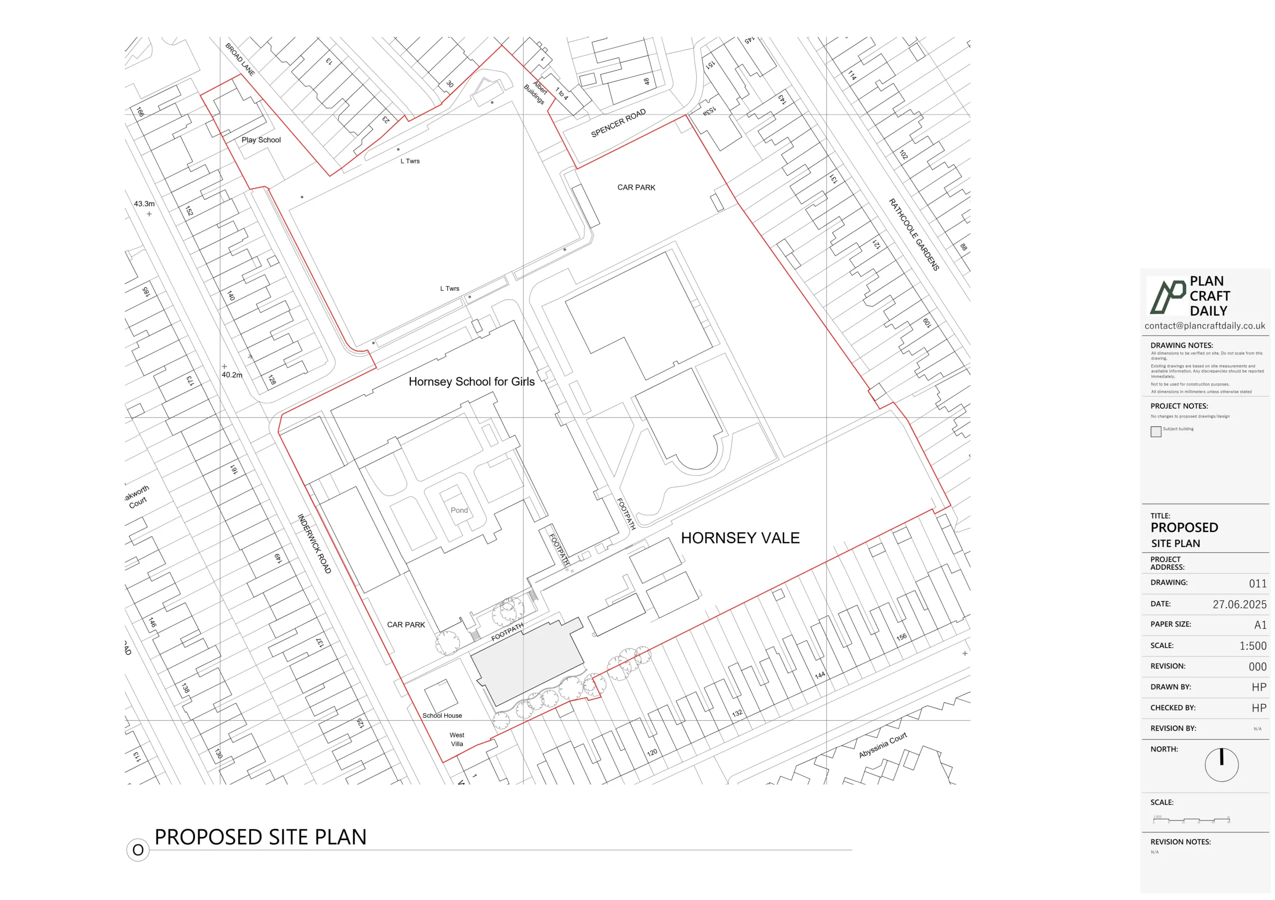
- The Land Registry title plans for the two buildings showed an unclear and partially incorrect car park layout.
- There was also an apparent “intrusion” from a neighbouring property on the opposite street into the car park area.
- The lawyers on both sides needed a single, Land Registry–compliant plan that:
- Clearly split the car park between No. 14–16 and No. 18.
- Showed the covered passageway and right of way for one property through to the car park.
- Could be submitted to the Land Registry as part of a sale and later correction of the title plans.
Noel needed someone who could understand both the legal and technical side: how the rights were described in the contract, and how to translate that properly into a clean, scaled plan that the lawyers could actually use.
Turning legal instructions & title plans into a working mock-up
Our first step was to review:
- The existing Land Registry title plans for both properties (supplied by Noel).
- A site photo of the shared car park, to understand the current reality.
- Noel’s detailed email explaining what the lawyers needed to see and how the rights were worded.
From this, we proposed a simple, fast approach:
- Desktop-based CAD drafting only – no full measured survey required.
- A fixed, low three-figure fee, including:
- A first mock-up plan for internal discussion.
- Light revisions once the lawyers commented.
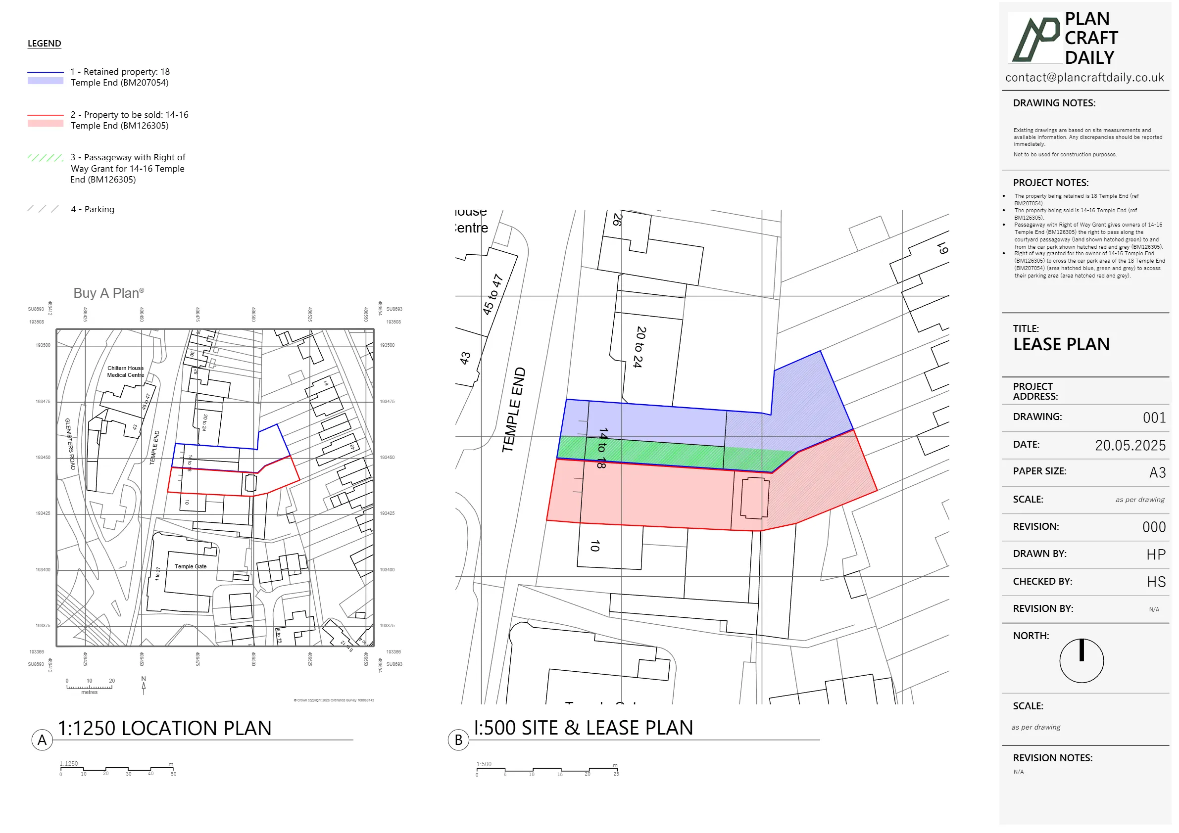
We then produced a mock-up lease/transfer plan showing:
- The two title parcels, clearly distinguished.
- The courtyard passageway under the building, highlighted and hatched to match the “right to pass along the passageway” wording in the legal documents.
- The split of the rear car park using a “dog-leg” red line exactly as shown on the relevant title, but tidied up so it could be understood at a glance.
- A proposed note format that could be adapted to match the lawyers’ preferred wording.
We sent Noel this mock-up along with an invitation to a quick call so he and our CAD technician could go through any adjustments in real time. That gave him something concrete to show both sides’ lawyers and helped him secure internal sign-off to proceed.
Refining the plan with the lawyers
Once the mock-up was in front of everyone, the feedback was small but important:
- The car park hatching needed to be more obvious, to remove any ambiguity.
- The note on the inset plan needed to reference “transfer” rather than “lease”, to match the actual transaction.
- The right-of-way wording and colours had to mirror the exact way the contract described the rights.
We treated this as a normal iterative design process:
- Issued the first draft Land Registry–style plan (PDF, with clear hatching and colouring for:
- Retained property
- Property being sold
- Shared access routes / rights of way.
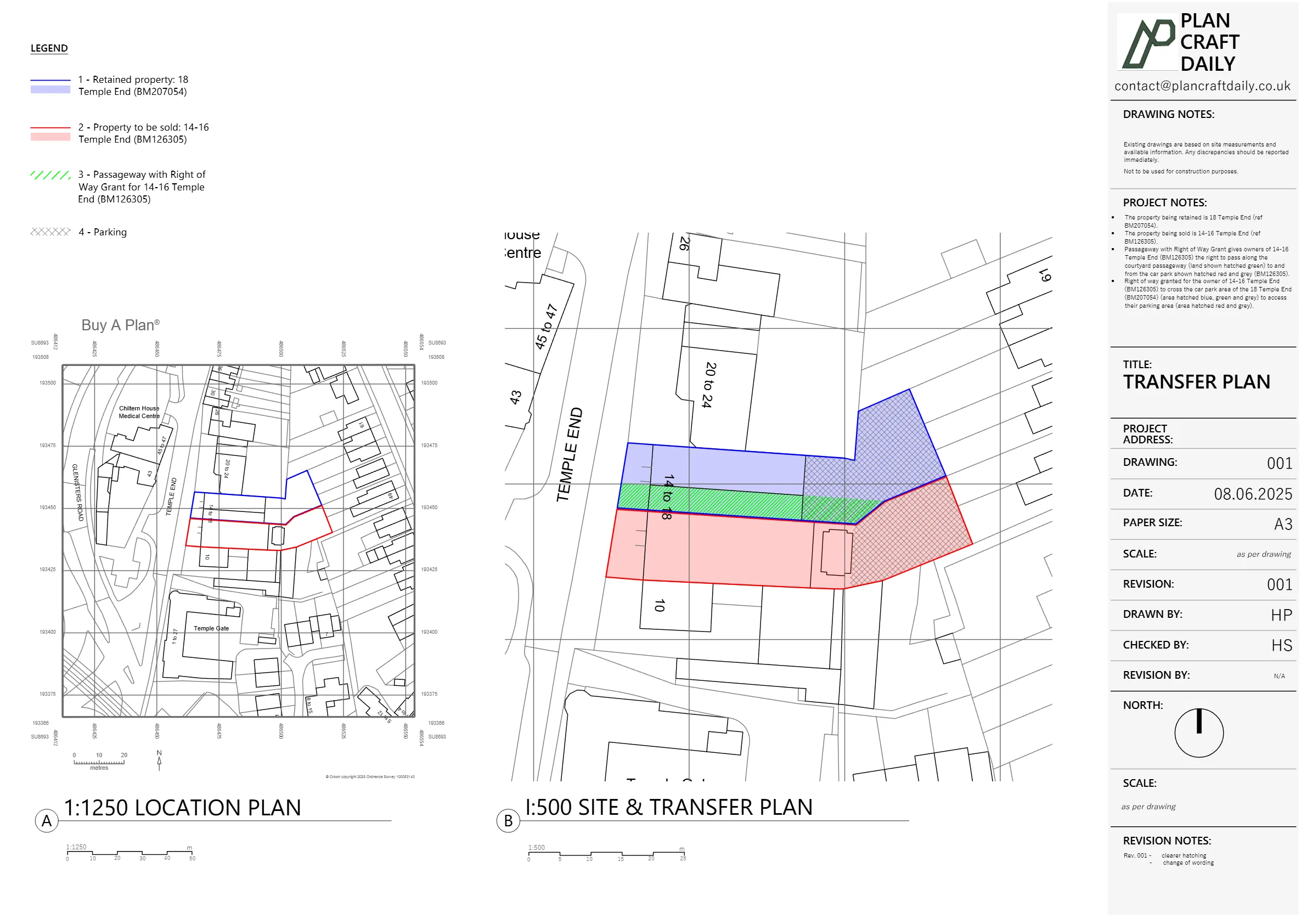
- Noel came back with the precise request from the lawyer:
- Change one reference from “lease” to “transfer”.
- Make the hatching bolder so the shared and retained areas were unmistakable.
- We prepared Rev001 of the plan, implementing:
- Updated wording in the key/notes.
- Stronger hatch patterns for each area (retained, transferred, rights of way).
- A clean, Land Registry-friendly layout at an appropriate scale.
Noel’s comment after sending Rev001 to his lawyer was simple: they were content with the plan, and we were “very nearly there”.
Managing changes & keeping the file live
Because this drawing was tied to a live property transaction, Noel also needed some flexibility:
- He expected that the Land Registry might ask for a further iteration later when they considered the correction to the neighbouring property’s encroachment.
- He wanted assurance that the file wouldn’t be archived immediately once the current sale completed.
We handled that in two ways:
- Confirmed that the project file would remain open and accessible on our side for the foreseeable future, so any follow-on work would be quick and cost-effective.
- Clarified that any future Land Registry-driven changes would simply be treated as a new, clearly scoped mini-project, building on the same CAD base we’d already created.
At the same time, we kept the admin side simple:
- Issued a 50% initial invoice to activate the work.
- Sent over the final invoice once the lawyers were happy with the draft plan.
- After Noel settled the final payment, we issued:
- A payment receipt for his records.
- The final, watermark-free plan suitable for submission and long-term file storage.
We also gently asked Noel, if he was happy with the service, to refer us back to his lawyers and leave a brief review—both of which help us grow this specialist part of our work.
Final outcome
For Noel and his legal team, we delivered:
- A clear, Land Registry–compliant plan showing:
- Exactly which building is being sold and which is retained.
- The shared car park split with the correct “dog-leg” boundary.
- The covered passageway and rights of access, visually aligned with the contract wording.
- A corrected depiction of the car park in preparation for approaching the Land Registry about the neighbouring title’s encroachment.
- Quick turnaround:
- Mock-up issued promptly so the lawyers could start reviewing.
- Draft and revision completed within days once feedback arrived.
- A reusable CAD base that can support future:
- Land Registry corrections
- Any later site sales, lease plans, or access-rights diagrams the group may need.
For other property owners and finance directors, this case shows how we can slot into a lawyer-led transaction, speak both “CAD” and “legal language,” and quietly solve a boundary and rights-of-way problem that could otherwise hold up a sale.
Project Details
| Service Type | Land Registry–compliant lease / transfer plan (no site survey) |
| Time Taken | 1 week |
| Location | Temple End, High Wycombe (Buckinghamshire) |