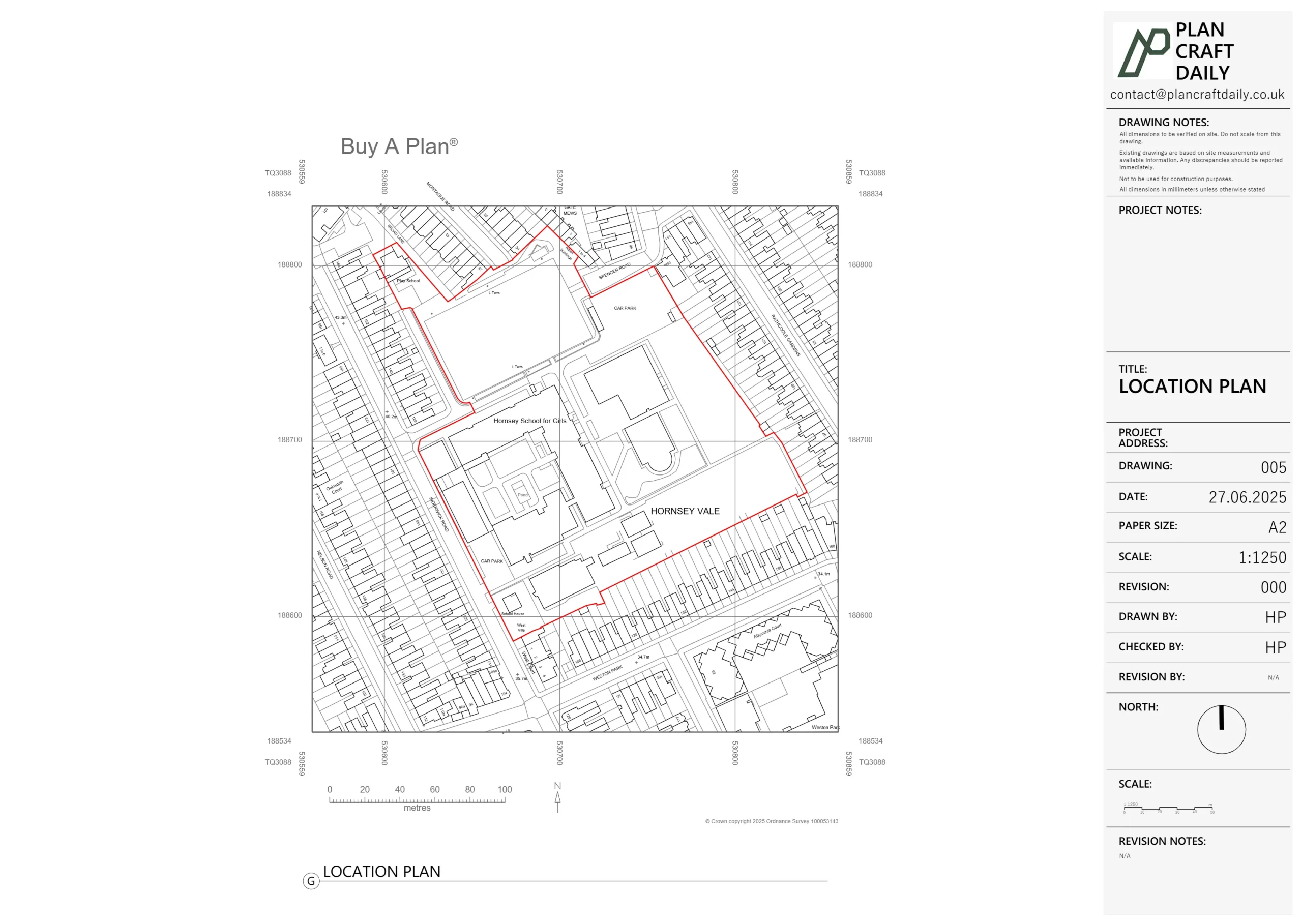
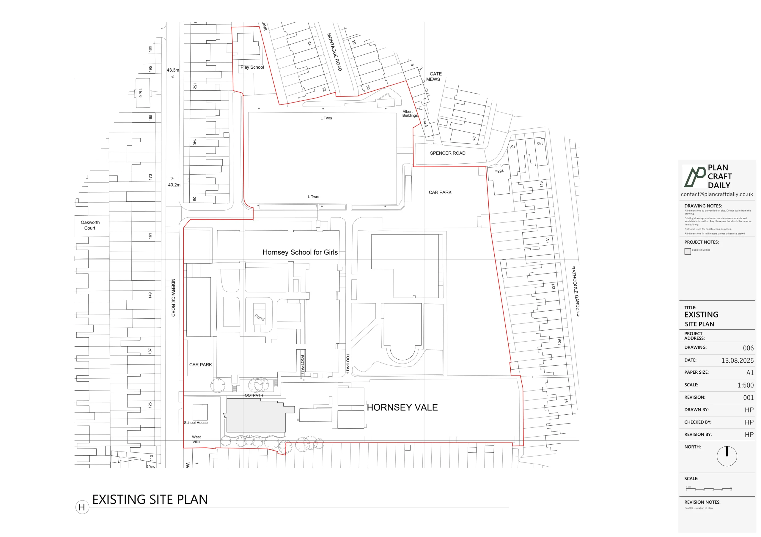
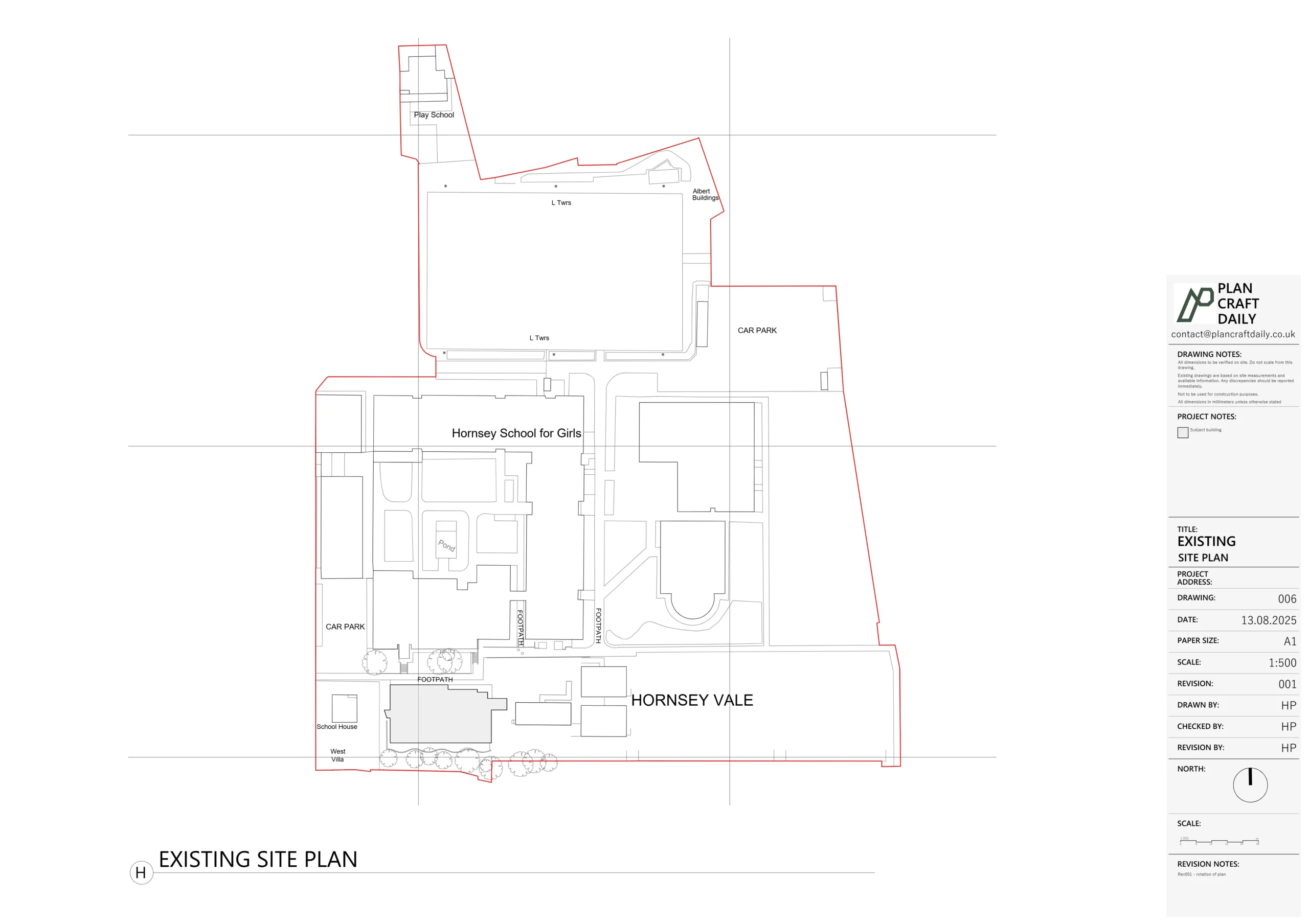
Matteo, an architect client, reached out about a detached property in Mill Hill where he needed a single, coordinated CAD base for both building and landscape design.
His brief covered:
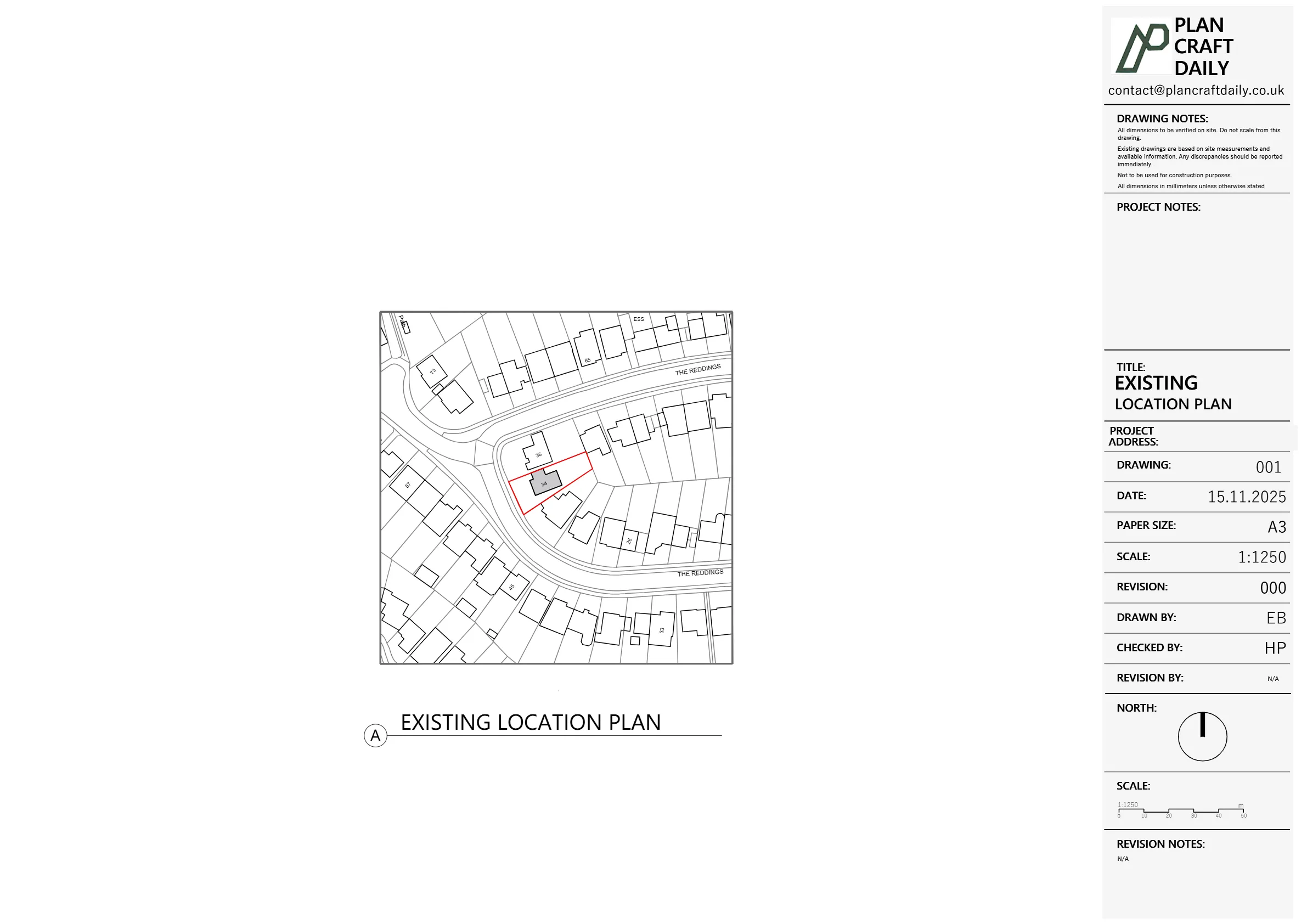
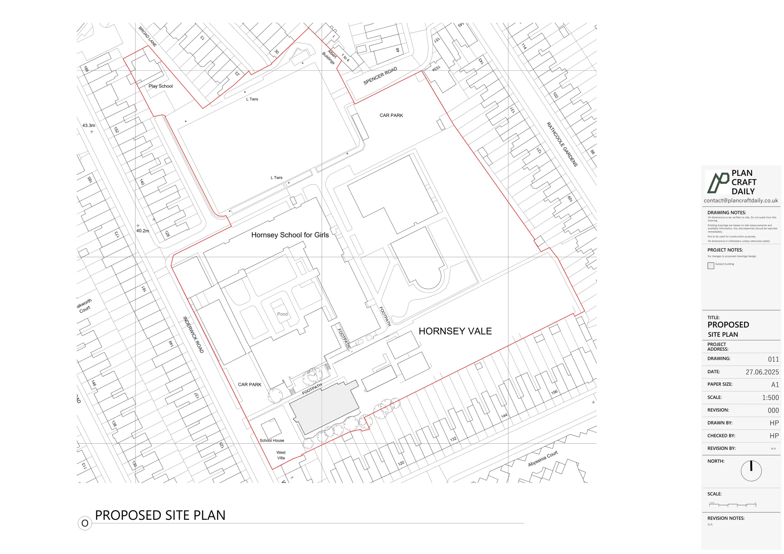
- Entire plot – front and rear gardens with spot levels and key features (walls, steps, boundaries)
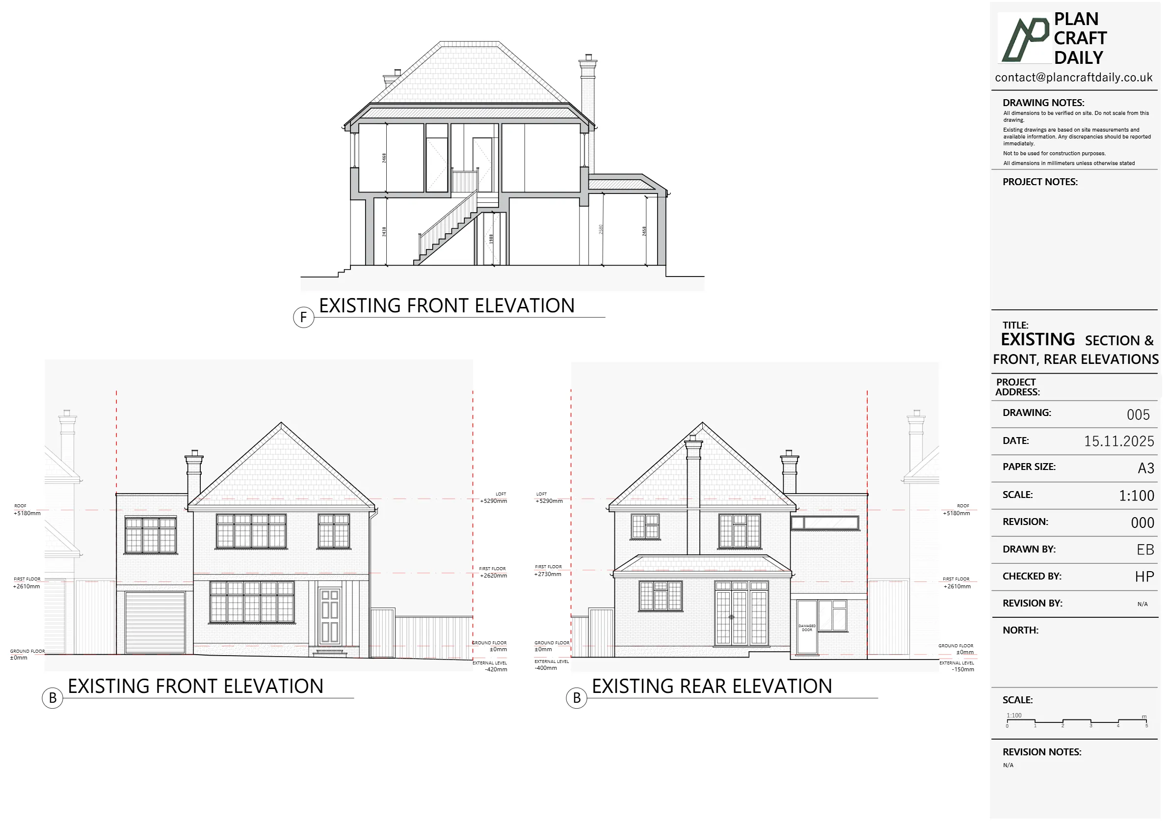
- External elevations – full house elevations, plus the front outlines of both neighbouring properties to show relative building heights
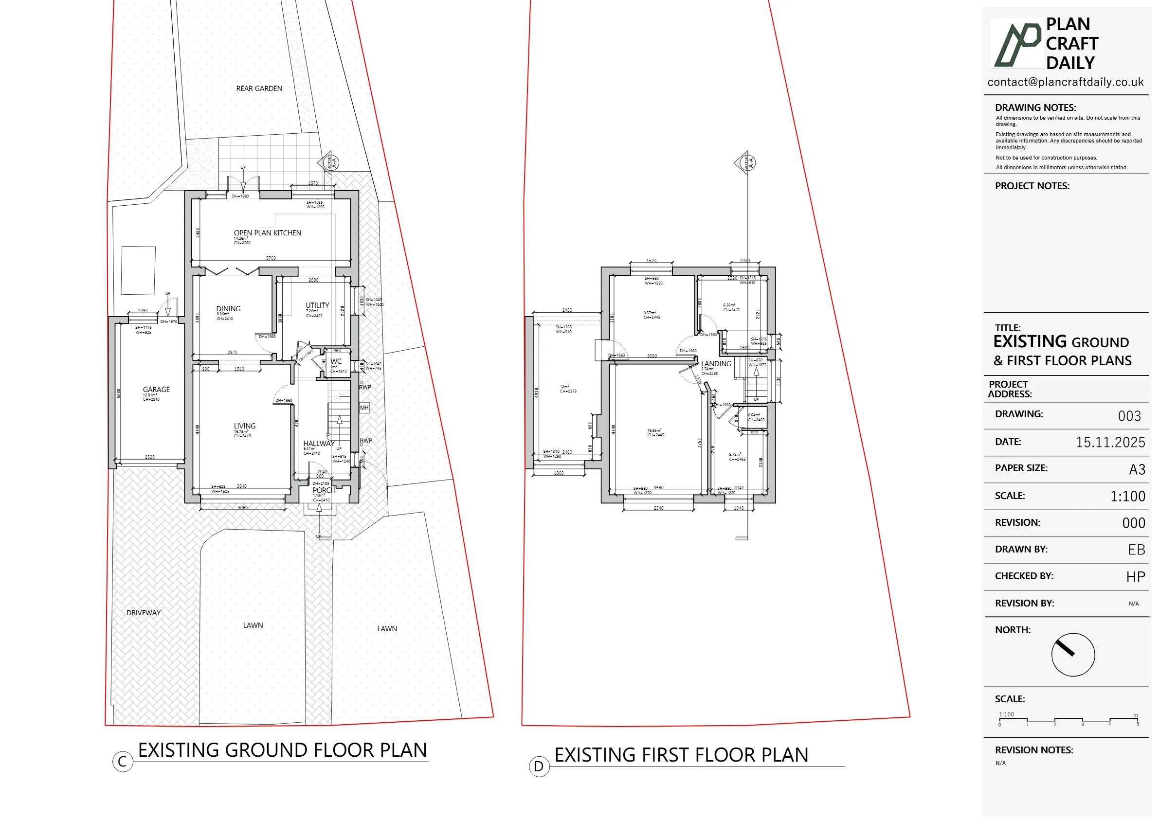
- Internal plans and a section – priced as an add-on option so the client could choose how far to go
The client was keen to move quickly, so from the very first email Matteo asked both for a quote and for how soon we could:
- Get the surveys done, and
- Turn around clean DWG files.
We proposed two scope options; the client confirmed Option 2 – the combined package of full site/topographical survey plus internal plans and one section – and asked us to make the invoice out to Adi, his client.
Scheduling and survey setup
Once Matteo confirmed:
- We issued the invoice and provisionally booked the survey for Saturday, with:
- Topographical survey 9:00–10:00 am
- Measured building survey 10:00–11:00 am
- Adi paid in full and sent payment confirmation, which we receipted straight away.
- We shared both surveyors’ details so the team could coordinate access on the day.
We also committed in writing to a 3–5 working day turnaround for the CAD files after the survey – an important promise for Matteo’s project programme.
How we carried out the surveys
1. Topographical survey – building the site model
Our topo partner attended site first to map the whole plot:
- Set up a total station on the front driveway and rear garden to pick up:
- Building corners and wall lines
- Garden walls, fences and obvious boundaries
- Steps, patios and changes in level
- Spot levels at key door thresholds and garden areas
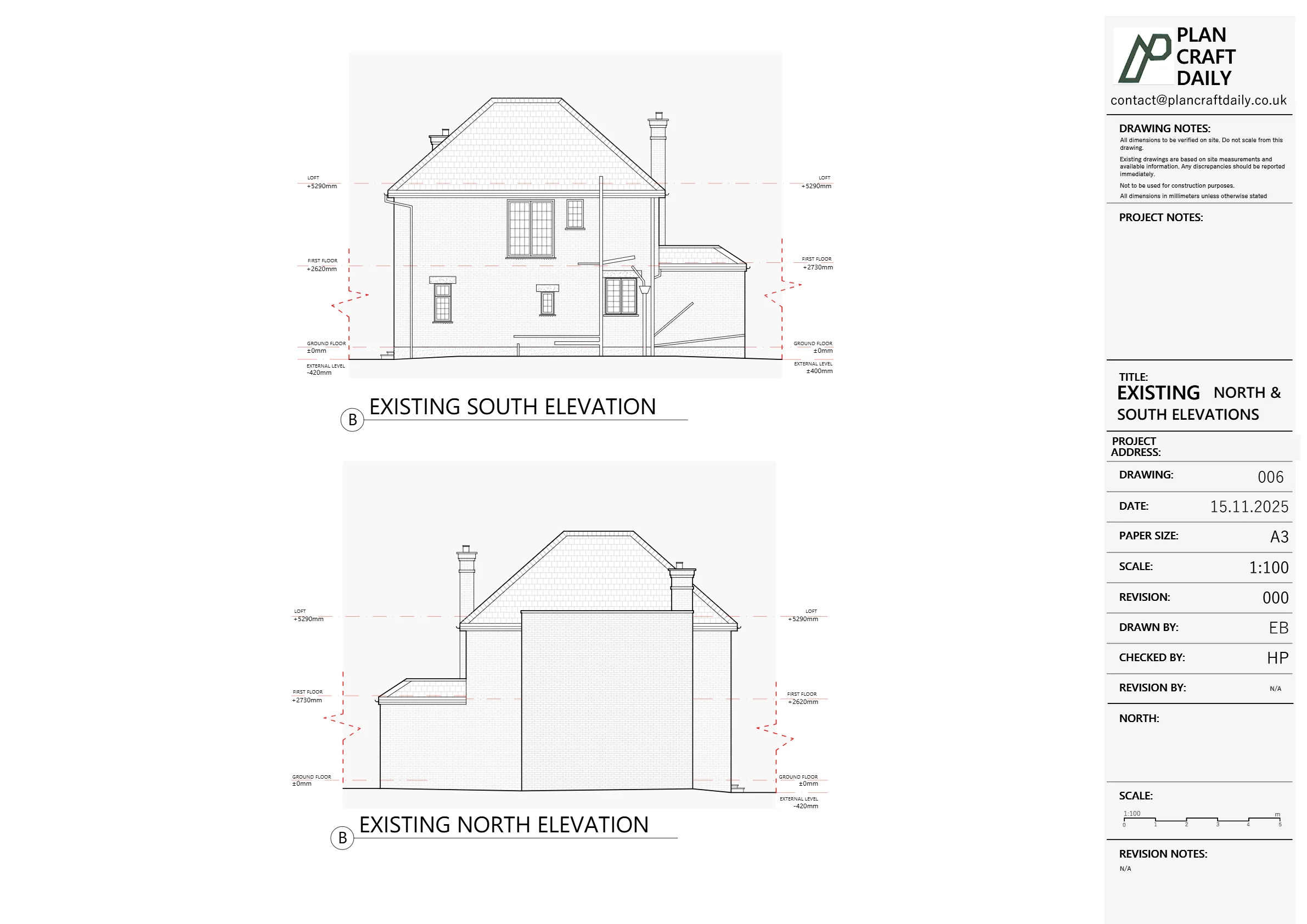
- Captured a simple front-elevation outline of the two adjacent properties so Matteo could clearly show how his client’s house sits in the street scene.
This work produced a 3D point cloud of levels and features, which we later converted into a 2D CAD topographical base and a contoured surface suitable for planning drawings and early design.
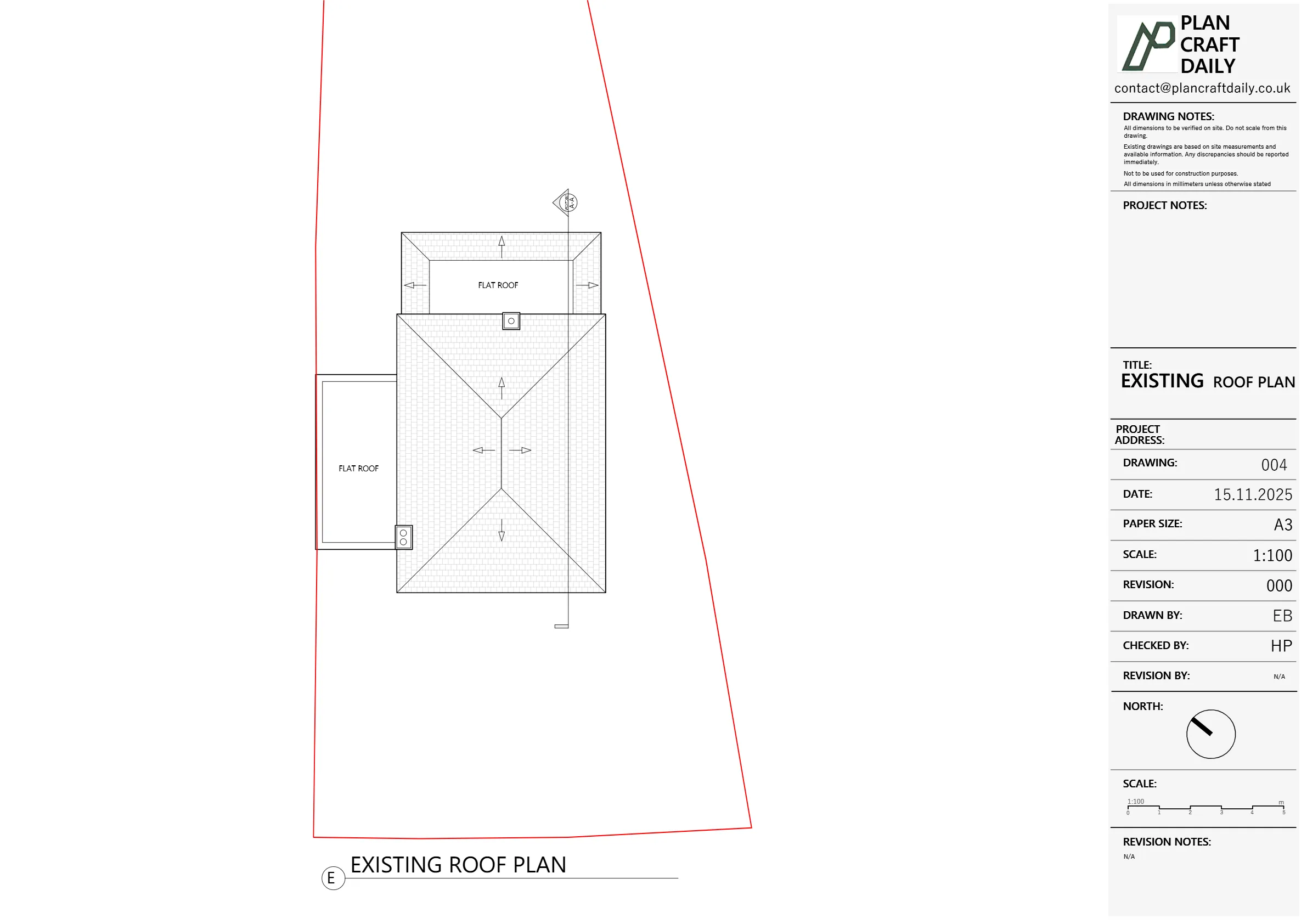
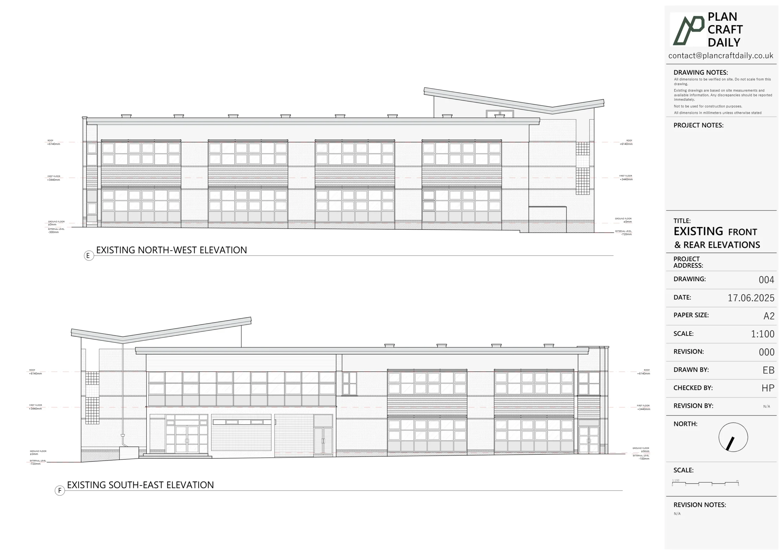
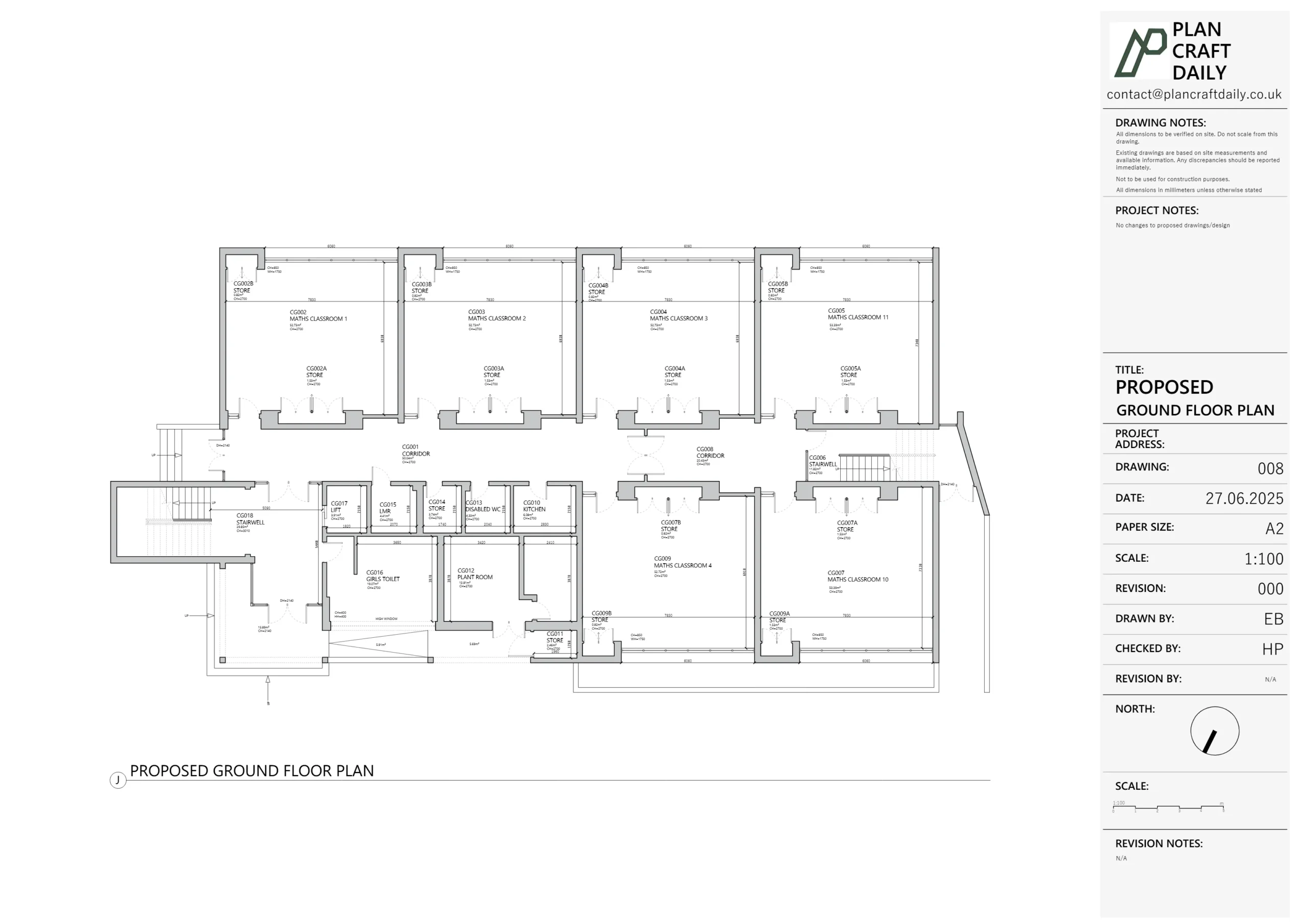
2. Measured building survey – internal plans, elevations, and a key section
Later that morning, our measured surveyor arrived to focus on the house itself.
Using a laser disto and tape, he:
- Worked room-by-room to record:
- Internal wall positions
- Door and window locations and sizes
- Stair geometry, landings and handrails
- Changes in floor levels and floor-to-ceiling heights
- Checked overall internal dimensions against the topo building footprint to reduce the risk of cumulative error.
- Took a structured set of site photographs (front, rear, sides, key internal views) to anchor the elevations and section later.
For the section, he collected:
- Floor levels, soffit heights, ridge and eaves levels
- Thicknesses of floors and roof build-up where visible
- Approximate positions of key structure (e.g. spine walls, main beams if exposed)
By the end of the visit we had:
- Full measurement data for internal plans and a long section
- Enough external control to produce coordinated elevations tied back to the topo level data.
Turning survey data into CAD drawings
Back in the office, we merged the topographical survey and measured building survey into a single CAD workflow:
- Topographical base
- Imported the surveyor’s point data and created a clean 2D site plan.
- Marked garden features, boundaries and spot levels in a layered, OS-aligned CAD file so Matteo could easily overlay proposals and drainage.
- Internal plans
- Drew ground and upper floor plans directly from our measurements.
- Standardised wall, door and window layers to match our usual architect-friendly layer naming, making the file easy to edit.
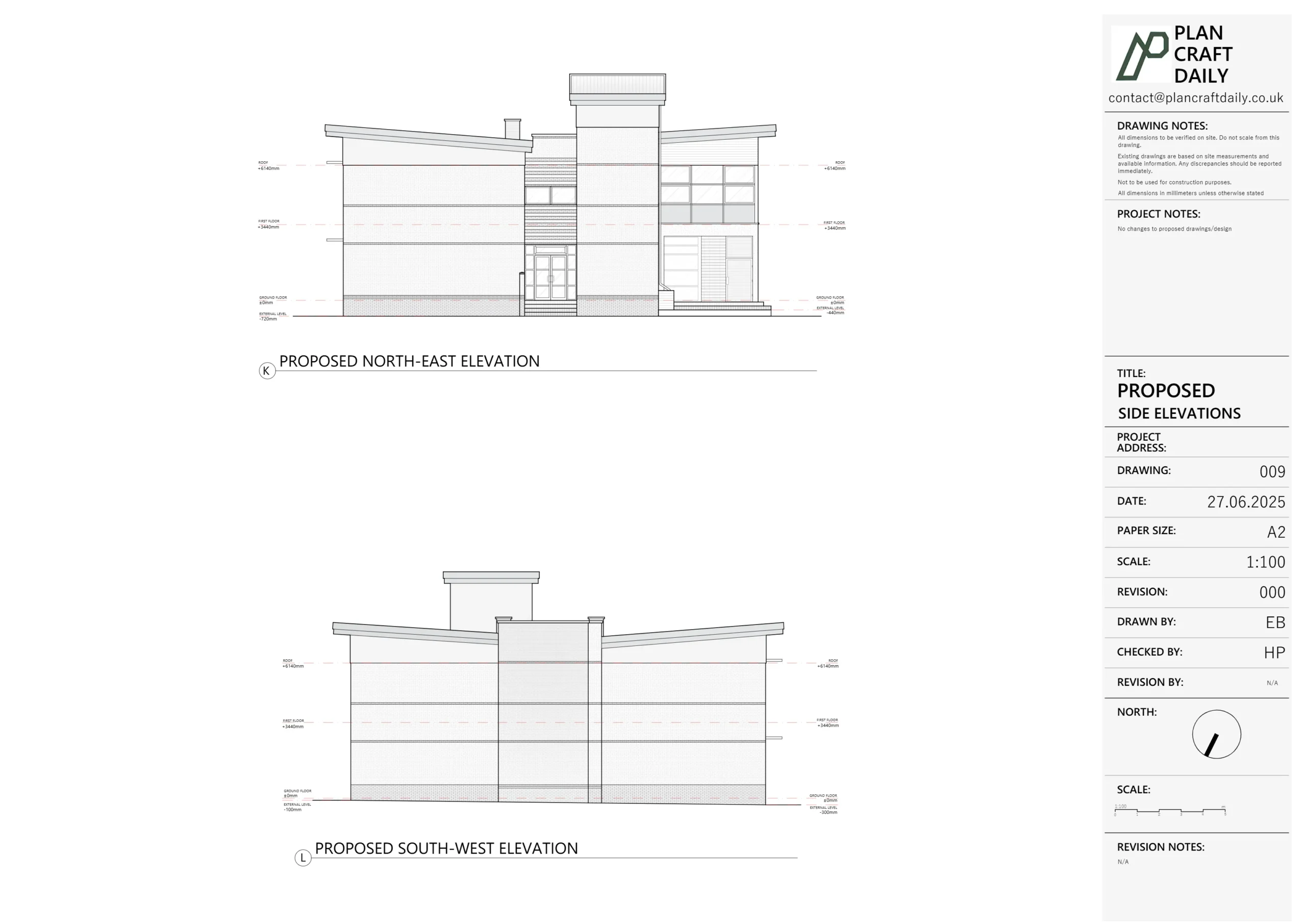
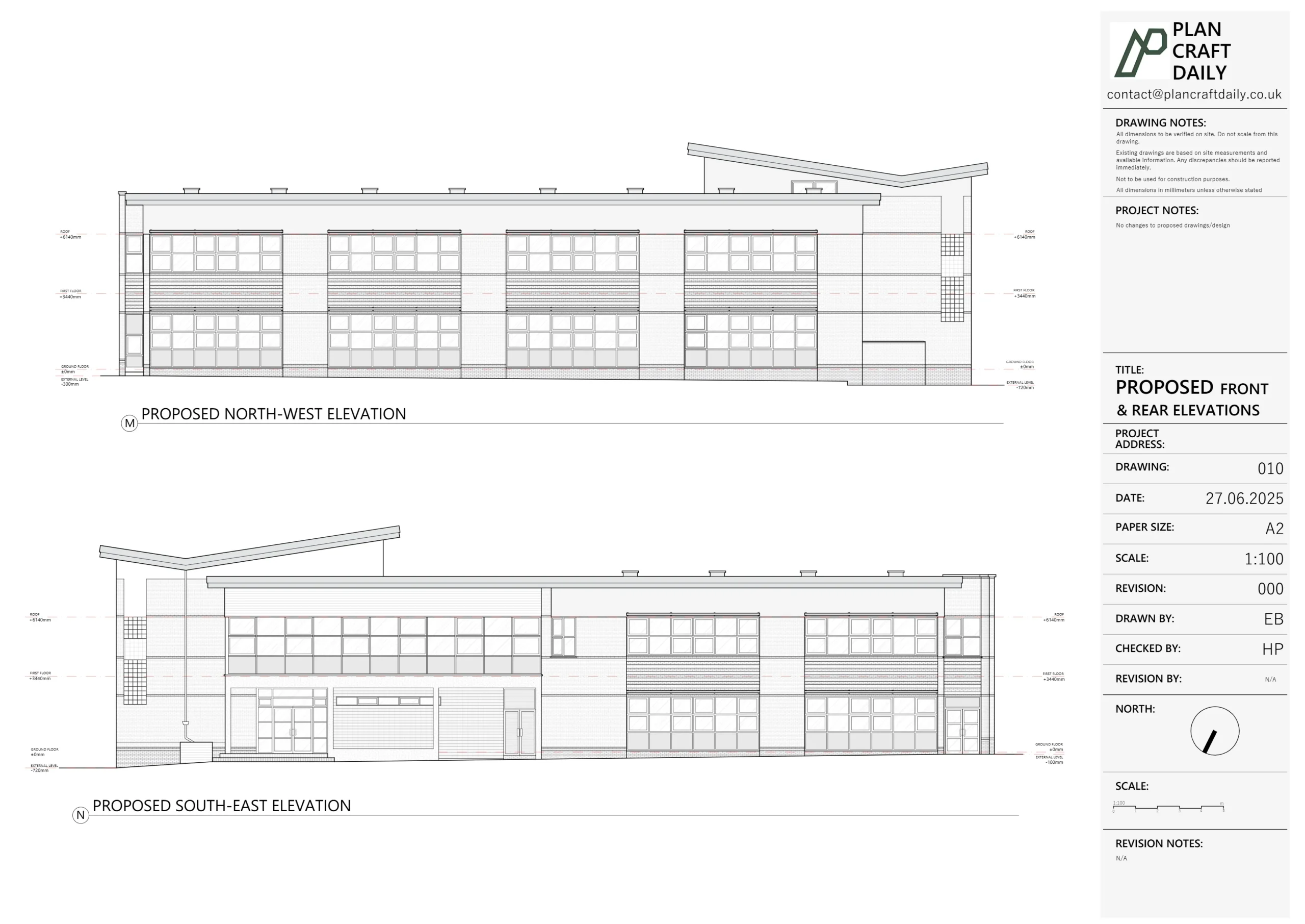
- External elevations & neighbouring outlines
- Modelled front and rear elevations from measured dimensions and photo references.
- Added the outline of the two neighbouring houses at the front, tied to the topo levels, so Matteo could immediately show relative ridge and eaves heights in planning submissions.
- Section through the house
- Cut a long section front-to-back, aligning all level information with the topographical base, including loft space where measurable.
- Ensured floor build-ups and roof pitches were recorded to a standard suitable for early structural and architectural design.
We then exported:
- A draft PDF pack for review
- Prepared the DWG and associated files ready to be issued as the final package once everyone was happy.
Managing delay and maintaining trust
Although we had aimed to hit the 3–5 working day target, the reality was that:
- Coordinating the topo data, neighbouring outlines and internal section into one coherent set took a little longer than planned.
- We held the drawings back briefly to complete extra internal QA checks, rather than rush something out.
Once the final pack was ready, Syed sent:
“HERE are the final drawings and related files of this project. Please let us know if you have any other queries.”
To close the loop properly, Harry then followed up directly with Matteo:
- Acknowledging the delay versus our original promise
- Explaining that we’d taken extra time to maintain our usual standards
- Offering a 15% discount on their next project as a gesture of appreciation for their patience.
This is exactly how we like to handle schedule pressure:
be transparent, own the delay, and give something tangible back.
Final outcome
For The Reddings in Mill Hill, we ultimately delivered:
- A fully coordinated CAD base covering:
- Entire plot with levels and garden features
- Front outlines of neighbouring houses
- Internal plans and a long section
- External elevations tied to real site levels
- A DWG package plus PDFs that Matteo could plug straight into his planning and design workflow.
- A positive working relationship with both the architect and the homeowner, strengthened by clear communication and a proactive goodwill gesture when timings slipped.
The result: Matteo and Adi gained a robust, future-proof survey base for everything from planning drawings to detailed design—while knowing that if something takes longer than expected, we’ll always be upfront and on their side.
Project Details
| Service Type | Full measured building survey + topographical survey, existing plans, elevations, section & CAD package |
| Time Taken | 2 weeks |
| Location | Mill Hill, North-West London |