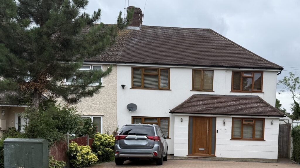
Kaushal, an architect, approached us for a measured survey and existing/as-built drawings of a residential property in Borehamwood, Hertfordshire.
His brief was more detailed than a simple “plans and elevations” job. From day one he was clear that he needed a drawing set strong enough to support:
- A Building Regulations application, and
- A potential future planning application.
He requested:
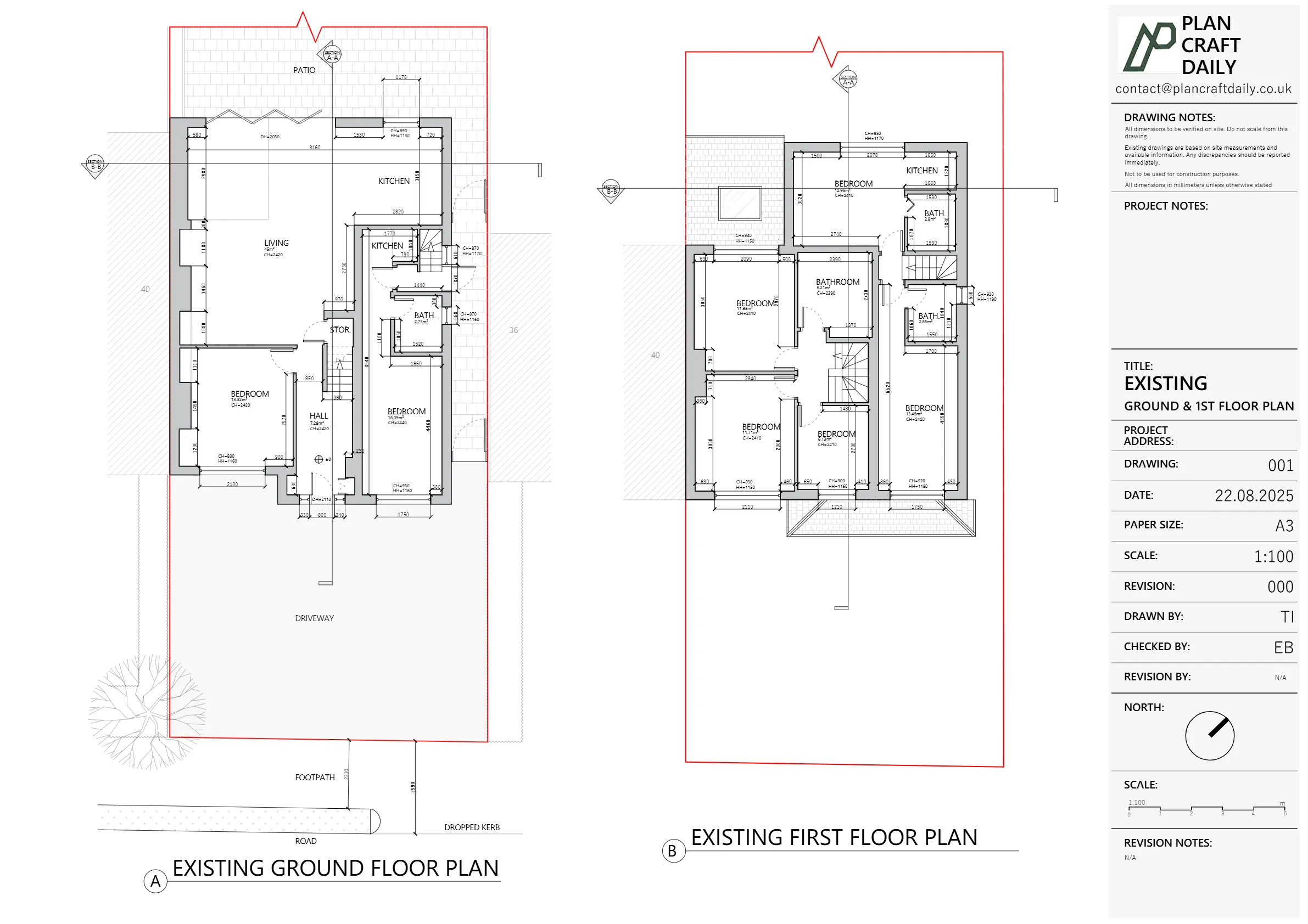
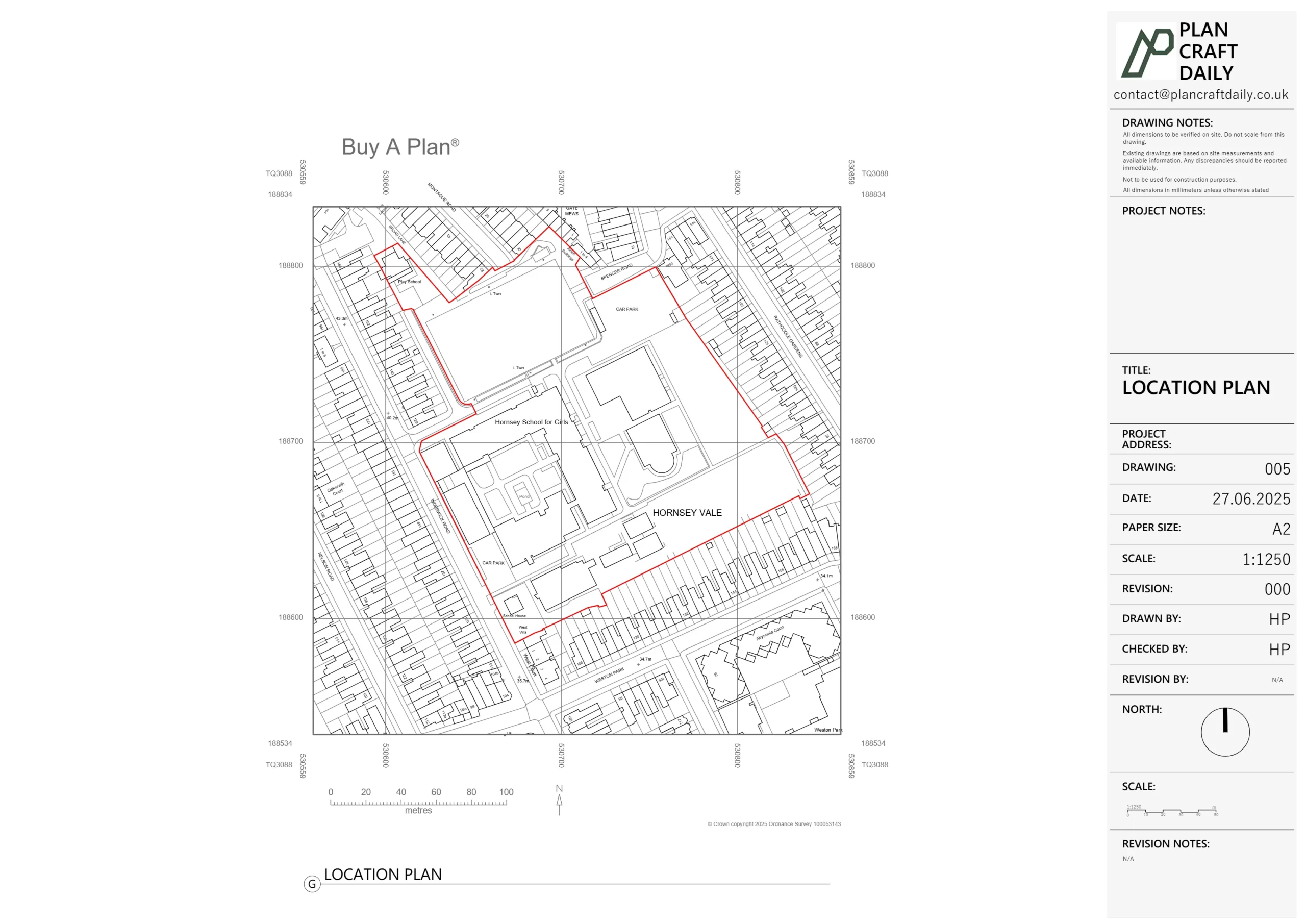
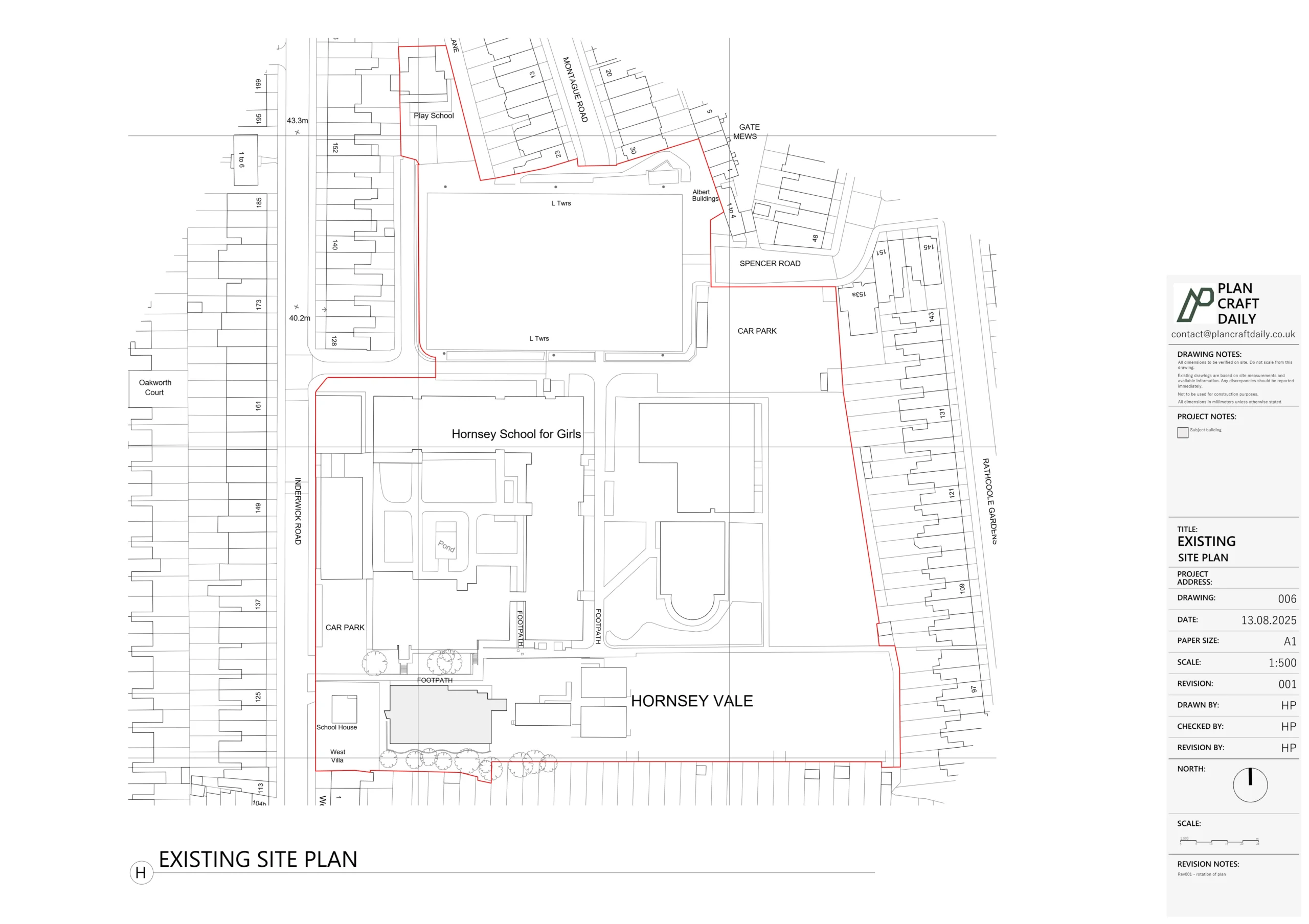
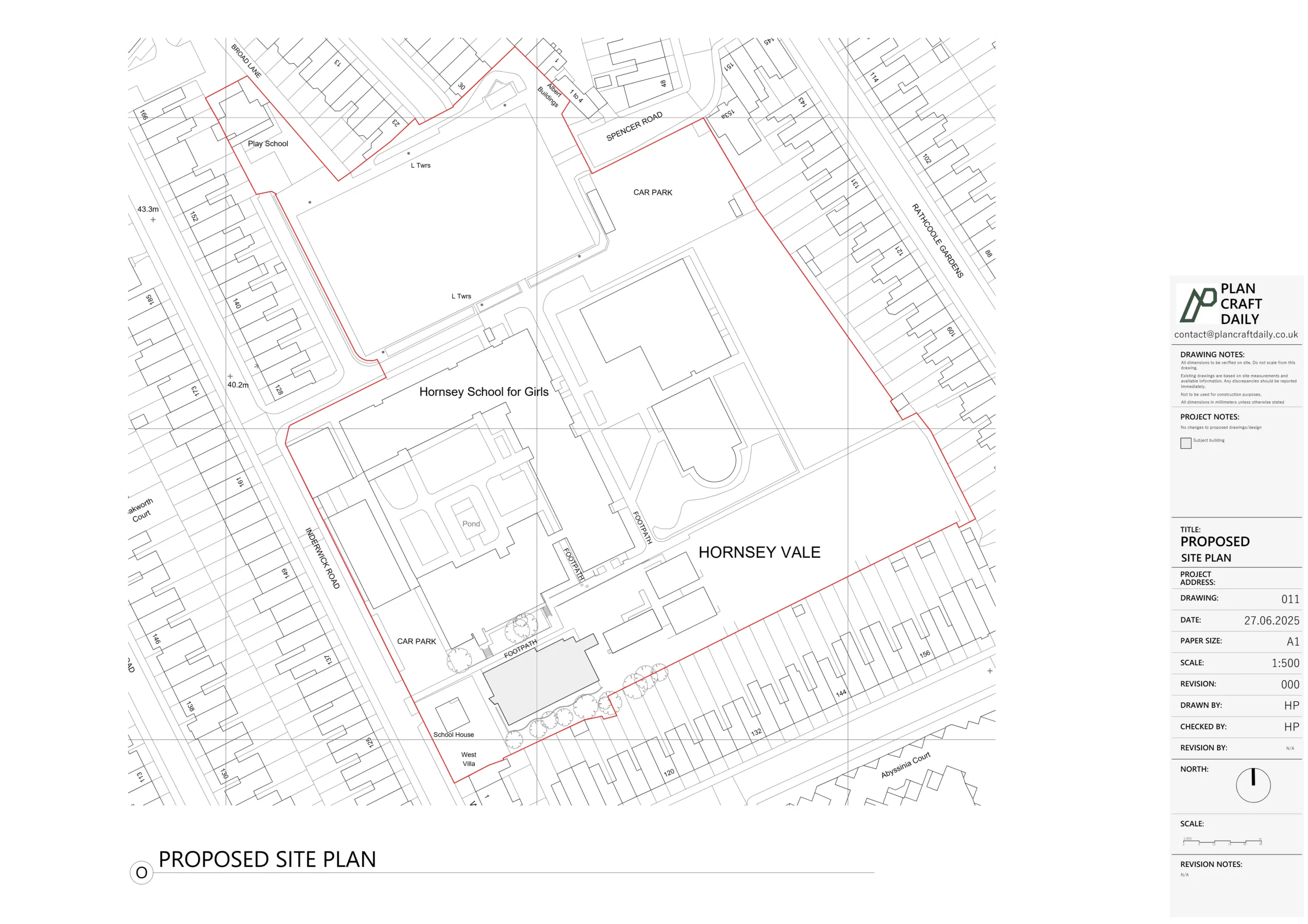
- Measured site plan (not an OS map)
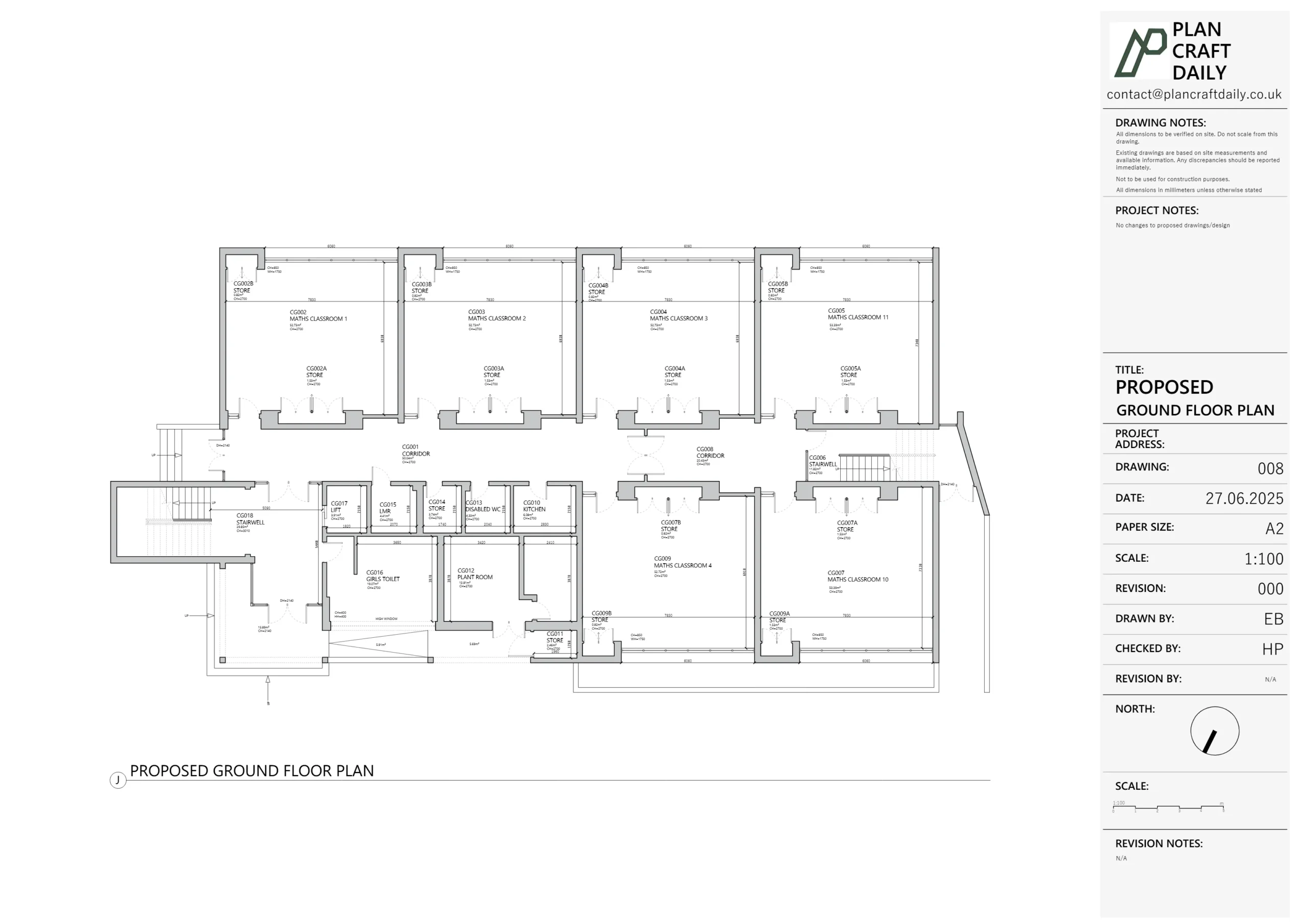
- All floor plans
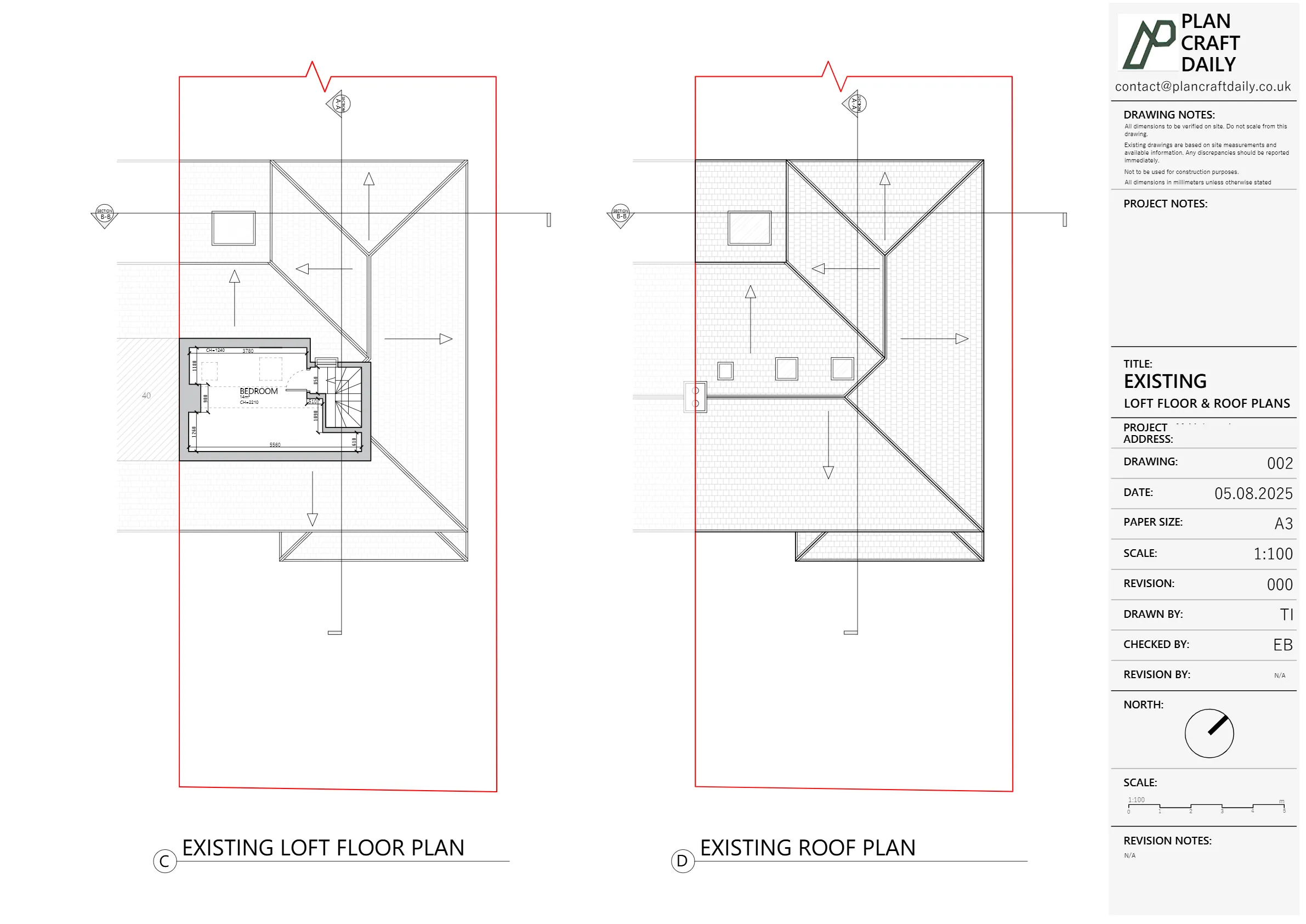
- Roof plan
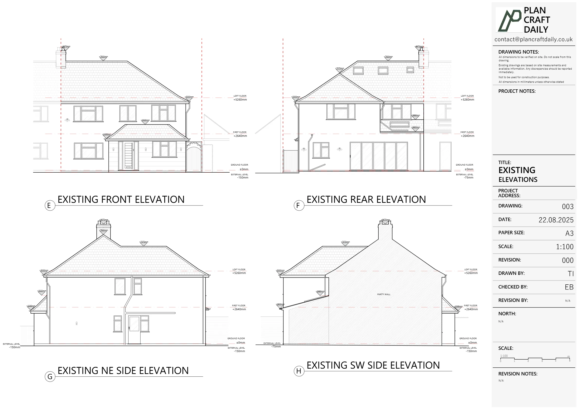
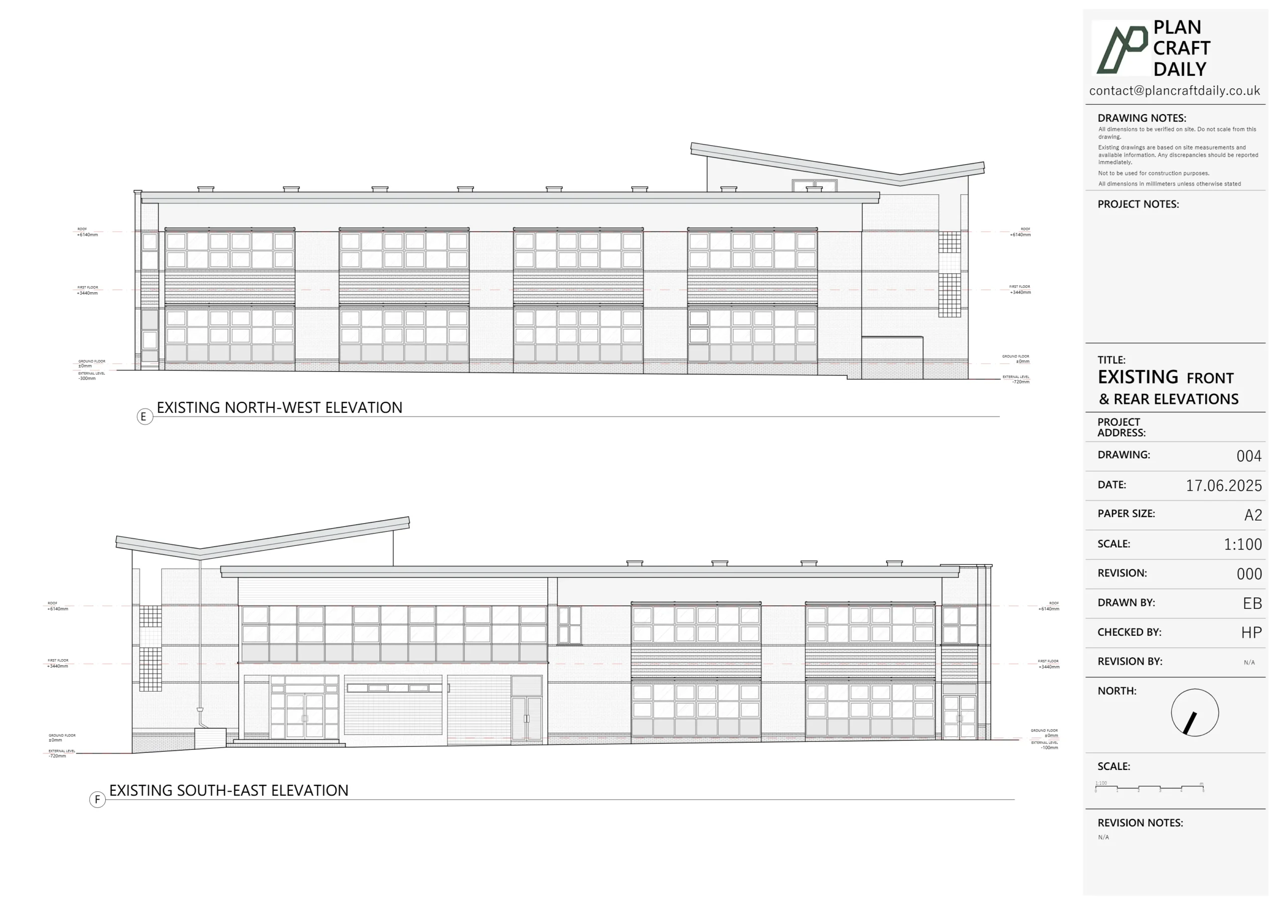
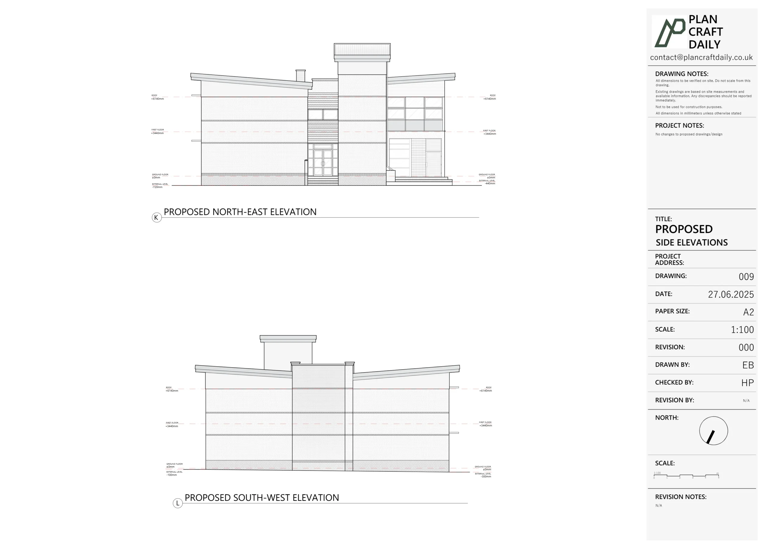
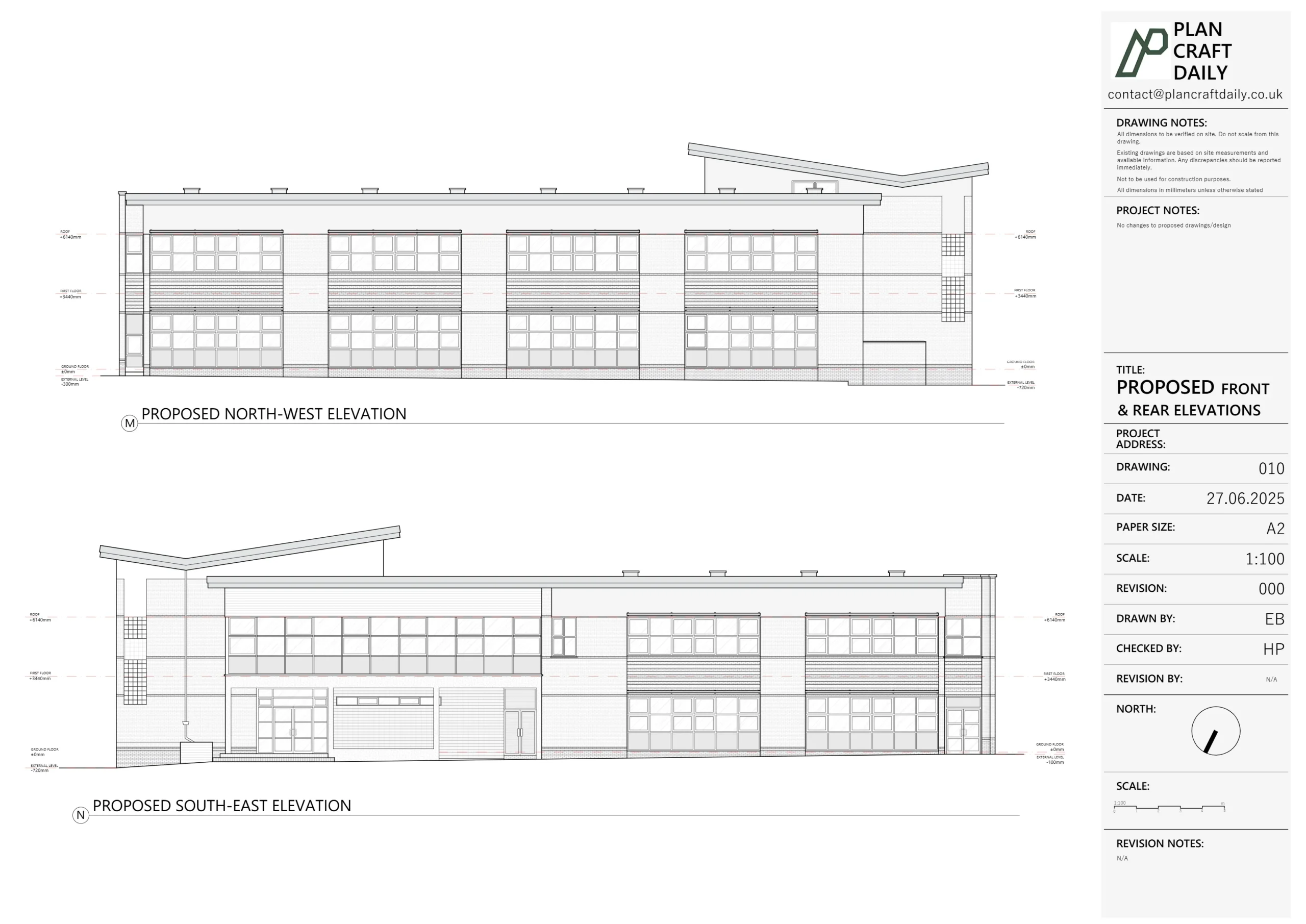
- All elevations
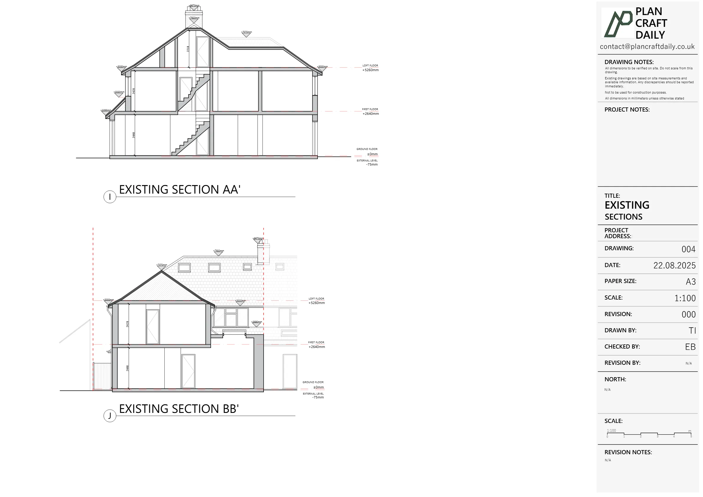
- Two sections
- Site photos for reference
Later, he also clarified that the site plan must include curtilage information such as:
- RWPs / SVPs and drainage information
- Manholes
- Tree locations
- Pavement to the front
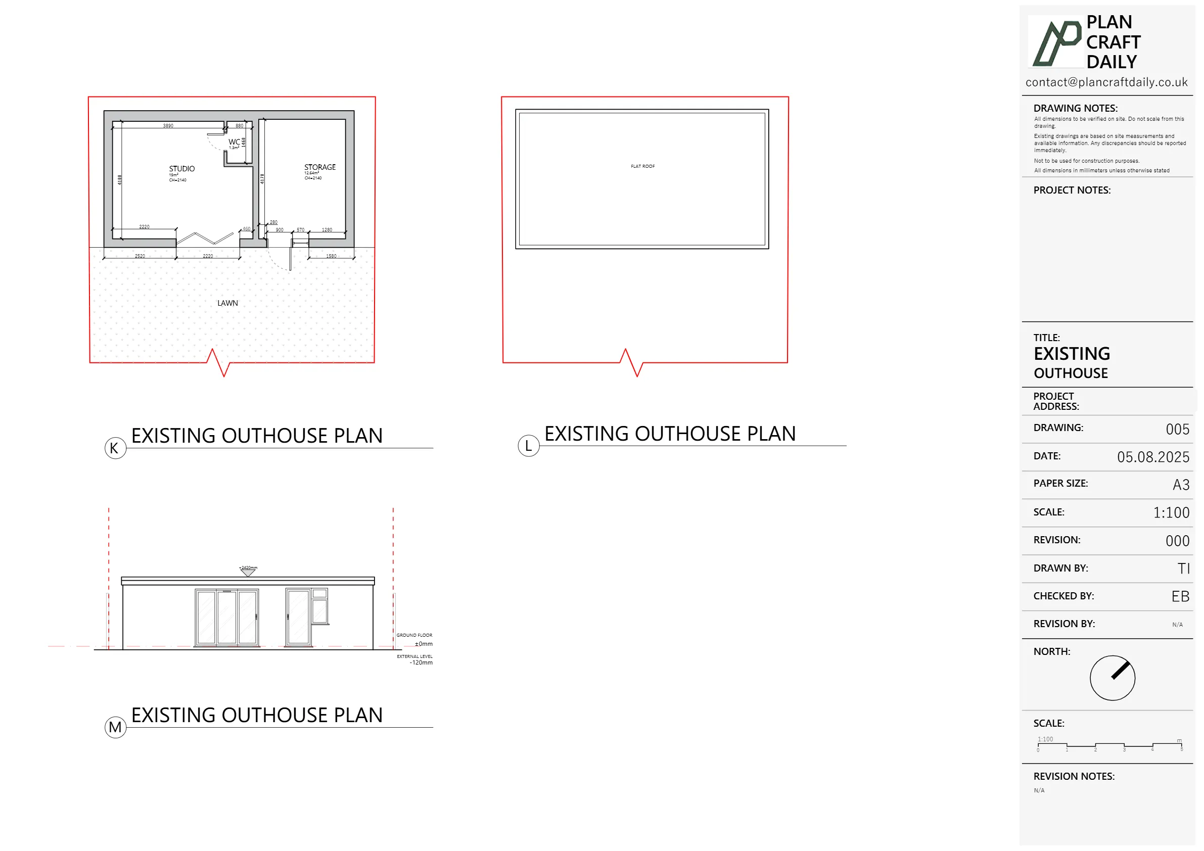
- Outbuilding in the rear garden
This would give him a single, well-coordinated base to handle both planning and building regs without having to commission separate surveys.
Scoping and quotation – expanding the brief for full site information
We initially issued a quotation covering the building survey and standard site plan, with the outbuilding included and photos to be released once the project was paid in full.
Kaushal then confirmed formal instructions on behalf of his client, but also expanded the scope:
“…the site and location plan wouldn’t be an ordnance survey plan but a measured survey of the site (with basic information within curtilage – RWPs, SWP, manhole, tree location etc. and pavement to the front).”
Because this went beyond the original “house + outbuilding” brief, we:
- Re-confirmed the revised scope with our surveyor
- Flagged that this would affect the overall price, as we’d be picking up more detailed site data
- Issued an updated quotation that:
- Included the measured site plan and curtilage details
- Explicitly confirmed site plan, ground floor, first floor and roof plan
- Added internal 3D scanning and extra photos (including electrical points and heaters) to support Kaushal’s later design work
We also proposed survey availability from the 21st of the month onwards, giving Kaushal a couple of target dates to coordinate access with his client.
Once he confirmed, we sent the initial invoice; after payment, we issued the receipt and locked in the survey:
- Surveyor: Mustafa Bashkal
- Arrival window: 11:00–11:30 am on a Thursday in late July
- Access coordinated with Mrs Delia, the on-site contact
Carrying out the survey – house, outbuilding and site
On the survey day, Mustafa carried out a combined building and site survey, focusing on the expanded brief.
On-site data we captured
Building (main house)
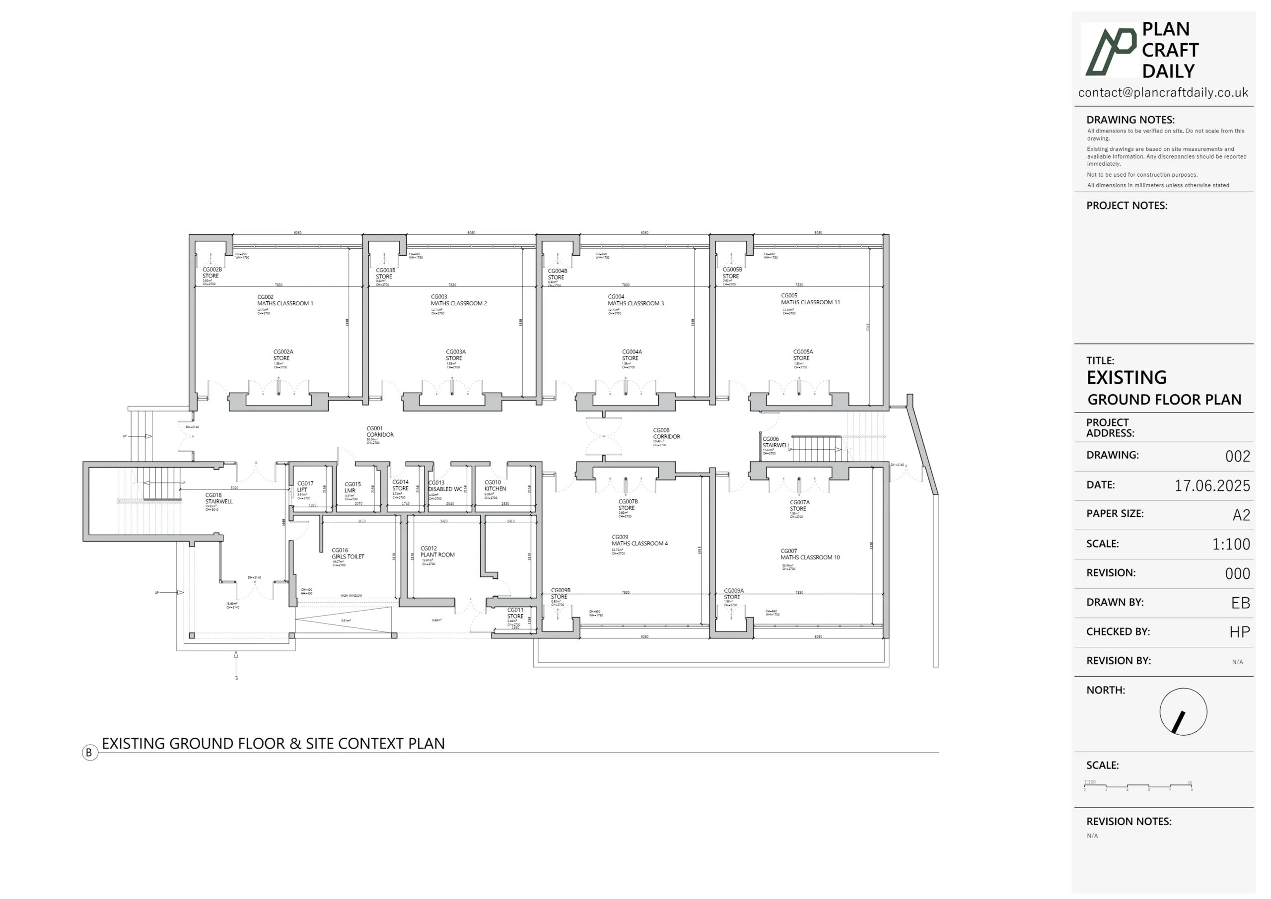
- Internal measurements for:
- All floor plans
- Two key sections (through the main structural lines)
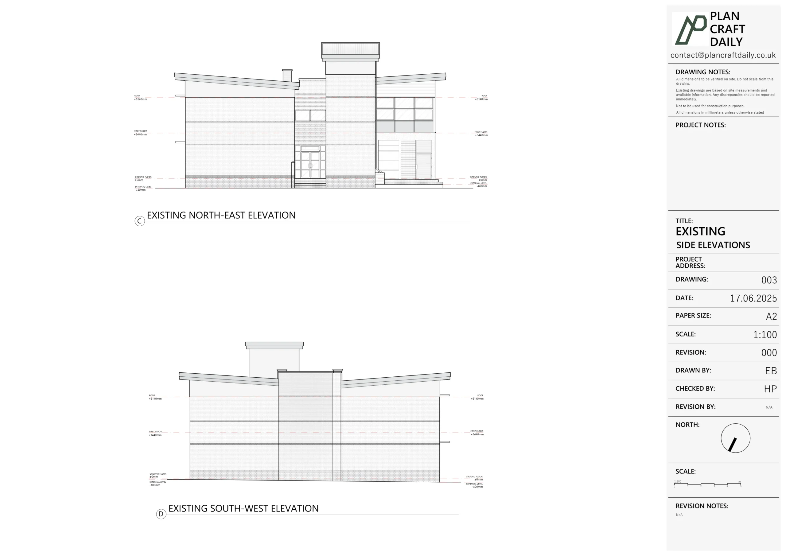
- External envelope checks for:
- Elevations, roof forms, ridges and eaves
- Window and door positions
Outbuilding & site
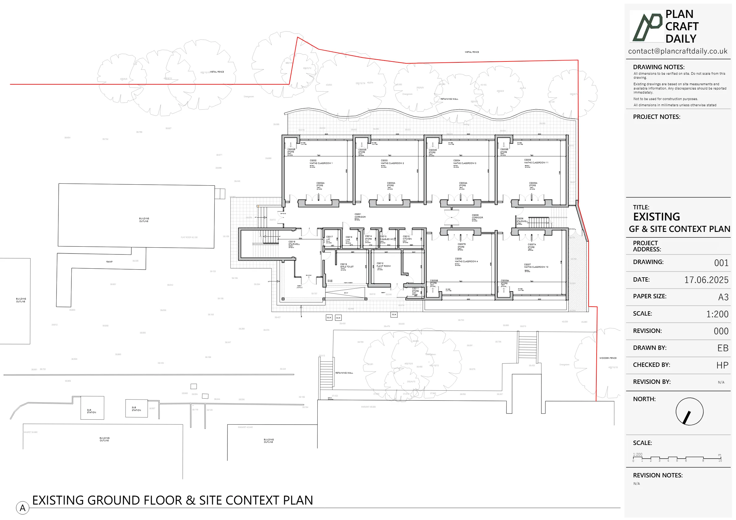
- Footprint of the main house and outbuilding
- Basic curtilage information, including:
- Manholes and drainage covers
- RWPs and services points where accessible
- Tree locations and key garden features
- Pavement lines and front boundary references
3D internal scan & photos
- Internal 3D scanning to support accurate modelling later
- A full set of photos, including the specific items Kaushal had requested (e.g. heaters, electrical points), ready to be released once the project was fully paid.
With that, the card was moved into In Progress, and the survey data came back to CAD.
Turning the survey into drawings – draft for review
Our CAD team converted the survey data into a draft existing drawing set:
- Measured site plan (based on on-site measurements rather than OS)
- Ground floor and first floor plans
- Existing roof plan
- All elevations
- Two sections
We checked the set internally, then:
- Issued a PDF draft pack for Kaushal
- Attached the final invoice
- Explained that once the invoice was settled, we’d release:
- Final PDFs,
- CAD (DWG),
- And photographs
At this stage, everything looked to be on track and the project moved into Approval / Finalisation / Pending.
Client markups, revisions – levels, roof slope and site plan
Kaushal came back with a detailed, professional markup:
- Level heights – he identified several level annotations that were missing or needed confirming based on his requested requirements.
- Roof slope – he attached an elevation from a previous architect where the roof slope terminated differently, asking us to double check our interpretation.
- Site plan – he reminded us of his earlier clarification that he needed an overall measured site plan showing:
- The main building footprint
- The outbuilding footprint
- Curtilage/site information on a single combined plan
We replied to say we’d review and revert, moved the card back to Revise, and:
- Checked levels and roof slopes against the original survey notes and 3D scans
- Updated the drawing set to incorporate his requested corrections
- Added a note on one side of the extension where access had been constrained, explaining that it appeared there was no gap between the properties, but this could not be absolutely confirmed on the day due to limited access
A Revision 001 draft was then issued for his review.
The missing site plan – owning the mistake and fixing it
After Revision 001, Kaushal forwarded the invoice to his client and, once payment was made, we:
- Confirmed receipt,
- Released what we believed to be the final drawings and files, and
- Sent over the relevant 3D scan links for each side of the property.
However, in a later email, Kaushal highlighted an important issue:
- The revised drawings pack still did not include the overall measured site plan in the way he had requested and we had agreed (and re-agreed) in writing.
- He pointed out that he’d raised this at quote stage, repeated it when sending markups, and it had still been missed.
- He described it as disappointing, and stressed that capturing the agreed information is also part of our duty and responsibility, not just the client’s job to request.
He was right.
We moved the card back to Revise and treated this as a priority correction.
Our response
Harry then wrote back:
- Offering a clear, unambiguous apology for the oversight
- Confirming that the drawings had now been updated to:
- Include the overall plan with site plan and outbuilding as originally agreed
- Incorporate the remaining elevation clarifications that had been discussed by phone
- Confirming that the files were now available via the same link
- Thanking Kaushal for flagging the issue and for his patience
Only once that corrected pack was issued and checked did we move the card to Completed again.
Final outcome – robust existing drawings and a tighter process
By the end of the Borehamwood – Melrose Avenue project, Kaushal had:
- A full existing drawing pack: measured site plan, floor plans, roof plan, elevations, and sections
- A coherent overall plan showing the main house and outbuilding footprints with relevant site details
- Supporting 3D scans and photos to help with Building Regulations and future planning
- A clarification note wherever site access constraints meant we couldn’t be 100% definitive (e.g. the side gap)
Internally, this project also sharpened one of our processes:
- When the scope explicitly includes a measured site plan and curtilage details, we now triple-check that:
- It’s captured in the original quote,
- It’s clearly marked on the CAD issue list, and
- It’s present in the final pack before we release and mark a job as completed.
From a client perspective, the end result is what matters most: a reliable, measured base that matches what was agreed. From our side, this one also reinforced the importance of owning small oversights quickly, fixing them properly, and tightening the system so they’re less likely to recur.
Project Details
| Service Type | Measured building & site survey, existing drawings (site plan, floor plans, roof plan, elevations, sections) |
| Time Taken | 2 weeks |
| Budget | £900–£1,200 |
| Location | Borehamwood, Hertfordshire |