Professional land and site surveys showing ground levels, contours, boundaries, and features. Essential data for new builds, extensions, and development projects.
Accurate site information for architects, engineers, and developers across London and the Home Counties.

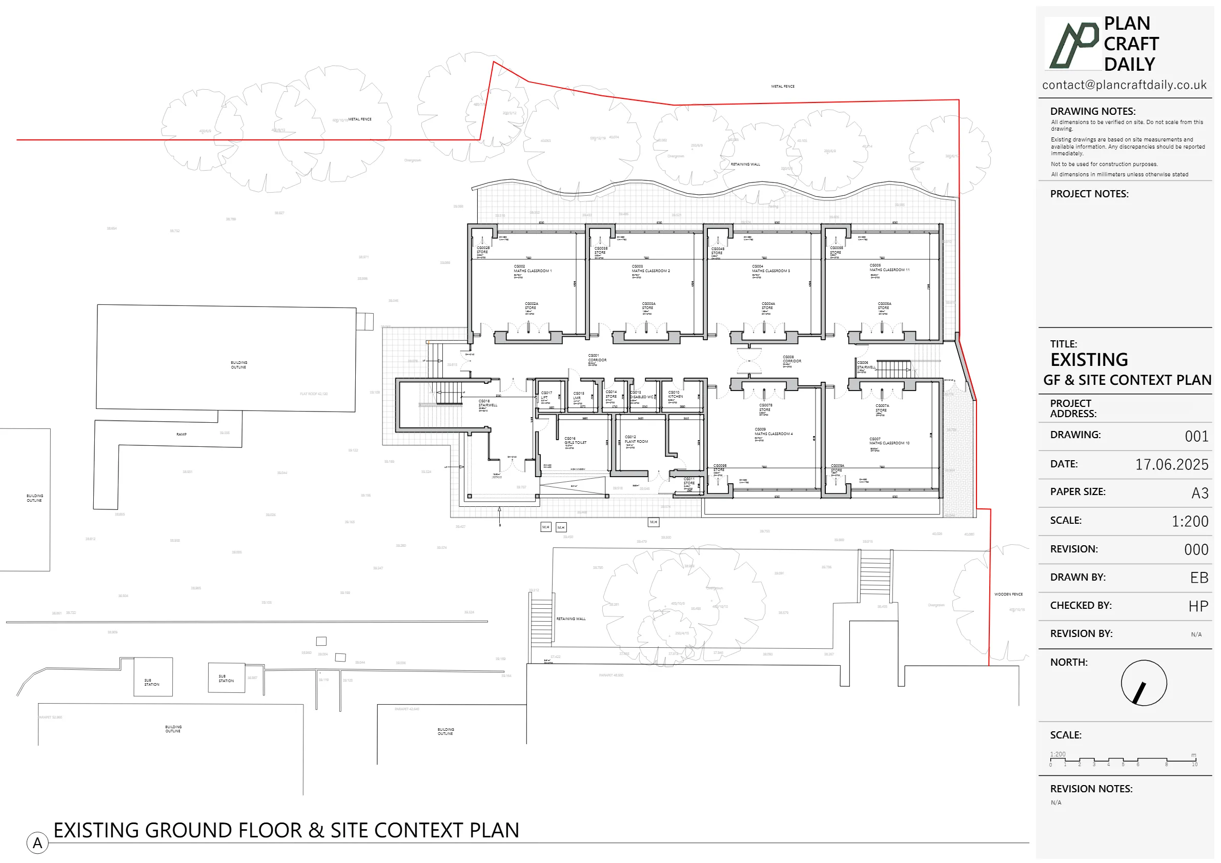
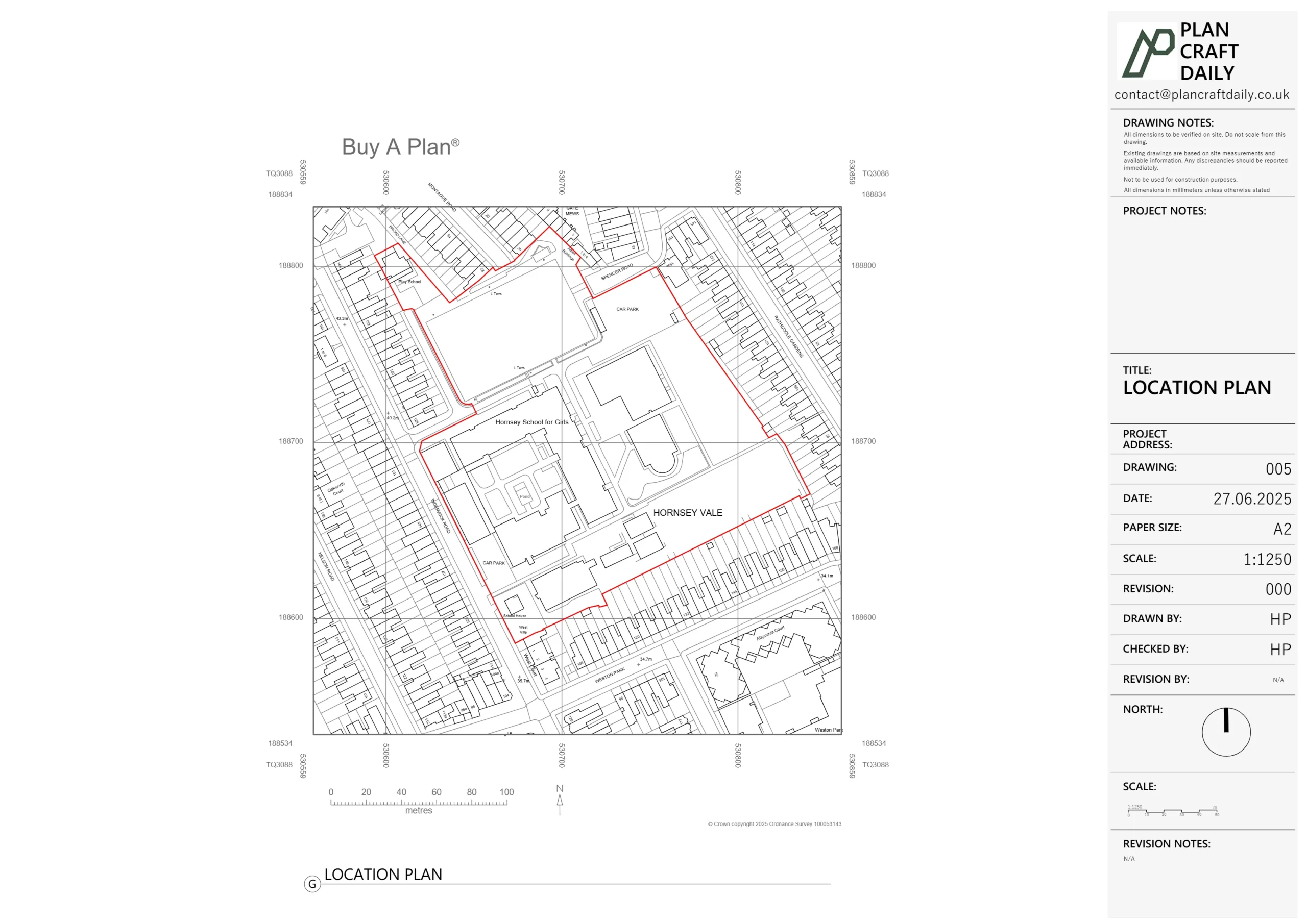
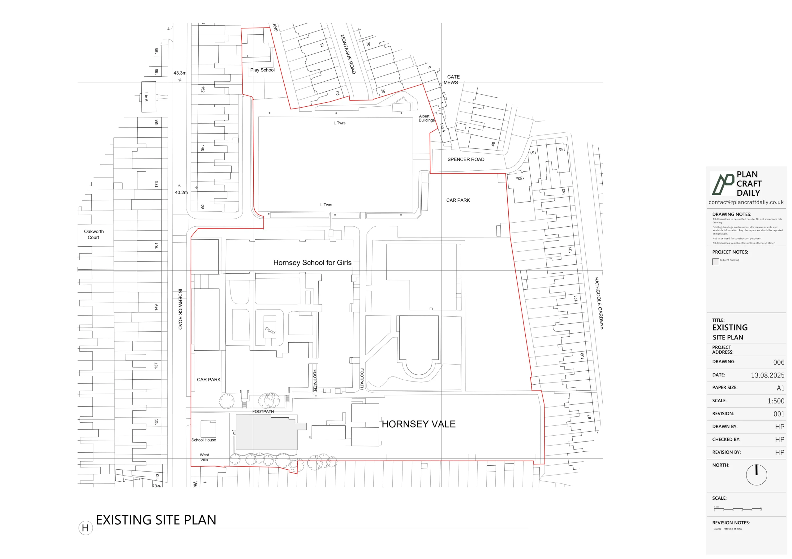
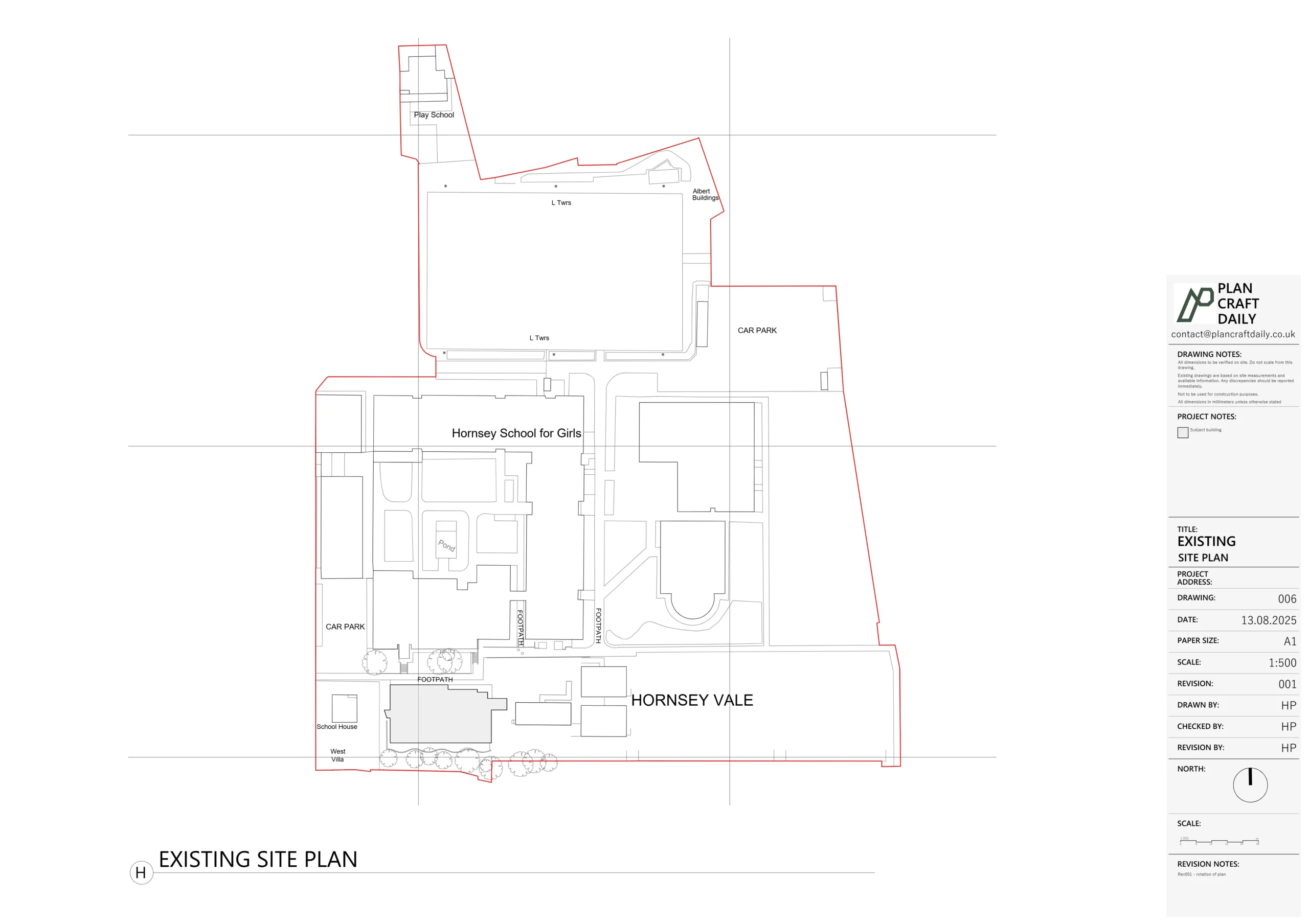
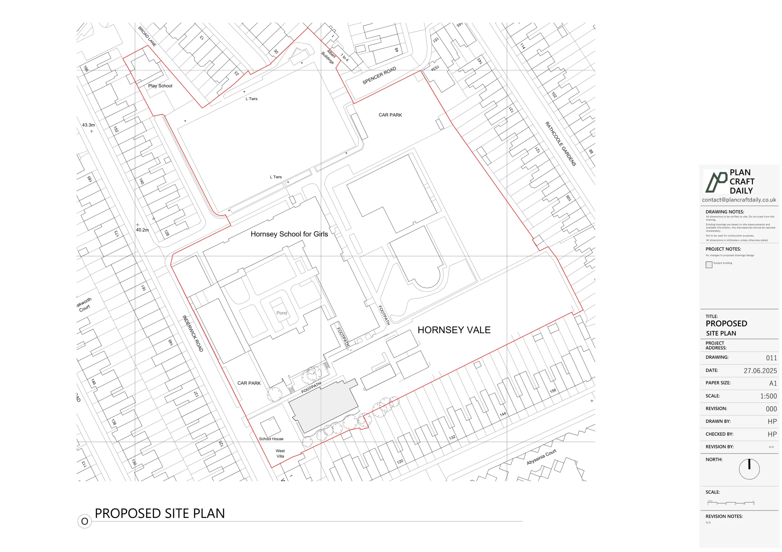
A topographical survey (often called a topo survey or land survey) captures the physical features of a site—ground levels, contours, buildings, trees, boundaries, and drainage. This data is essential for any project where external levels matter, from new builds to drainage design.
Site levels for foundation and drainage design
Contour mapping for design on challenging terrain
Existing levels for garden and landscape design
Accurate boundary positions for legal purposes
Why survey accuracy matters: Inaccurate site levels can lead to drainage problems, foundation issues, and costly design changes during construction. Our surveys provide the accurate baseline data your design team needs.
Contour survey at specified intervals
Spot levels across the site
Building outlines and floor levels
Boundary positions
Tree positions and spreads
Drainage features and manholes
CAD file (DWG) for design use
PDF drawing for review
A topographical survey (or topo survey) is a detailed survey of land and external features. It shows ground levels, contours, boundaries, trees, buildings, drainage, and other features. This information is essential for site design, planning applications, and construction projects where external levels matter.
You need a topographical survey for new builds, extensions on sloping sites, drainage design, landscaping projects, boundary disputes, or any project where accurate ground levels and site features are required. If your site isn’t flat or you need to understand external levels, a topo survey is usually necessary.
Topographical survey pricing starts from £600 for a small residential plot. Costs depend on site size, complexity, required detail level, and access. Larger sites, heavily vegetated areas, or projects needing very detailed surveys will cost more. We provide accurate quotes after understanding your specific requirements.
We use total station theodolites and GPS equipment to capture accurate positions and levels. Data is processed into a CAD drawing showing contours, spot levels, and feature positions. All measurements are tied to Ordnance Survey datum where required.
Site work typically takes half a day to a full day depending on site size. A small residential plot might be 2-3 hours; a larger development site could be 1-2 days. Drawing production takes an additional 3-5 working days after the site visit.
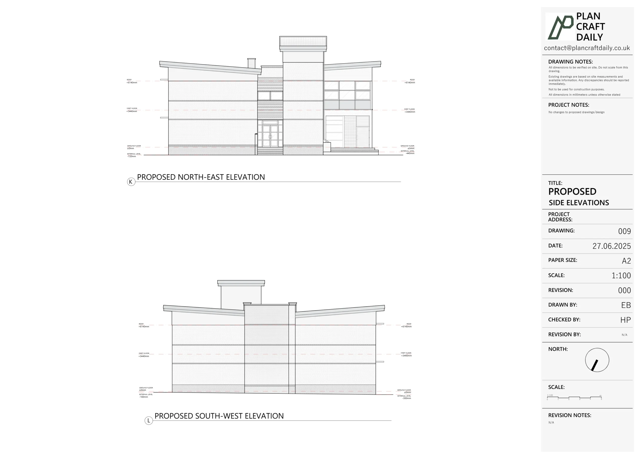
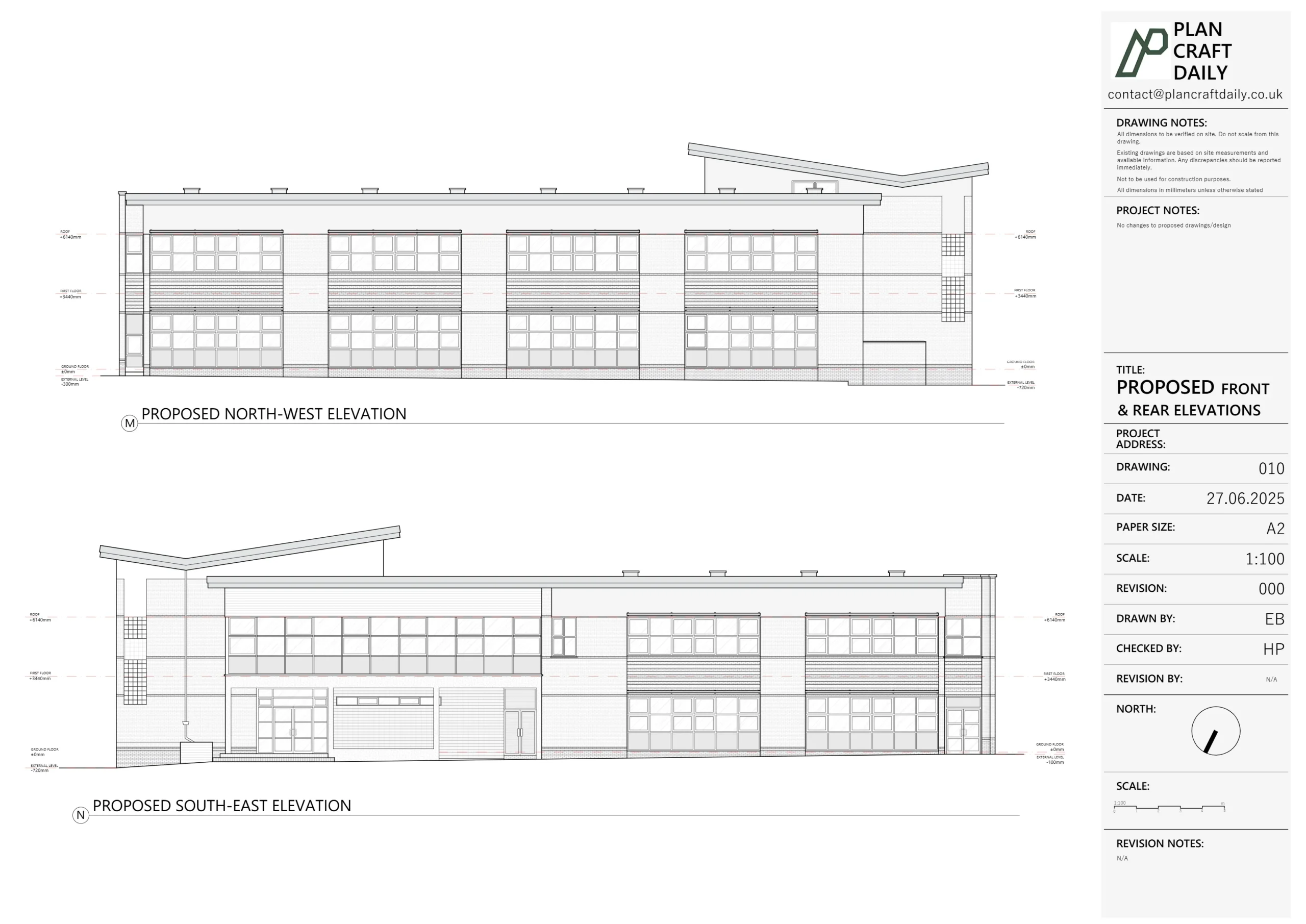
Standard outputs include a CAD drawing showing contours (typically at 0.5m or 1m intervals), spot levels, building outlines, boundaries, trees, manholes, and other relevant features. The drawing includes a grid and can be referenced to Ordnance Survey coordinates if required.
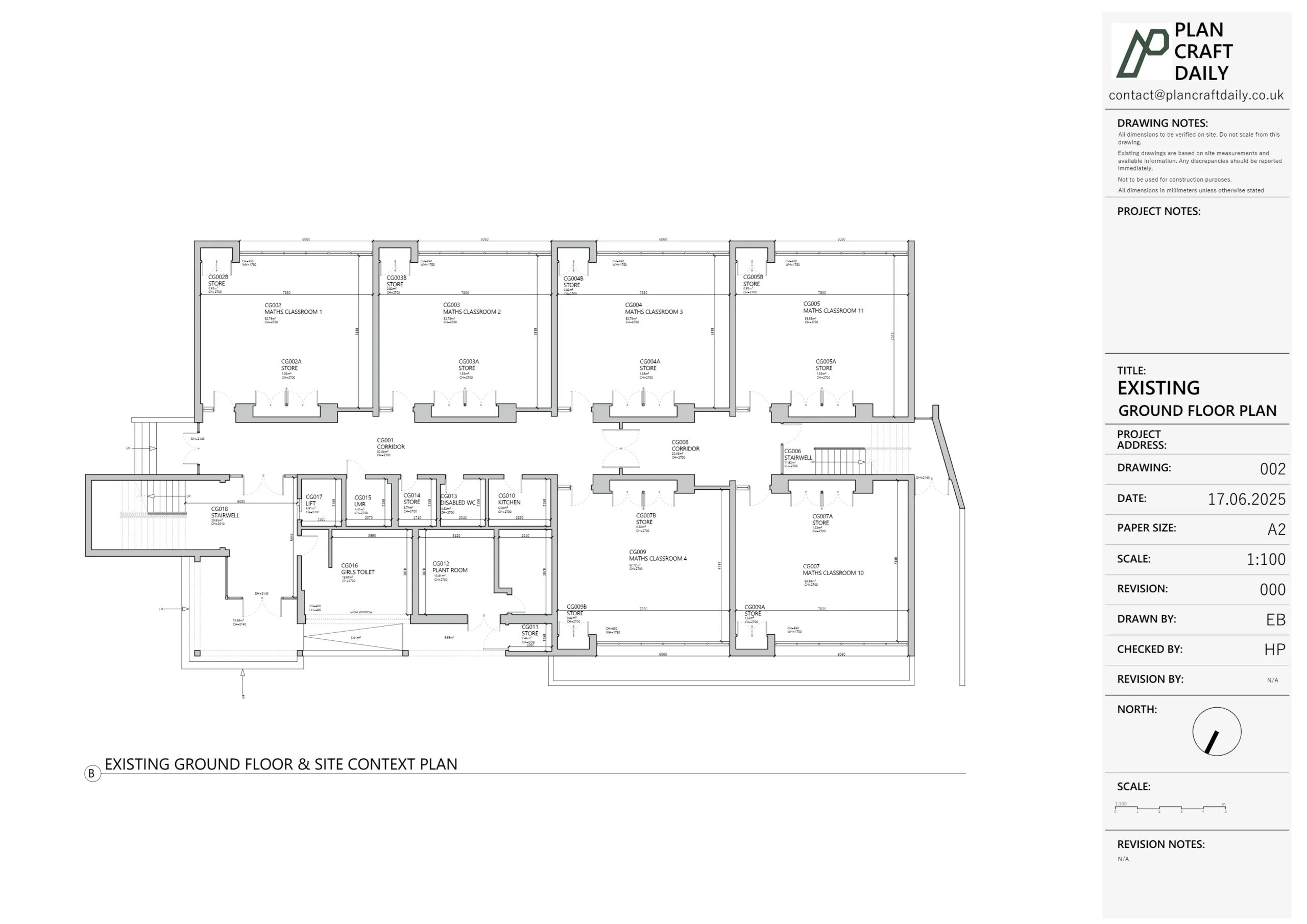
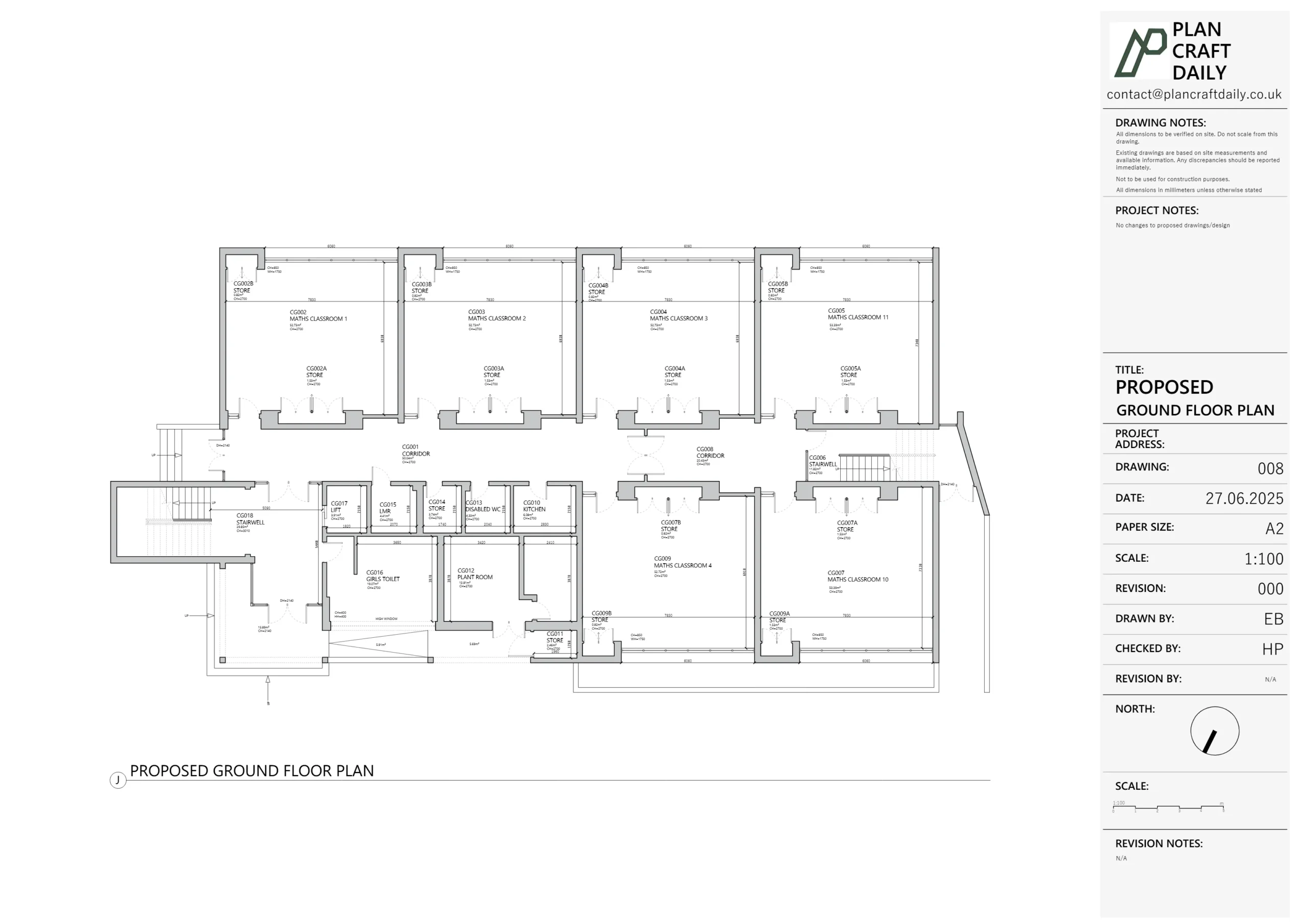
A measured building survey focuses on the building itself—internal layouts, room sizes, floor plans. A topographical survey focuses on the land—ground levels, site features, boundaries. Many projects need both, especially new builds or extensions on sloping sites.
Yes, we can work around access restrictions. If parts of the site can’t be accessed (e.g., neighbouring land), we’ll survey what we can and clearly note areas not covered. For sites with tenants or occupiers, we coordinate access in advance.
Get a free, no-obligation quote for your project. We’ll respond within 24 hours.