Kaushal, an architectural assistant, approached us on behalf of a client looking to redevelop a former police station in East London.
They already had some legacy drawings for the building, but:
- The level of detail wasn’t sufficient for serious redevelopment work.
- The site sits on a main road, so kerb levels and external grading were important for access and streetscape design.
- Internally, the building had been altered over the years; they needed a clean, current “as existing” model with clear room layouts, levels, and external context.
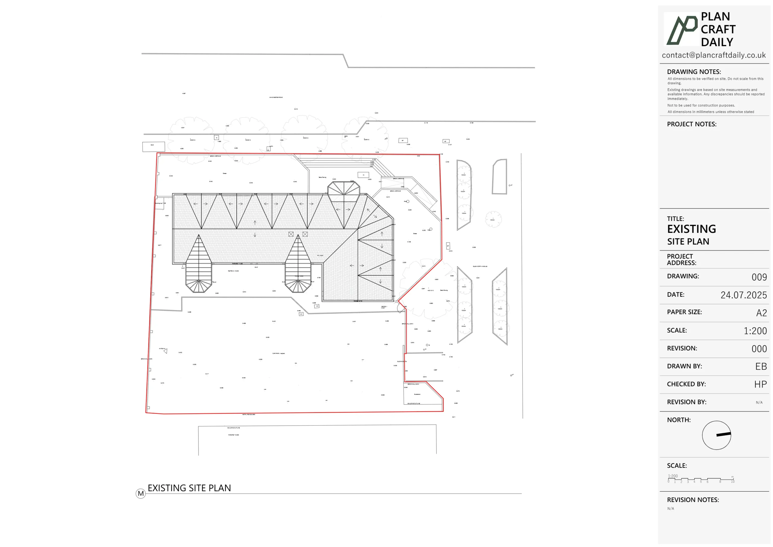
The brief was to deliver a combined measured survey and topographical survey with:
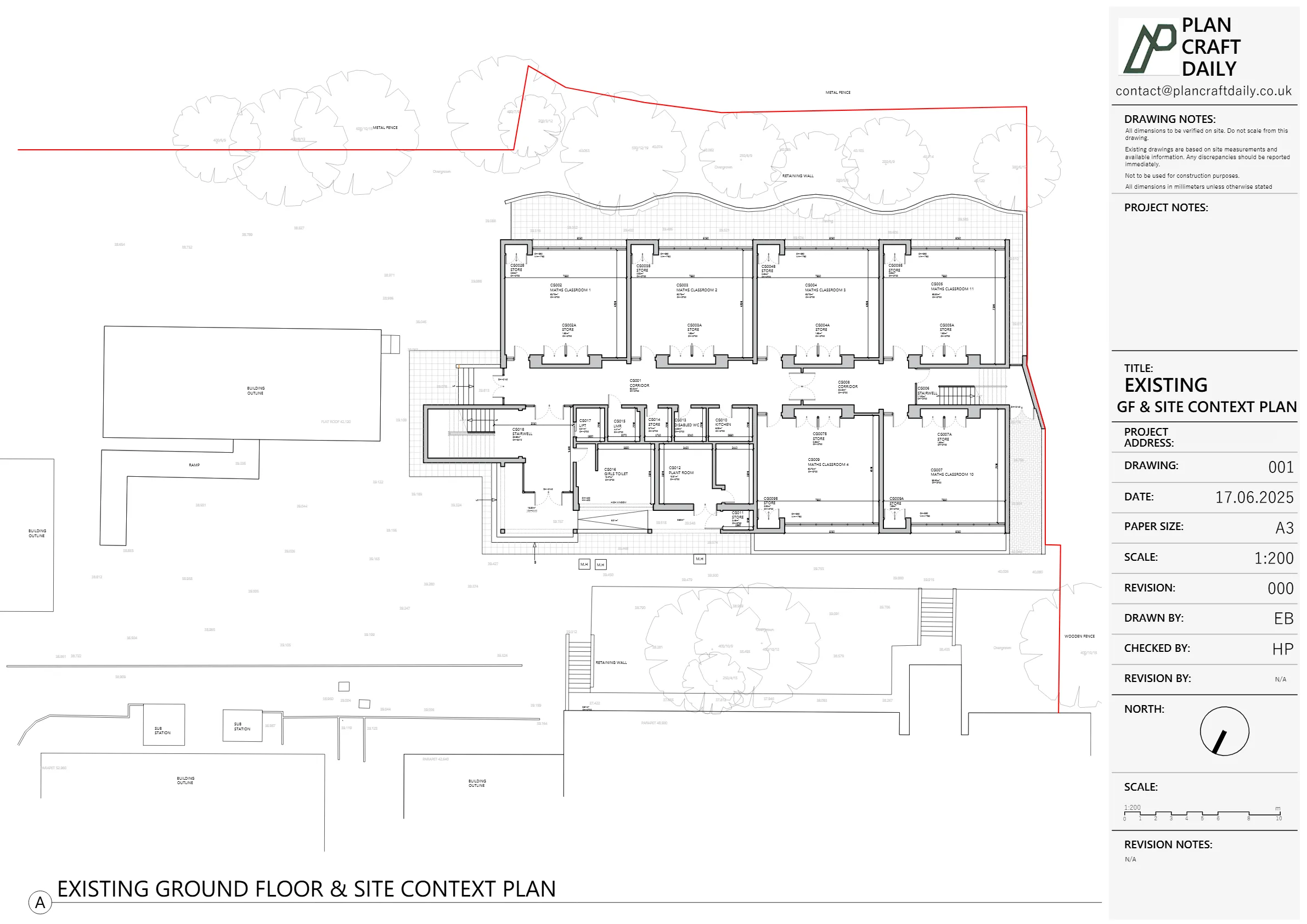
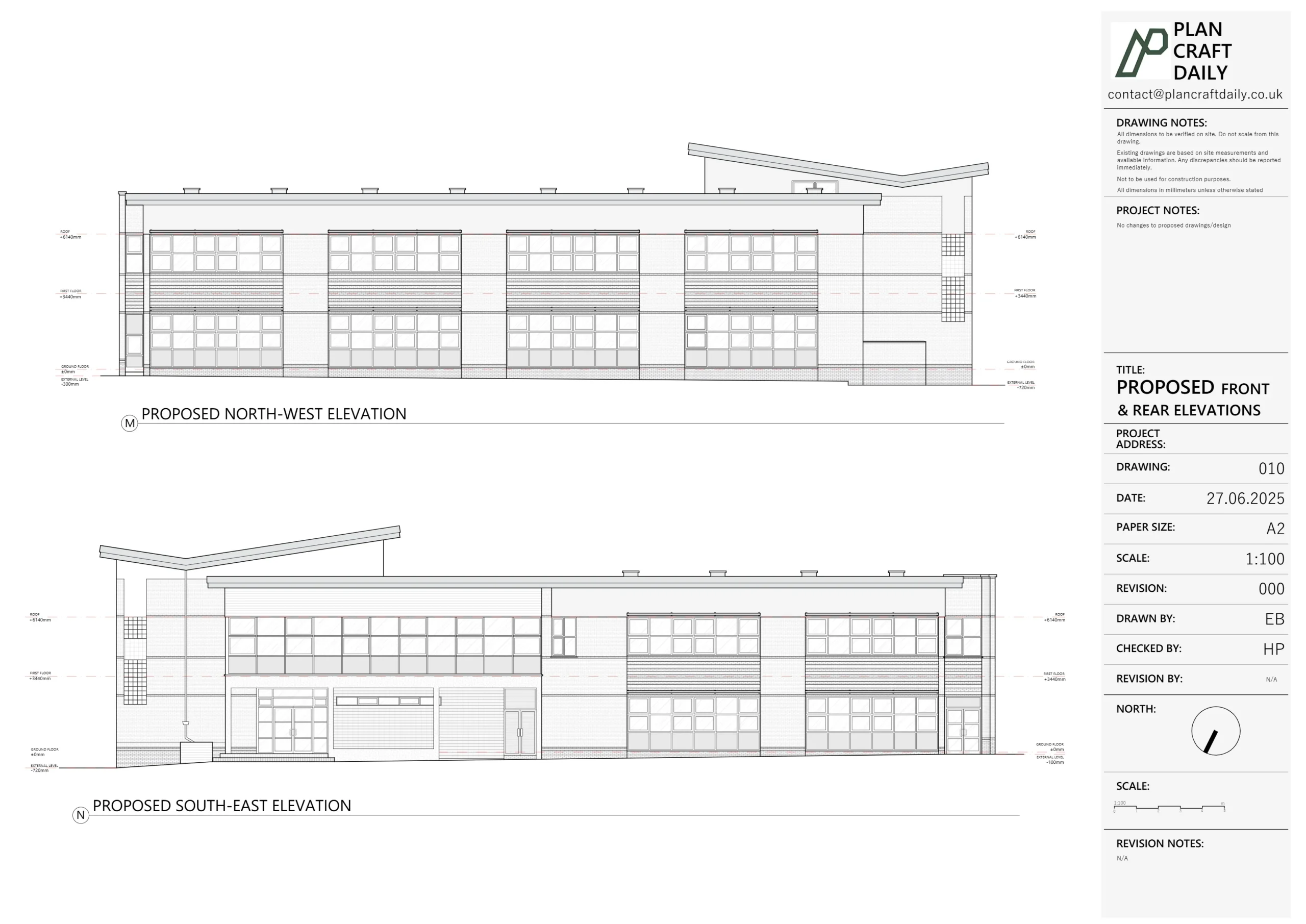
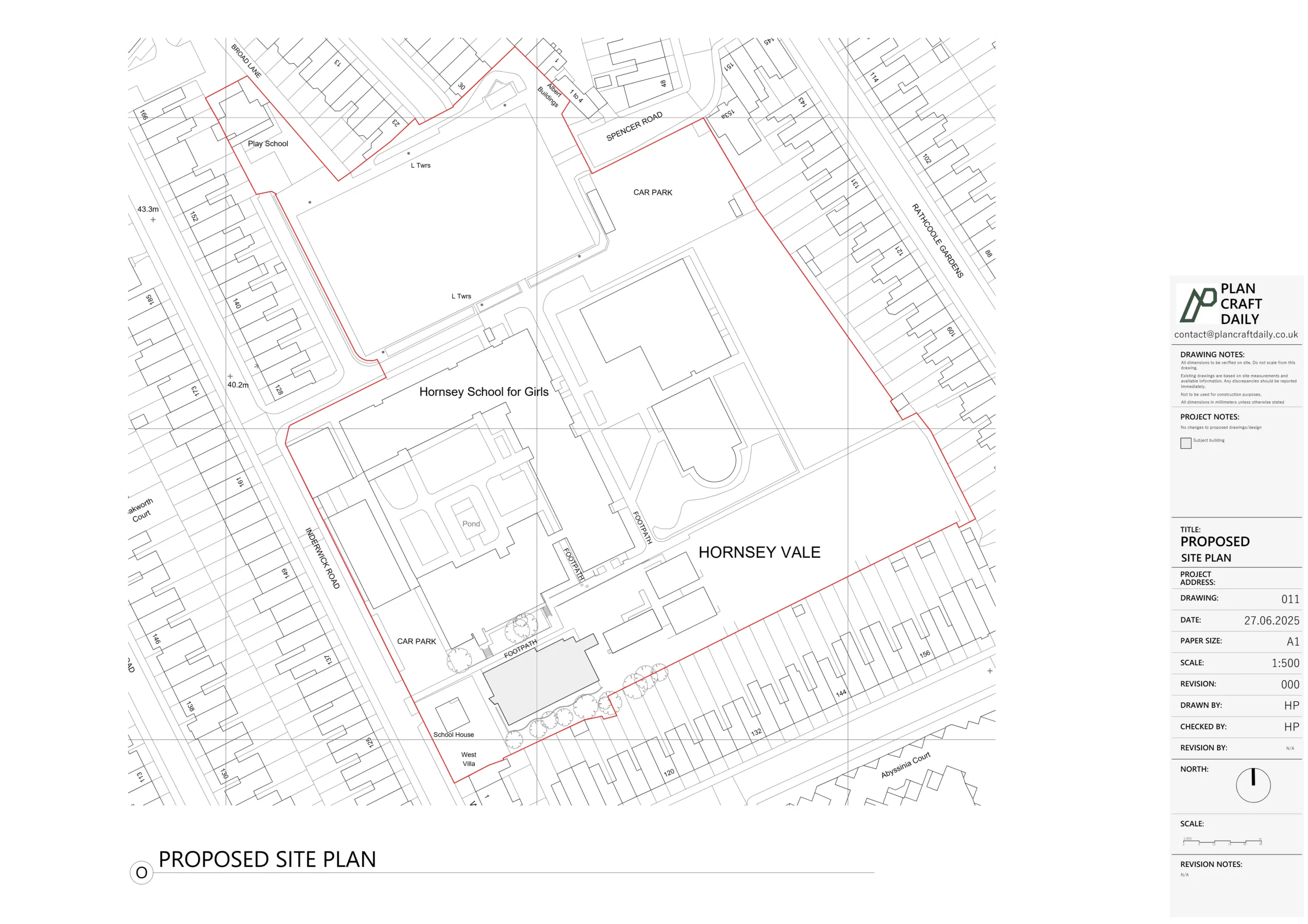
- Accurate site plan & roof plan
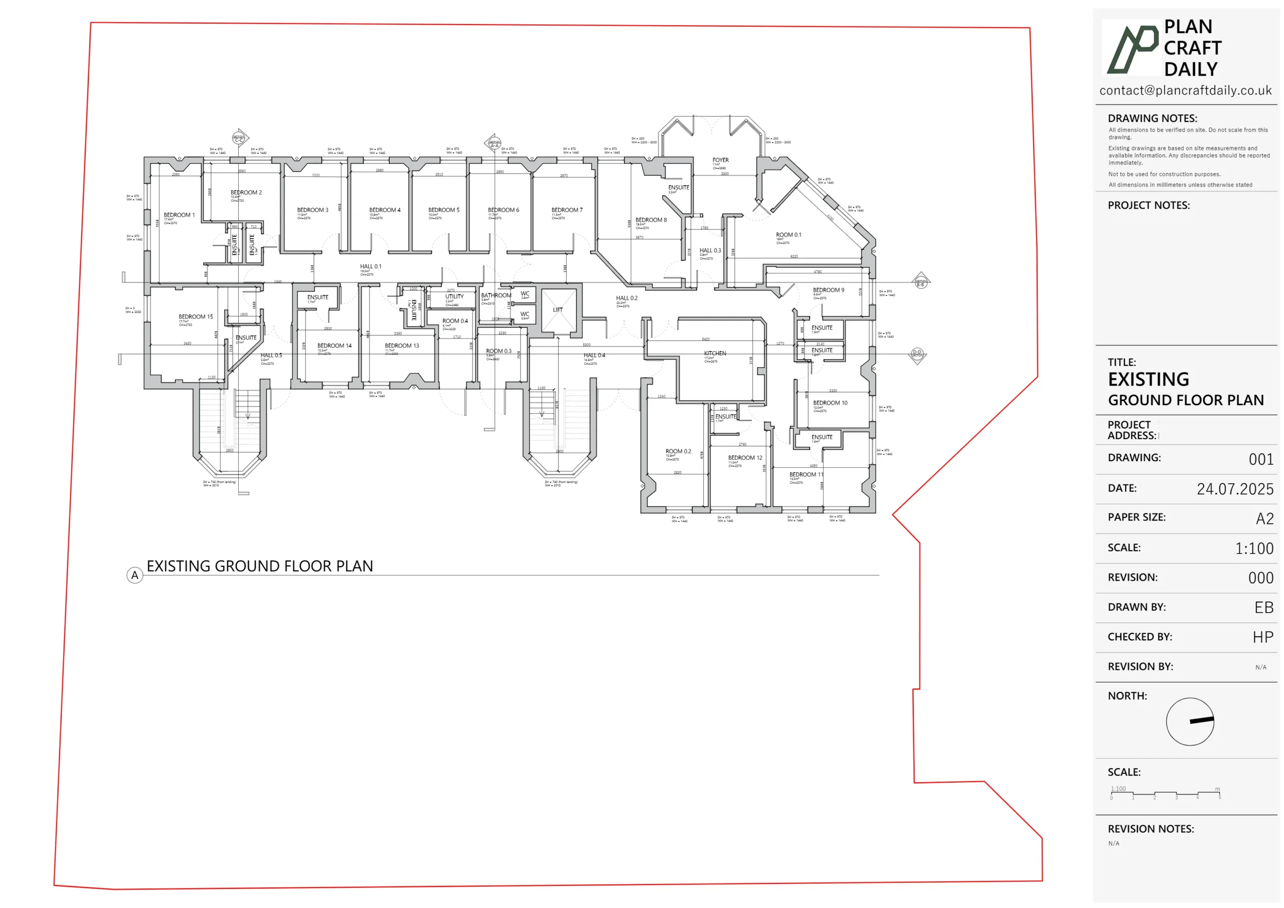
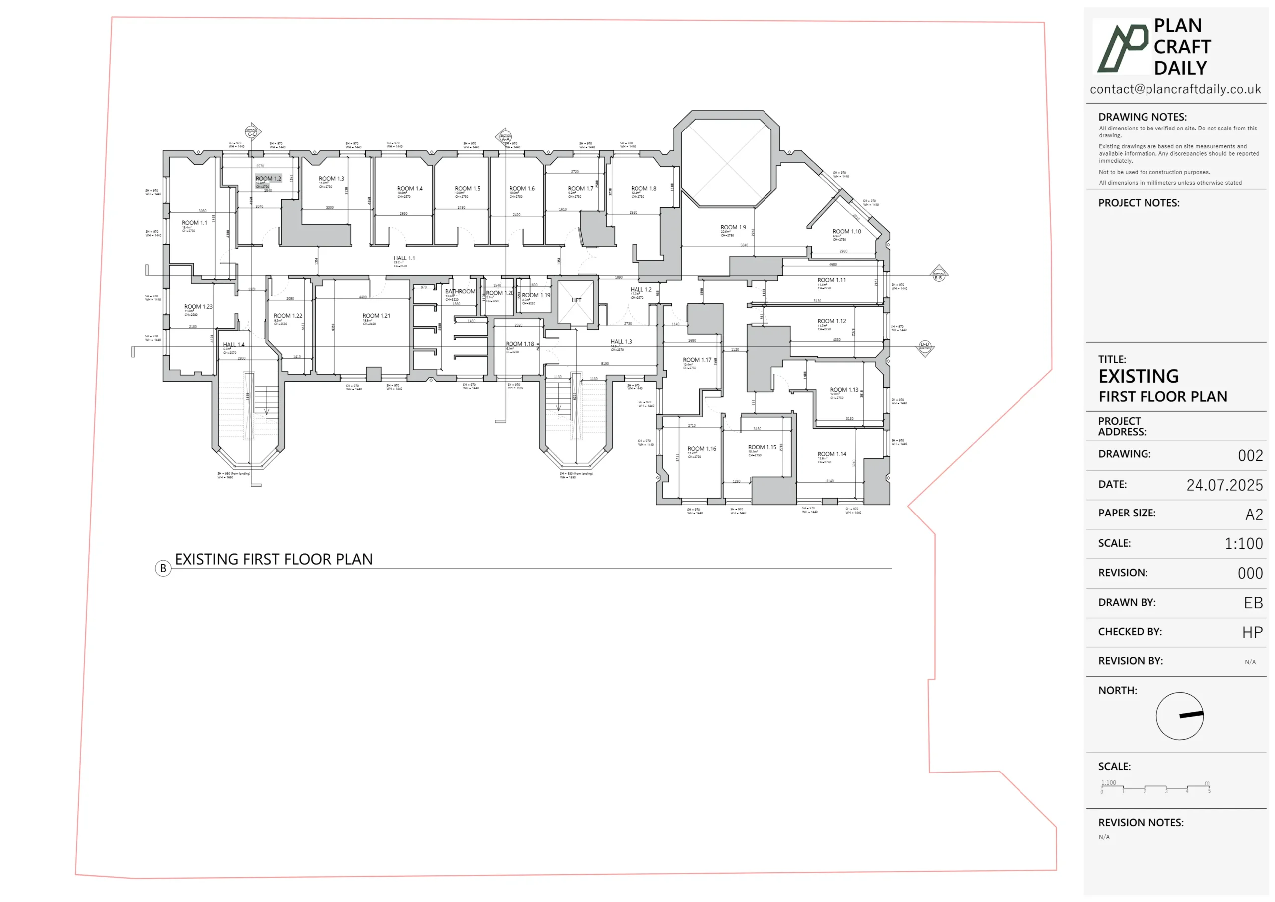
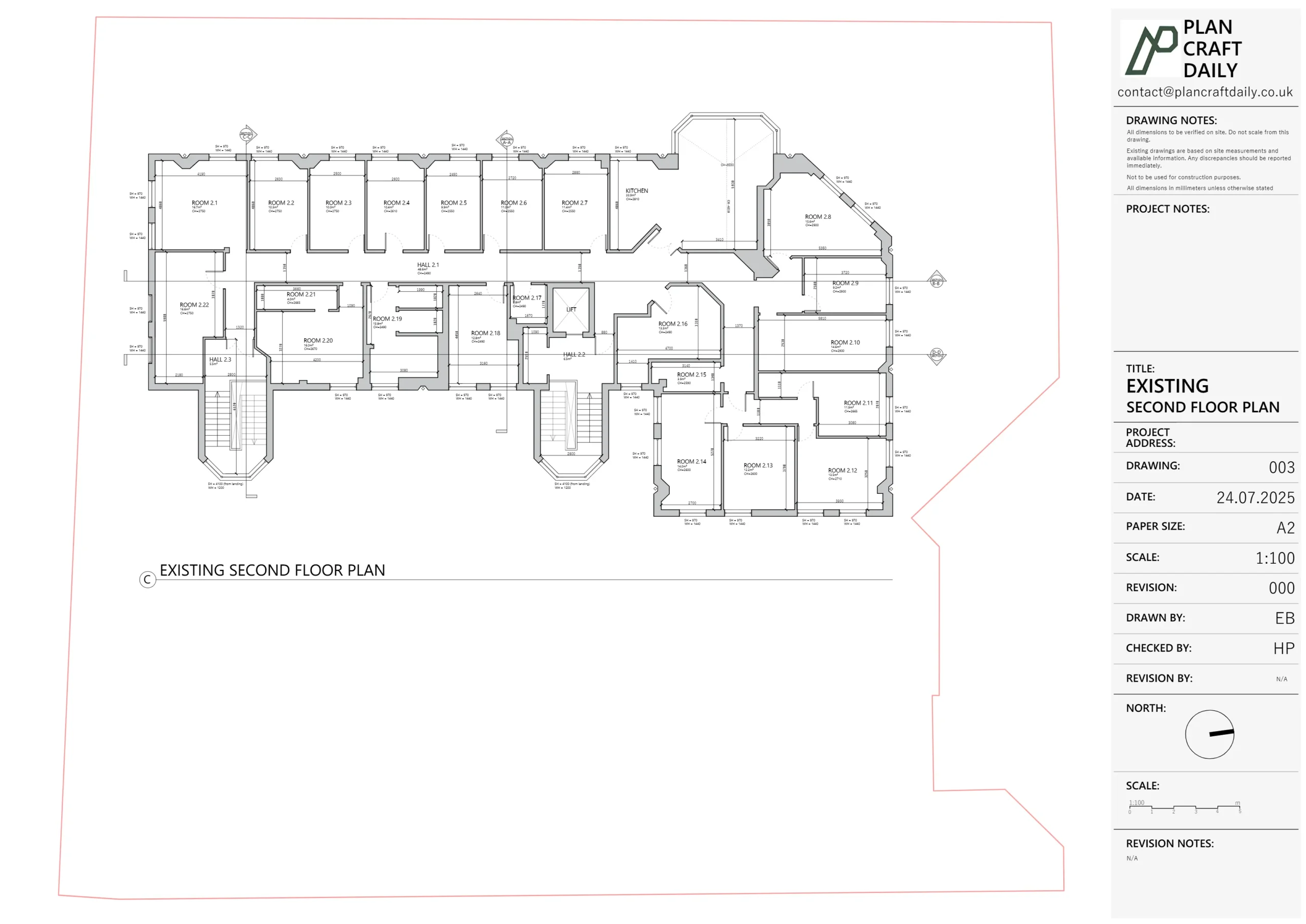
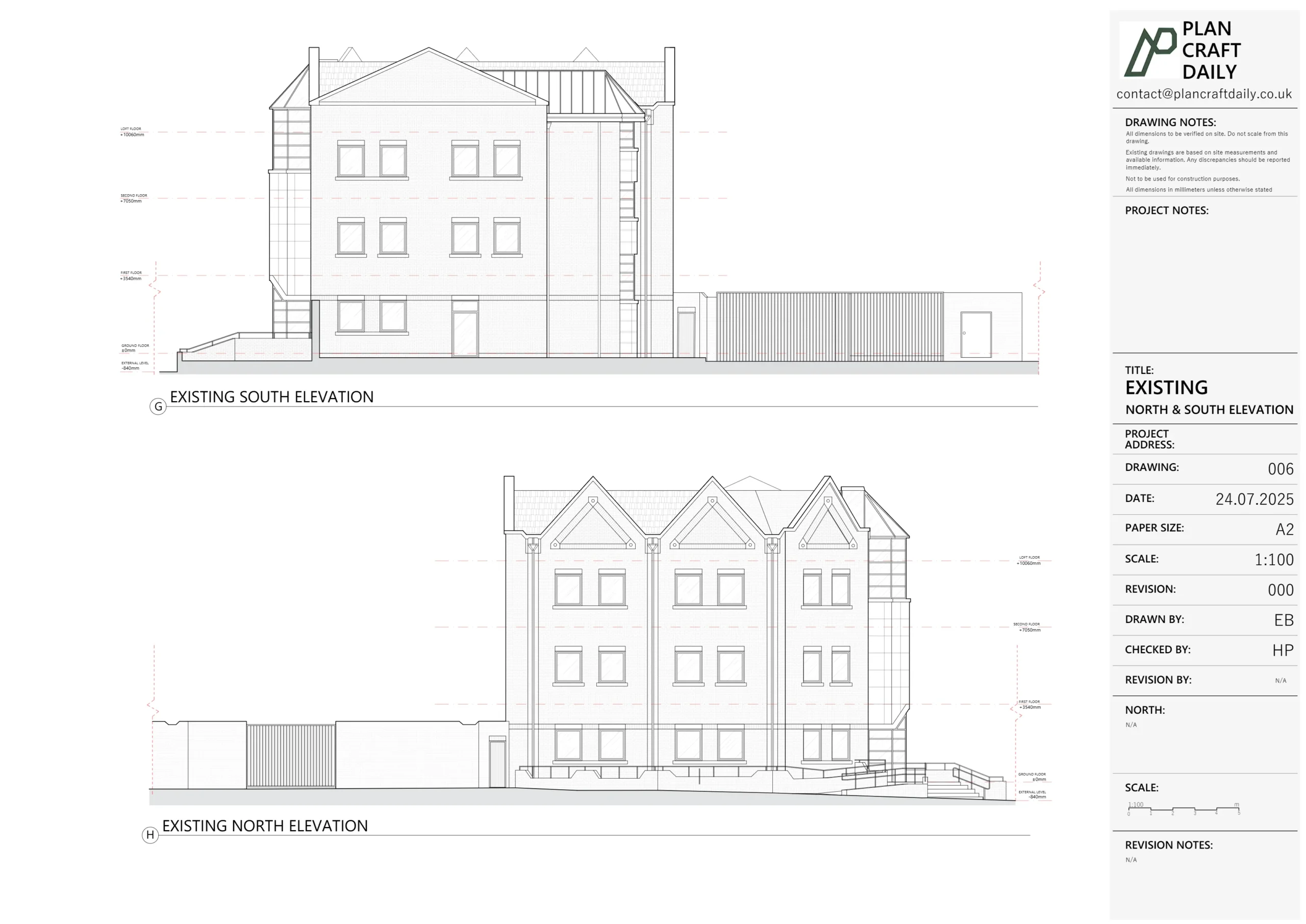
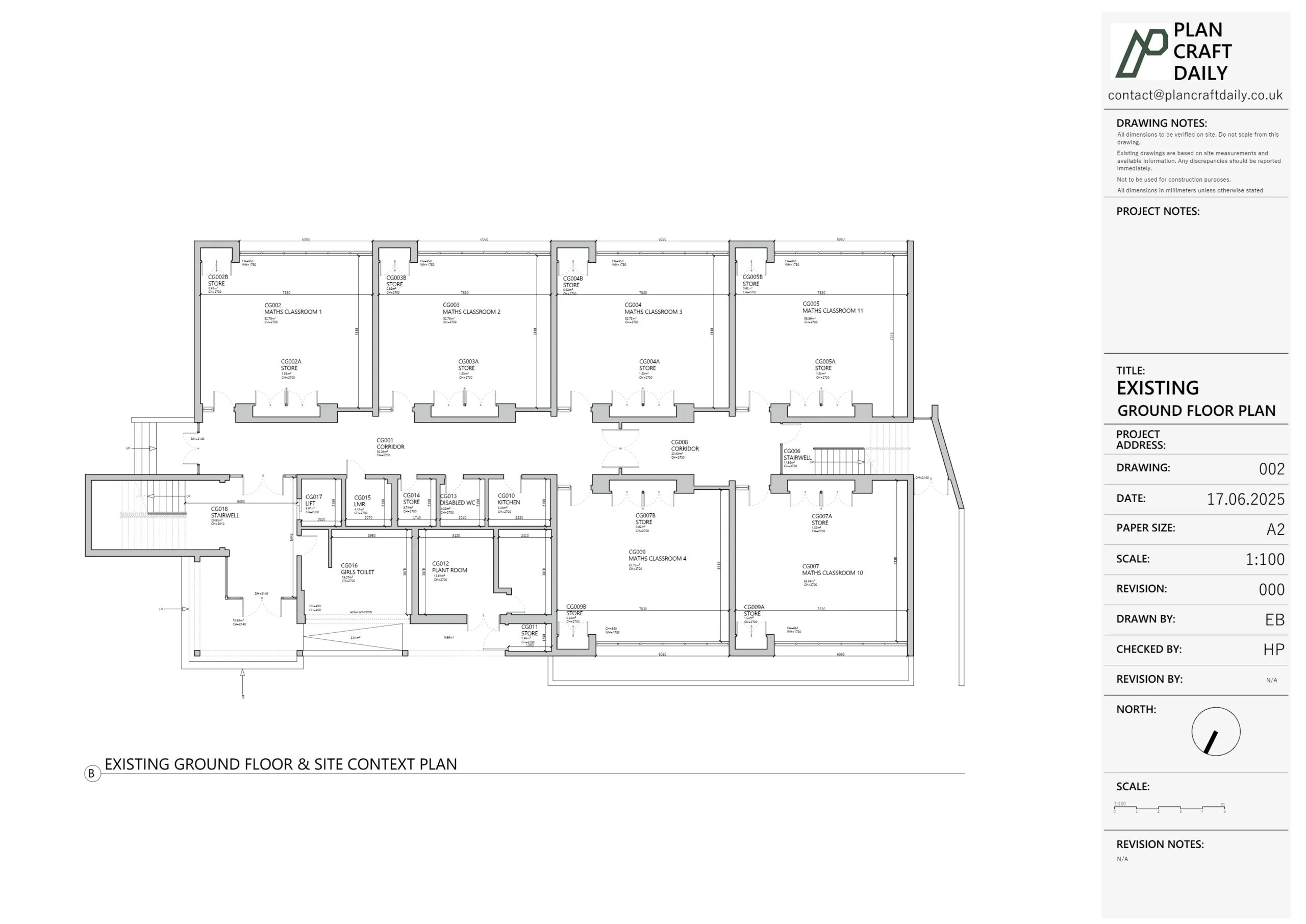
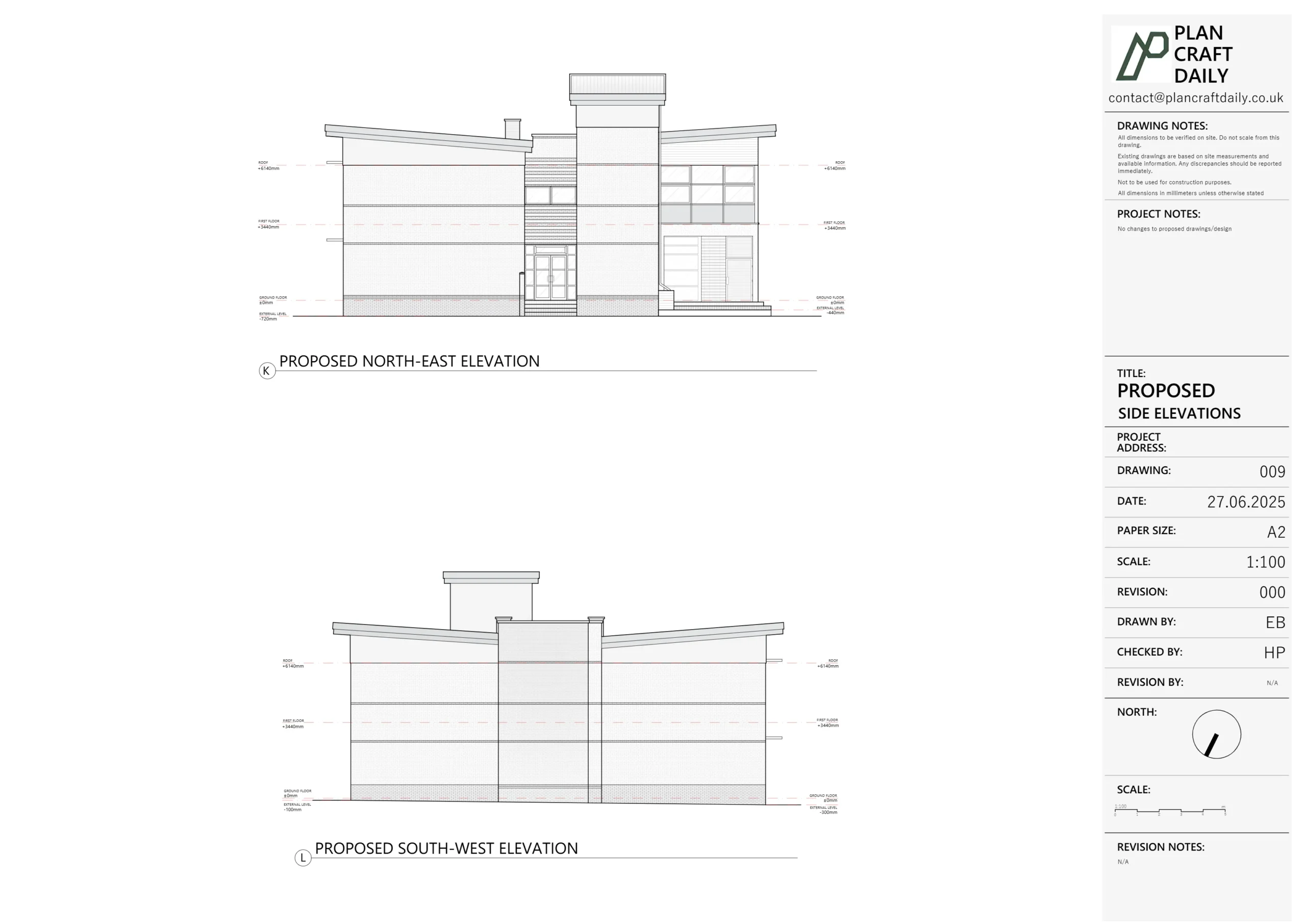
- Ground, first and second floor plans
- A topographical base including kerb heights on both sides of the road and key external features
- CAD deliverables and a 3D visual record to support design, planning and discussions with consultants.
Defining the scope with the architect
We began with Kaushal’s email confirming that the client wanted to proceed with Option 1 from our original fee proposal.
Through a short call and follow-up emails we refined the scope:
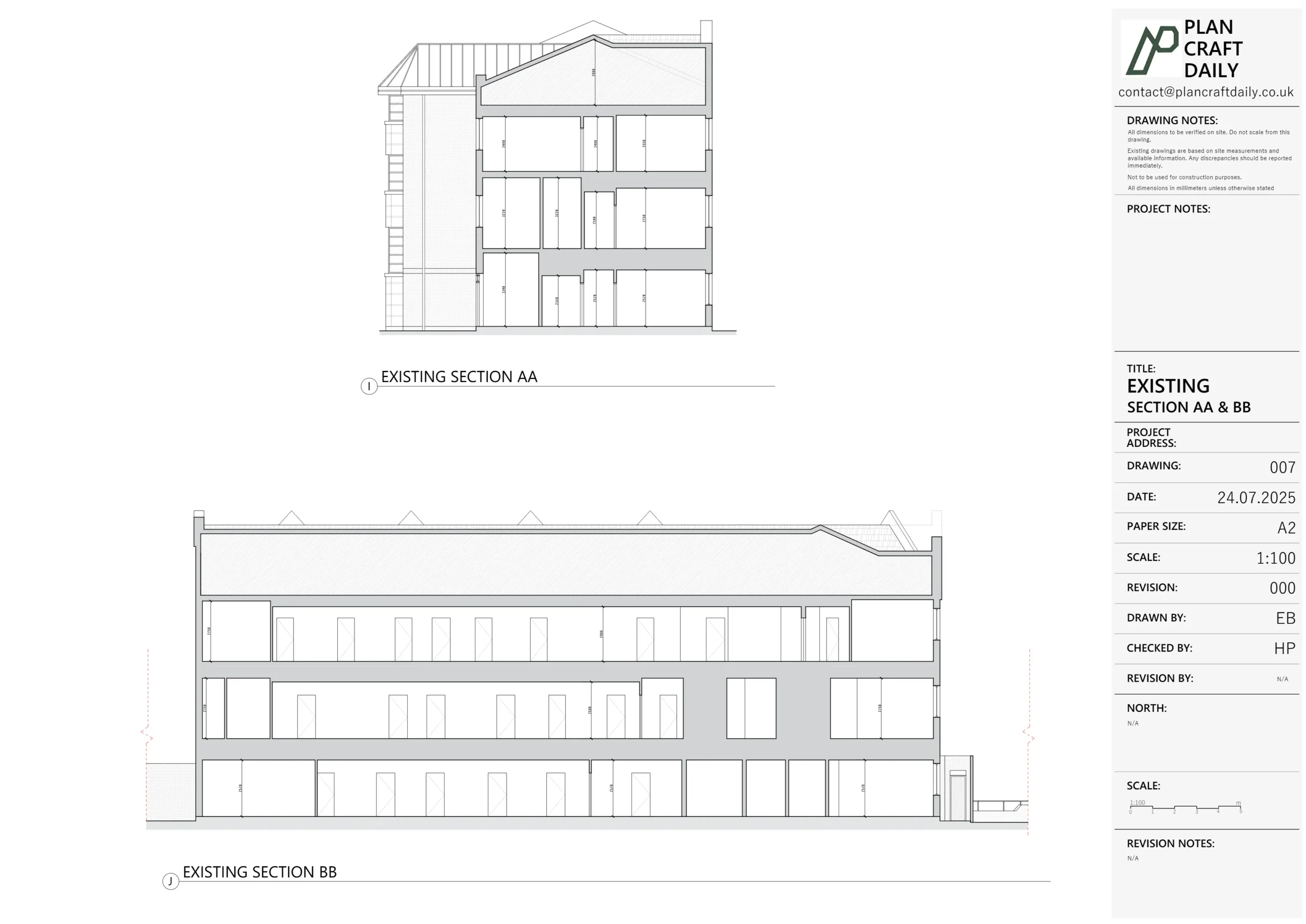
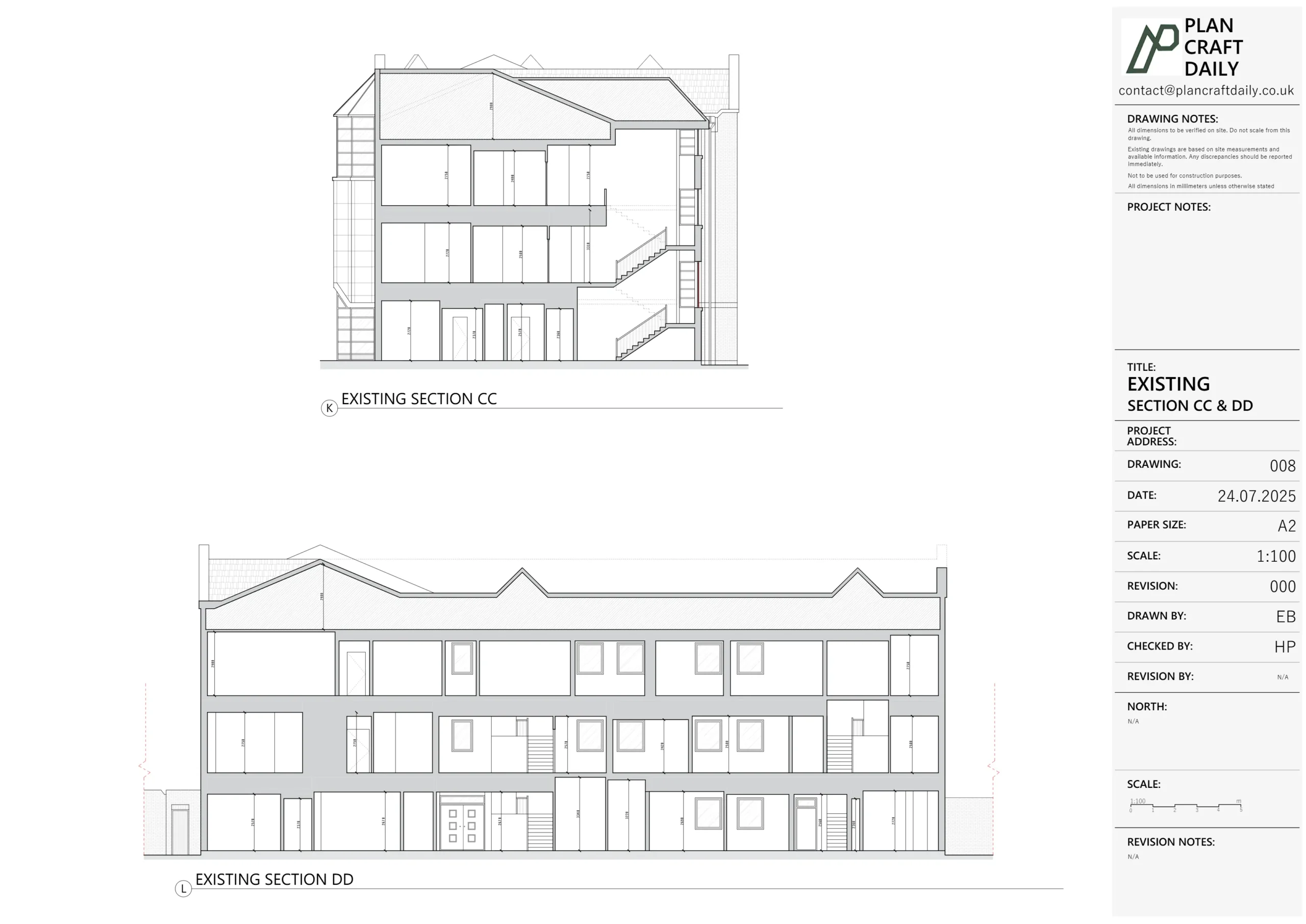
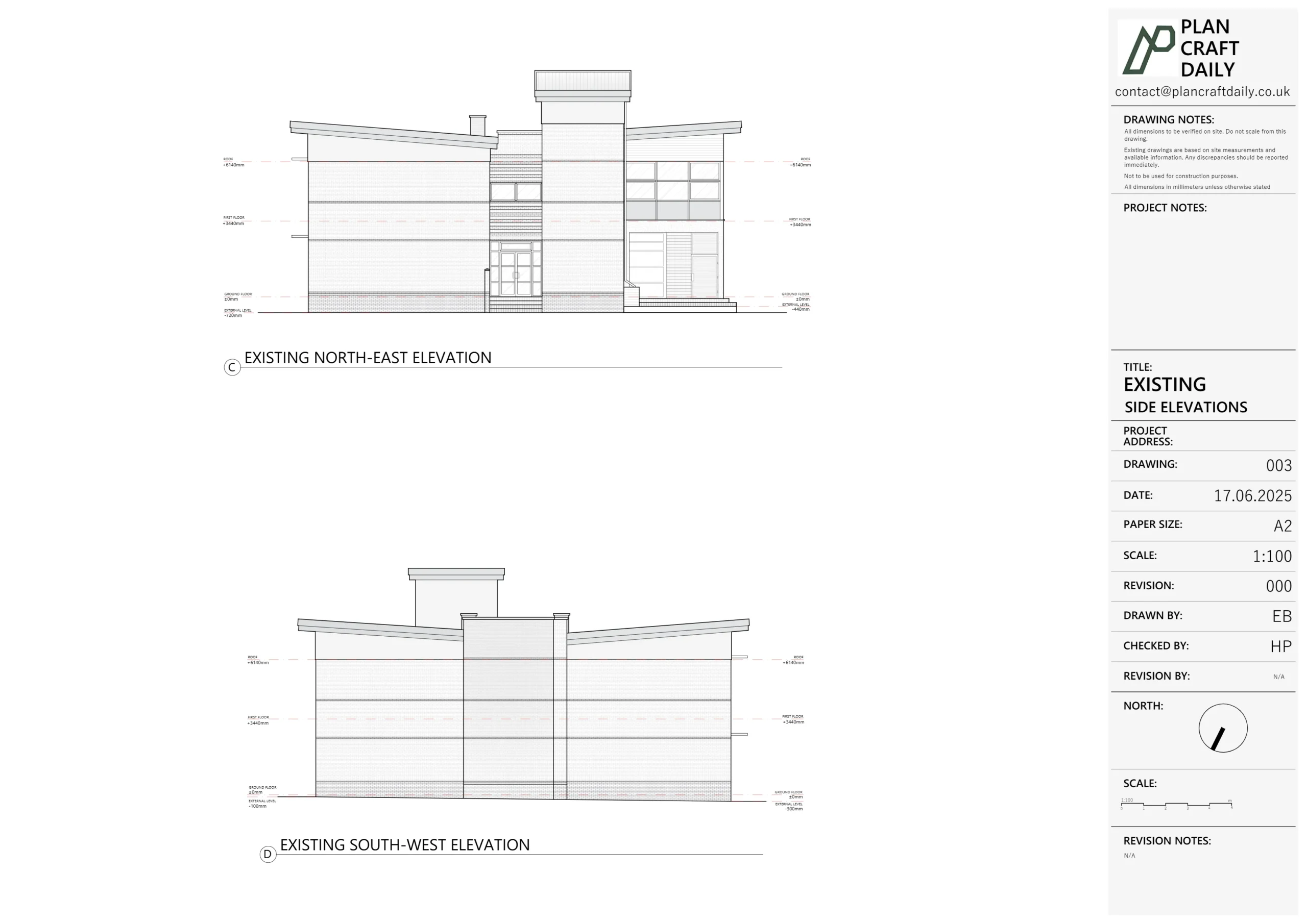
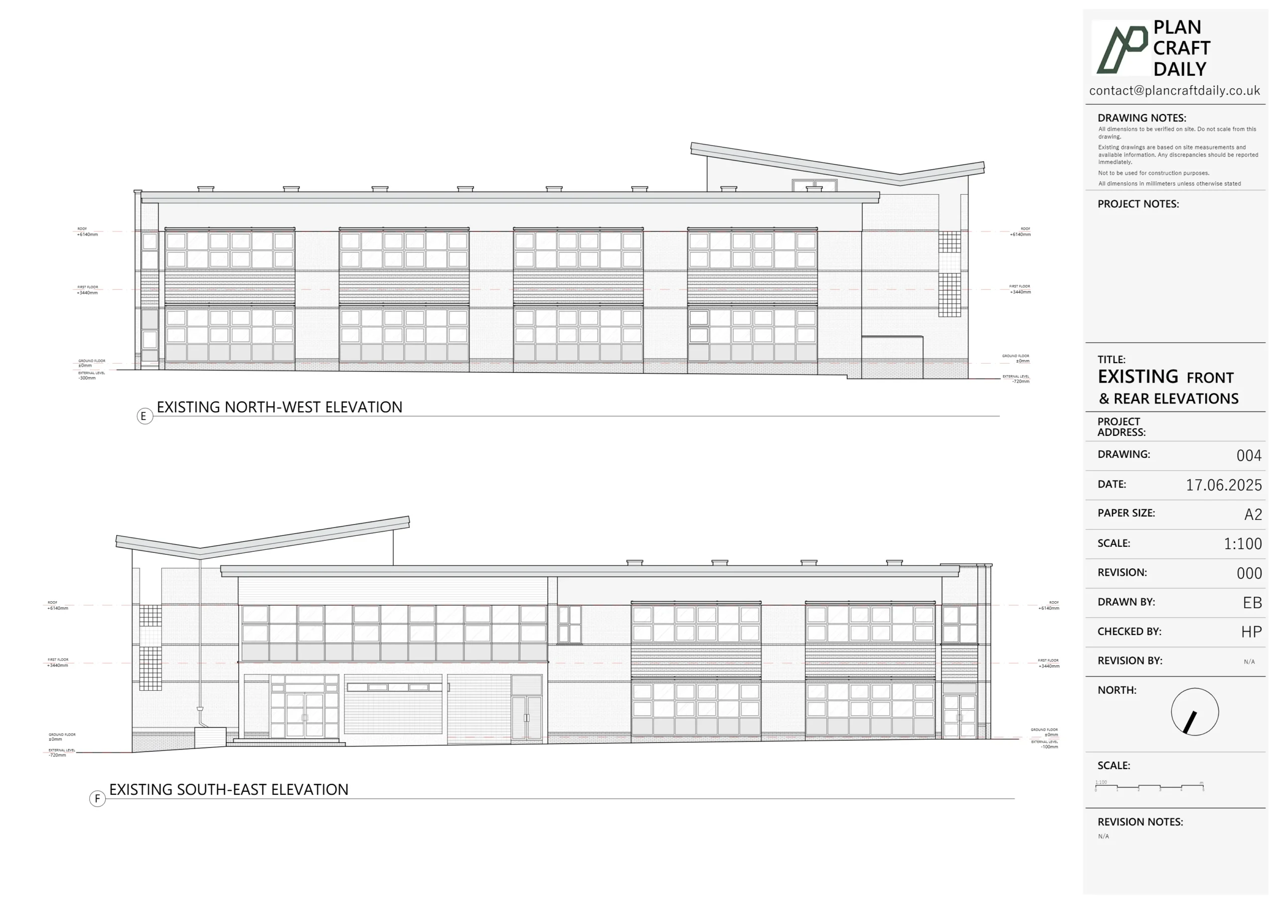
- Measured building survey of the former station:
- Ground floor
- First floor
- Second floor
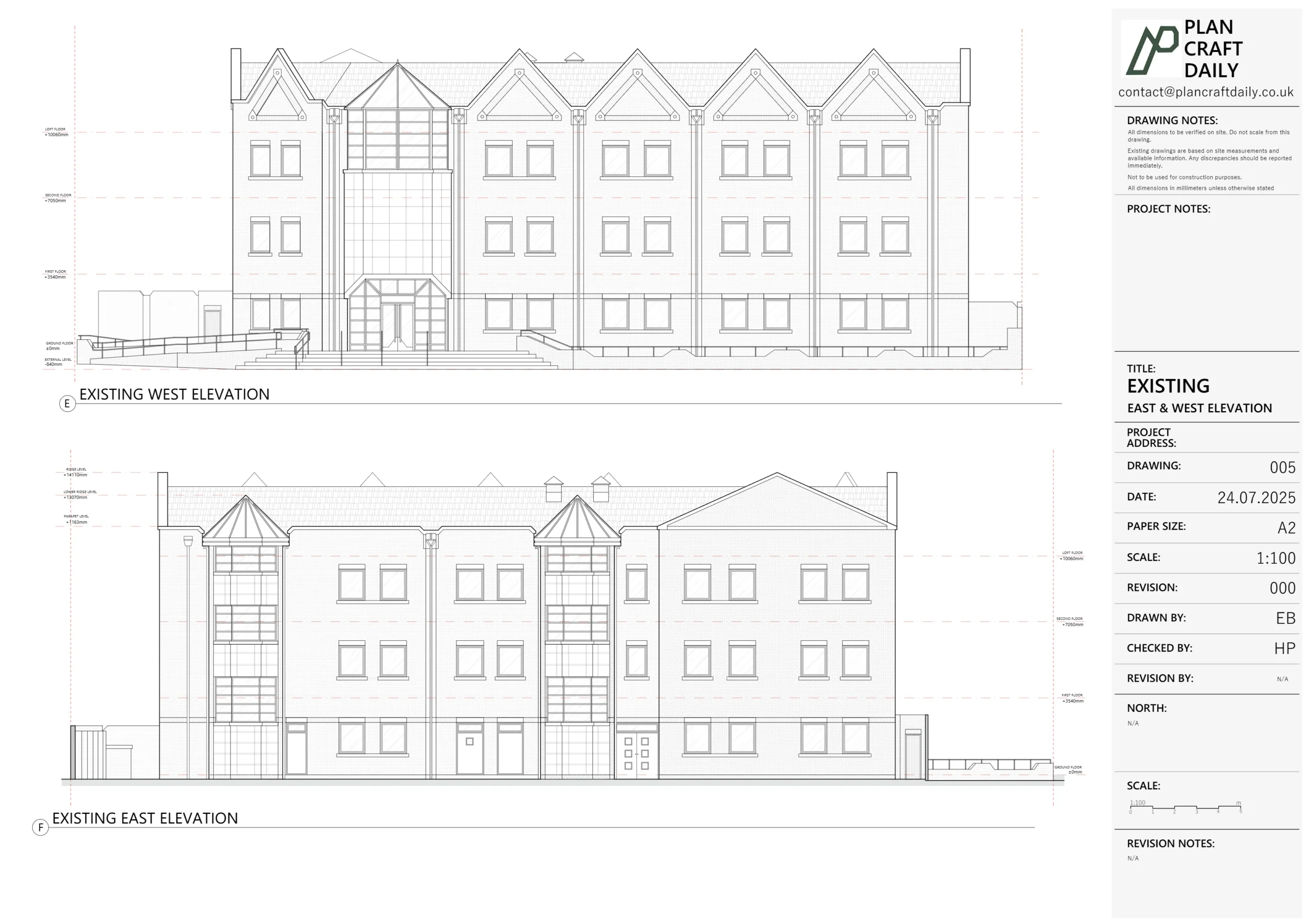
- Roof outline
- Topographical survey of the immediate surroundings including:
- Footways and kerb lines on both sides of the street
- Site boundaries and key level points
- Existing drawing set comprising:
- Site plan
- Roof plan
- Ground floor plan
- First floor plan
- Second floor plan
Kaushal also supplied the existing drawings and marked-up sections to confirm where additional kerb and street details were required. This meant our surveyor could arrive on site with a very focused brief, rather than starting from a blank slate.
On the commercial side, there was a short back-and-forth around payment structure (50% vs 75% upfront, and invoice addressee). We agreed a one-off compromise to take 50% in advance for this project, invoiced directly to Saloria Architects Ltd, and kept the future default as a per-service structure where surveyor fees are billed first.
How we carried out the surveys
We split the work into two coordinated strands:
- Topographical survey – led by Mihai
- Measured building survey – led by Mustafa
First survey visit – working around a live construction site
On the initial visit, the survey team discovered that the ground floor was mid-redecoration, with wet paint and trades on site. As a result:
- Much of the ground floor couldn’t be safely measured that day.
- Time on site was limited, so after completing the upper floors and external checks, we proposed a second visit to finish the ground floor properly rather than rushing and compromising quality.
We kept Kaushal informed:
- Explained why the ground floor wasn’t fully captured on the first day.
- Proposed a follow-up survey date (a Tuesday morning), matching the same site contact used previously.
Second survey visit – completing the picture
On the second visit, we:
- Completed full ground-floor measurements, including circulation, key rooms and access routes.
- Confirmed door openings and wall positions, noting any doors that had been removed from hinges at the time of survey.
- Tied in the topographical levels (including kerb heights) to the building footprint so that elevations and sections could reference real-world levels.
Throughout, we used our usual combination of laser measurements, internal 3D scanning and topo techniques to ensure a dense and reliable dataset for the CAD team.
From survey data to drawings and 3D links
Back in the studio, our CAD lead coordinated the building and topo data into a coherent drawing pack.
Draft drawings and technical notes
The initial draft set included:
- Site plan & roof plan
- Ground, first and second floor plans aligned with the topo base
- Corresponding PDFs for review
Alongside the drawings, we added clear notes for Kaushal, for example:
- Blocked-out areas on plan had no safe or practical access at the time of survey; they were left blank or schematically indicated.
- Some rooms (labelled e.g. Room 0.3 and Room 0.4) had unclear current uses; we did not guess functions, only geometry.
- Door locations were checked; doors removed from hinges during survey were omitted in plan rather than assumed.
- Internal wall projections related to downpipes / services were drawn as measured rather than “prettied up”, so the architect could rely on them for detailed design.
Kaushal then took this draft set to review with their team and came back with a small list of amendments. We implemented those changes and returned a Rev 001 draft for final sign-off.
Quality assurance and timing
There was a short period where drawings sat in internal QA. We kept Kaushal updated:
- Confirmed when the project was in QA and that there had been a slight delay because we were double-checking the building against the topo.
- Gave realistic target days (Wednesday/Thursday of the following week) for receiving the complete draft set.
This helped manage expectations with both Saloria’s internal team and their client, without compromising on drawing quality.
Final delivery – CAD, photos and 3D floor links
Once Kaushal confirmed that accounts had processed the final payment (and we saw the funds arrive a couple of days later), we:
- Issued the full CAD file set, ready for the architect’s design team.
- Supplied the final PDF drawing pack.
- Shared 3D viewing links for each level:
- Ground floor
- First floor
- Second floor
These 3D links allow the architect and client to “walk” the building in a browser and cross-check details visually against the CAD, without needing to return to site.
Outcome and lessons
For the client, the end result is a single, consistent base package for the former police station:
- Topographical survey and kerb data suitable for streetscape and access design.
- Full set of measured “as existing” plans for the building.
- A robust 3D visual record of each floor.
For us, this project nicely illustrates how we handle complex, part-occupied or under-construction sites:
- We’re transparent when a second visit is needed to maintain quality.
- We document limitations and assumptions rather than guessing.
- We keep architects closely informed during QA and invoicing, so they can manage their own client’s expectations.
The Isle of Dogs police station is now a clean, survey-accurate canvas for whatever Saloria and their client choose to do next with the building.
| Service Type | Measured building survey, topographical survey, existing drawings & 3D scan links |
| Time Taken | 2–3 weeks |
| Location | London |