Home » Case Studies » Residential Measured Building Survey & Elevations — Brockley, London

Brockley, South East London

Residential

London

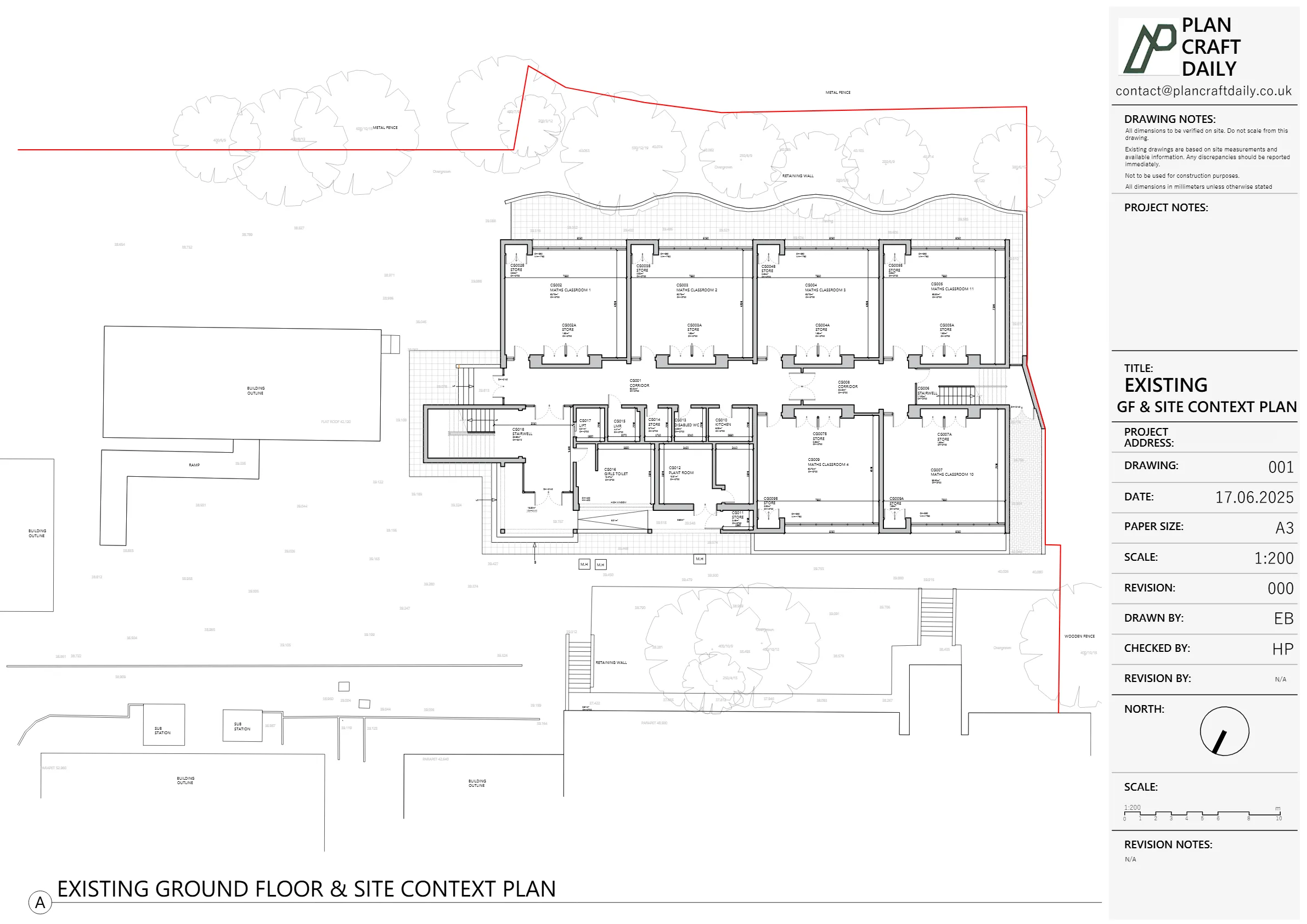
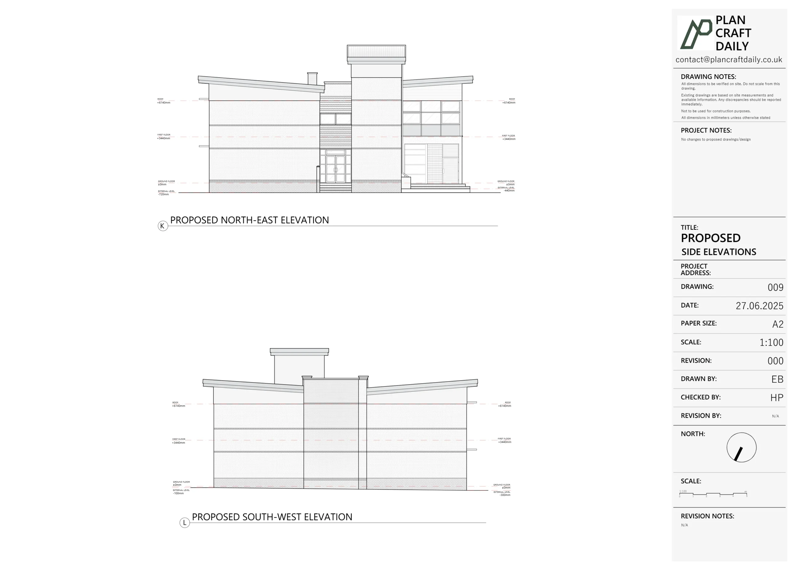
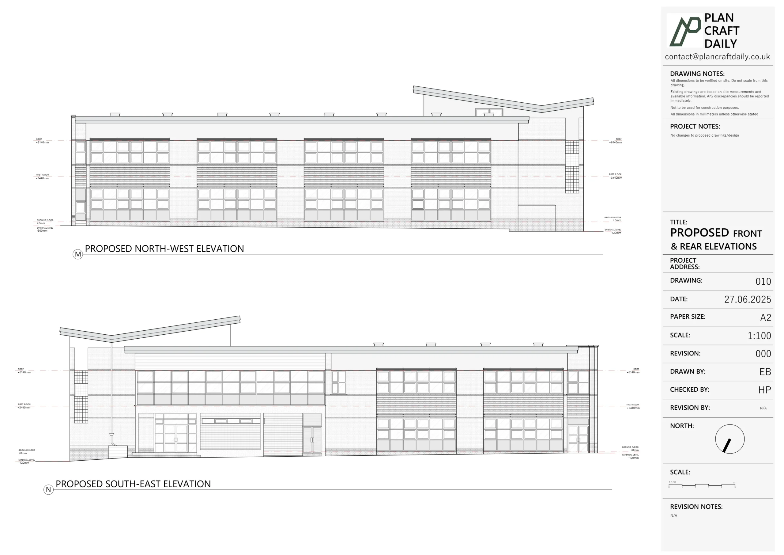
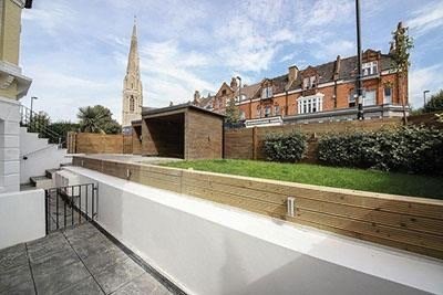
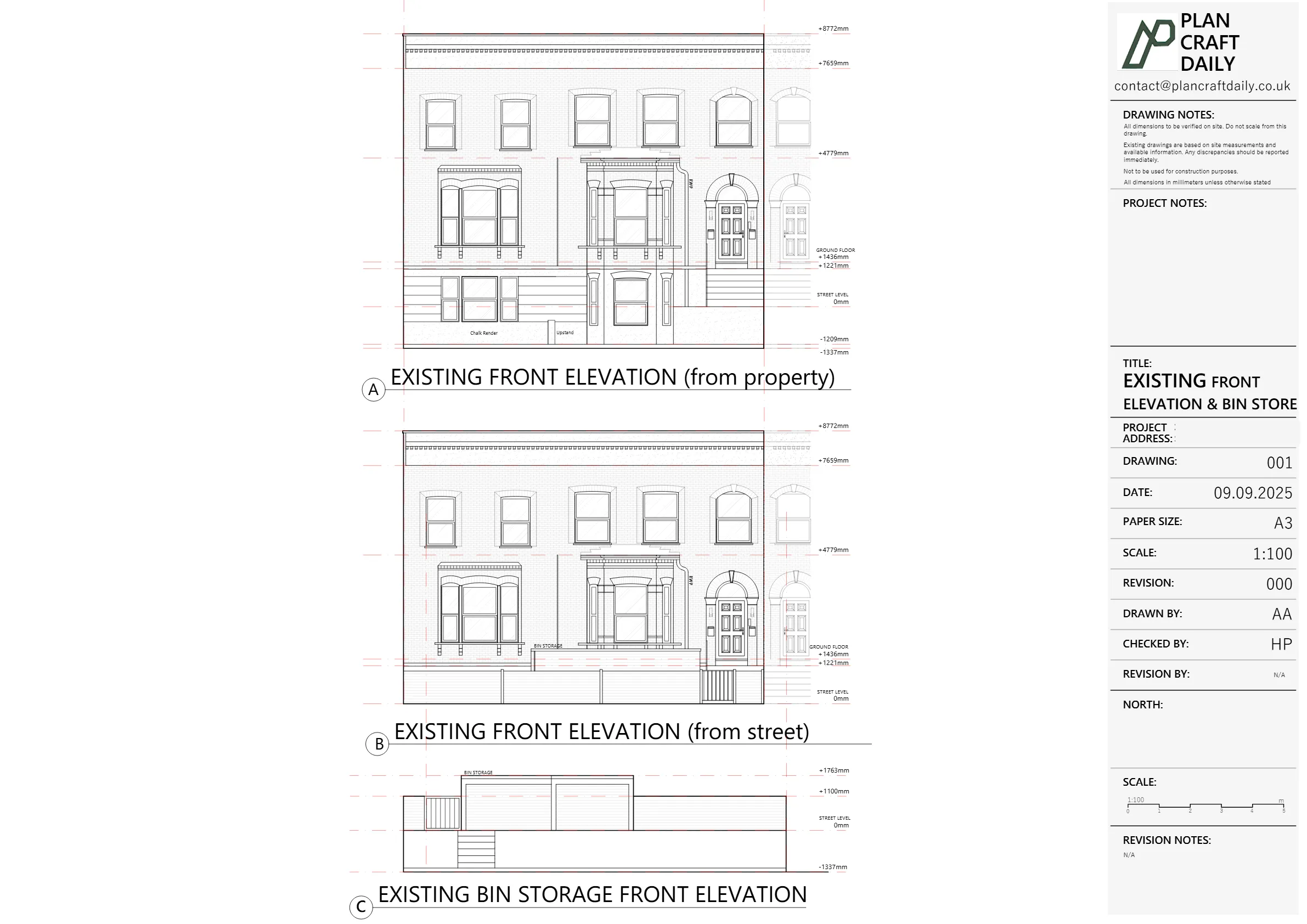
The client needed a measured survey and as-built drawings focused on the front external elevation and the stepped elevation towards the front boundary wall (including the existing bin store). The wider building and internal layouts were not required, as the project team already held other information.
Access constraints added complexity: the building included multiple flats held by individual leaseholders, making internal access difficult to coordinate. At the same time, the planning process was under pressure, with the planning officer requesting clear timeframes to support a retrospective submission.
The challenge was to confirm and deliver a limited but precise drawing scope, complete the survey within the agreed access window, and provide dependable delivery milestones so the wider planning work could proceed confidently.
We clarified the exact scope with the design team, confirming that the required outputs were a single front elevation and the elevation towards the front boundary wall, capturing the bin store within the same elevation rather than as a separate sheet. This ensured the survey and drawing production stayed tightly aligned with what the planning submission needed.
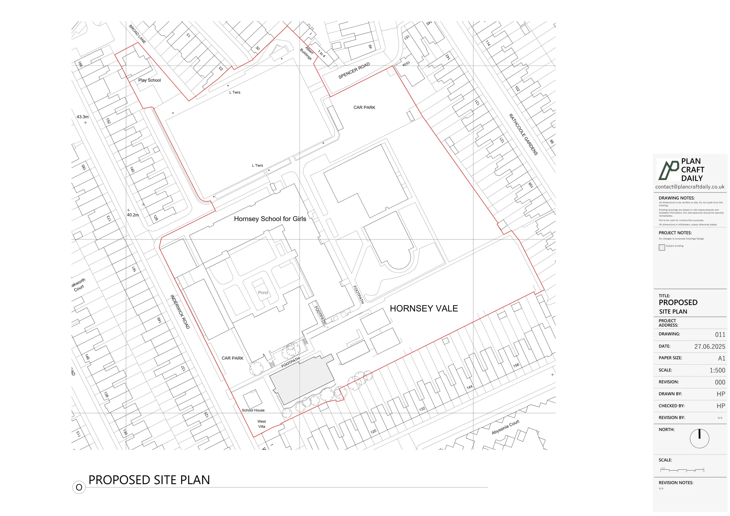
To reduce reliance on internal access, we arranged the survey schedule around tenant availability and confirmed arrival windows in advance. Where access was limited, we focused fieldwork on obtaining reliable external measurements for the requested elevations and site frontage elements.
Following survey completion, we moved into an internal quality assurance phase before issuing a draft drawing pack for review. Once comments were resolved, we issued the final drawing pack in the agreed formats for use by the planning team.

Property Type
Residential
Location
Brockley, South East London
Area
London
Time Taken
11 days (survey to final drawing pack)
Completed
September 2025
The project team received a final drawing pack covering the agreed external elevations, enabling them to progress their planning work with clearer timing and documentation. Drafts were shared first for review, then final CAD and PDF files were issued for onward coordination. Communication throughout focused on scope clarity, survey scheduling, and dependable handover milestones.


Survey and drawing support
Send the property address, any existing information and the drawings required. Plan Craft Daily can confirm whether a site survey is needed and provide a quotation.